

WHATEVER YOU DO, don’t make the mistake of thinking ‘ah its only 180 km – we’ll be back by lunchtime’. No – this drive must be savoured. Most people do it in a day – but its a long day. Two days would be better. Every image you have of Ireland’s beauty, culture and celtic heritage is encapsulated here on this peninsula and you must take your time and enjoy the breathtaking scenery at every turn on the road…
So, what exactly is the Ring of Kerry? The Iveragh Peninsula in Ireland’s southwest is an area of astounding natural beauty – we’re talking mountains, lakes, amazing cliffs and a stunning coastline. Throw in some beautiful villages, ancient stone rings and castles, fabulous beaches, even more fabulous food …. did I say ‘do it in a day or two! The ring is a scenic route around that peninsula and is the country’s most famous driving trail.
Ideally, this should be a self-drive trip. The bus tours are great but they have a limited number of stops and those stops will have time restrictions. The buses go counter-clockwise so I’d prefer the opposite direction – you won’t get stuck behind a convoy of touring coaches and you have the sea views on your left all the way around, making it a bit easier to pop out of the car for a quick photo. (There are only a few very narrow stretches of road – if you are nervous about meeting buses on a twisty stretch of road then maybe you should consider travelling counter-clockwise).
You can begin from any spot of course but most people set out from either Killarney or Kenmare. Head off early and have a list of the things you don’t want to miss. But be prepared – especially on a good day – to spend that extra hour on a beach or walking out along some headland that caught your eye from the car. Unless you are spending a week on the route, you will have to prioritize – you can’t visit every castle, big house, interpretive centre and shop on the one day as well as stopping at sights, walking a bit to stretch the legs, getting that jarvey ride and braving the Atlantic for a quick swim.
Start and Finish – Beautiful Kenmare
As you head off, Kenmare Bay will be on your left – sun would be nice but you can’t have everything!!!

Sneem
You won’t have time to stop at every village but many of them are tempting for a quick look around. Colourful Sneem is very popular with its river, square and rolling hills. Its a bit early for a coffee but you could pick up a packed lunch for later if you’re heading to the beach.


(an idyllic spot for a night or two…)


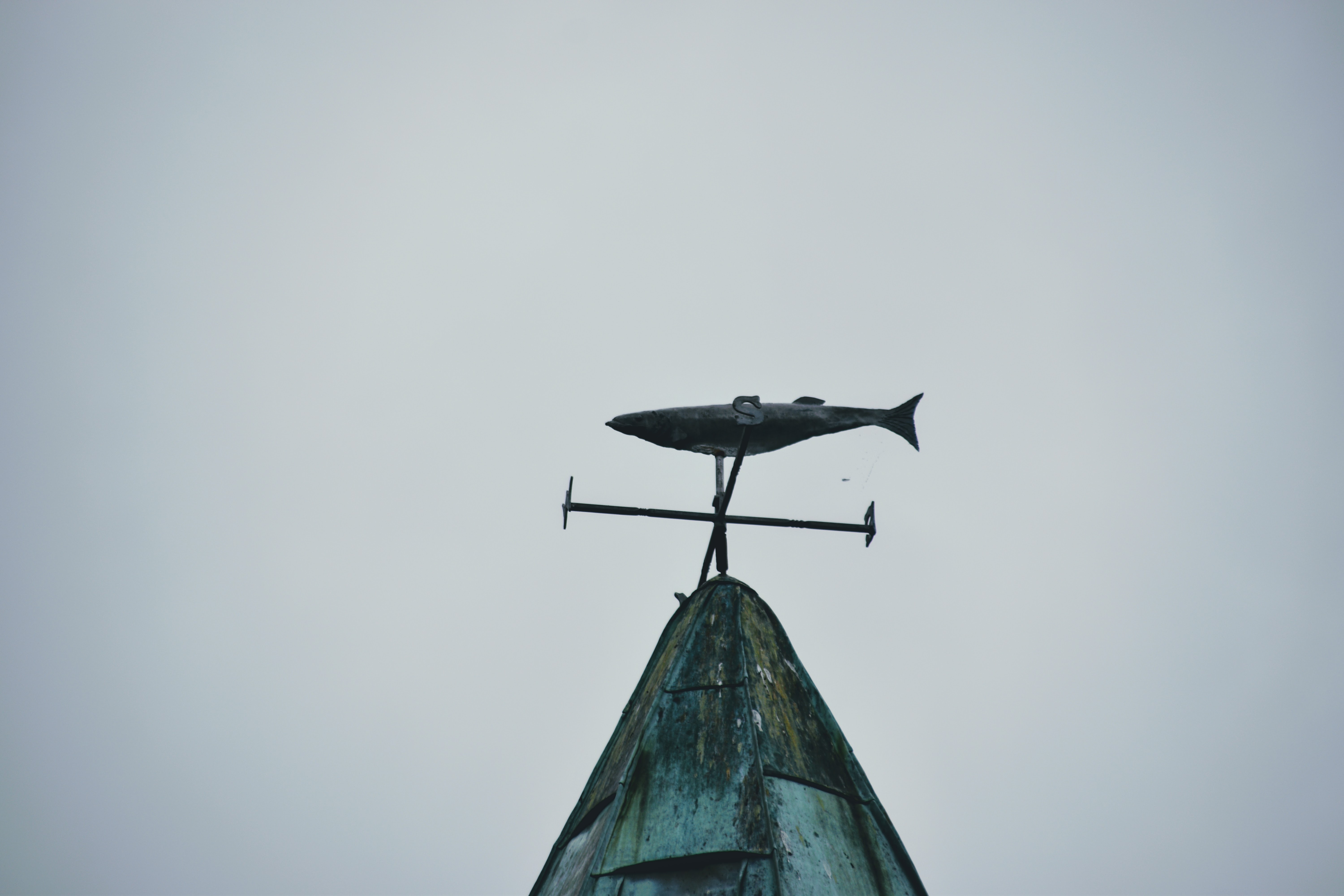
(I love the fish on the church wind vane)
You can already see how difficult it is going to be to fit everything into one day!!! Don’t be tempted to linger for too long in Sneem – you’ve only covered 26kms!


Hedgerows in August are a riot of orange and red. All over Kerry, Montbretia and Fuchsia are fighting for space along every road and laneway….


Its time for your first detour..
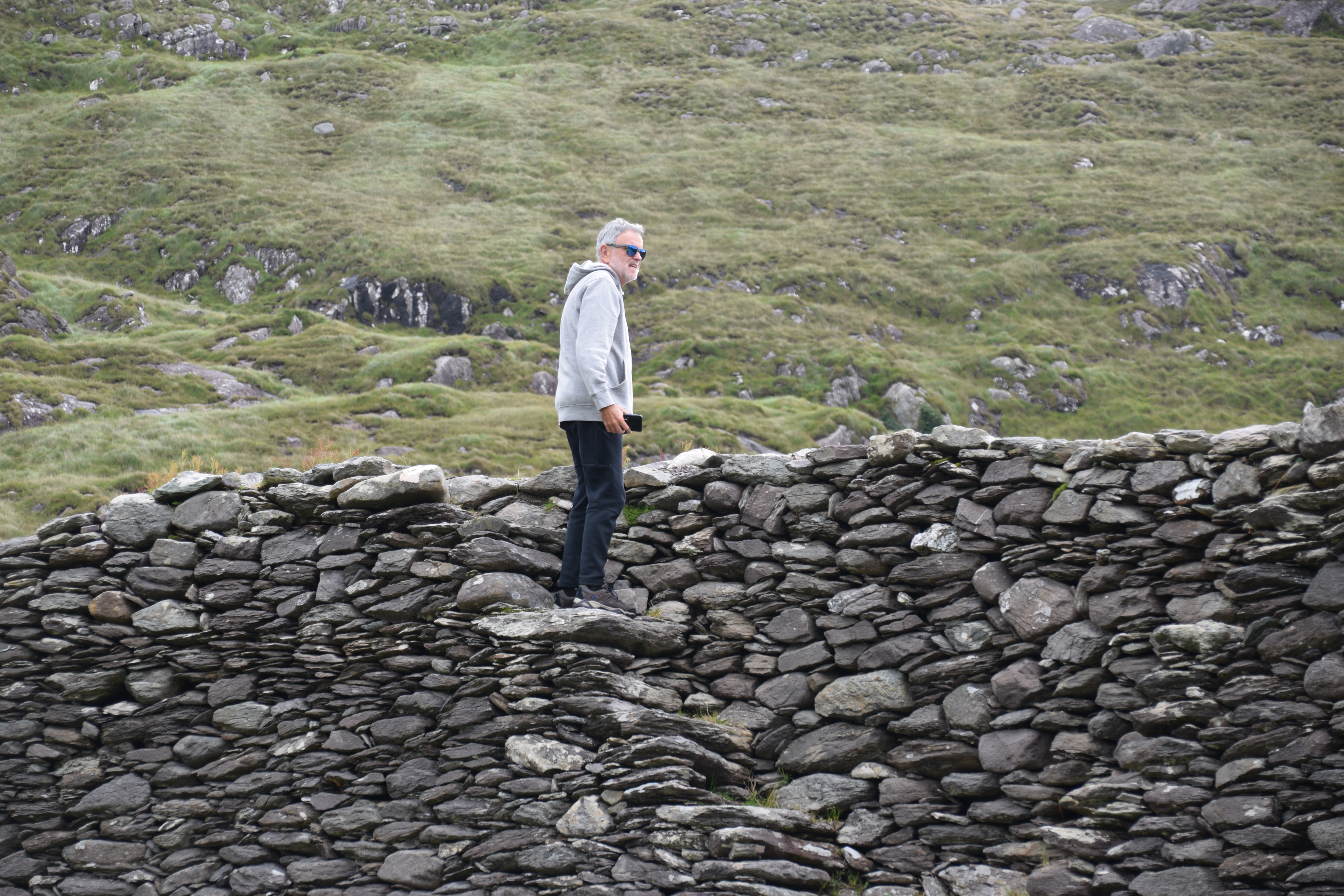
Staigue Fort
In an almost desolate valley, you will find one of Ireland’s biggest and best preserved ringforts. Built sometime between 500 BC and 300 AD the drystone walls have survived without the aid of cement or mortar. They measure 12 feet thick at the base and reach up to 18 feet. Just imagine the work and toil that went into its construction! It was probably owned by a wealthy chieftain and provided refuge for locals and animals in times of tribal war and raids.

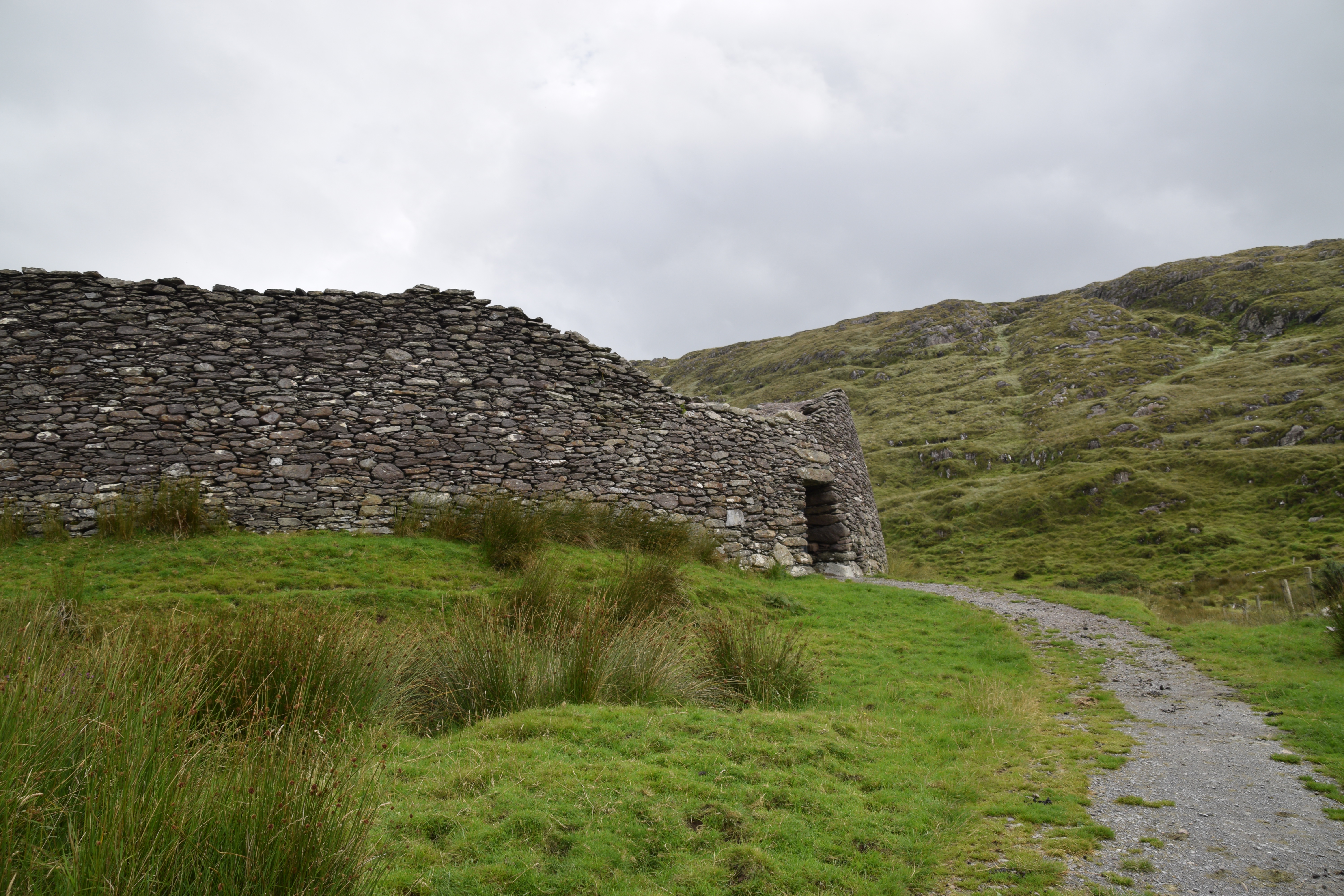

(I wonder if our ancestors had time to admire the view!)

Back on the road, you continue along by Kenmare Bay.

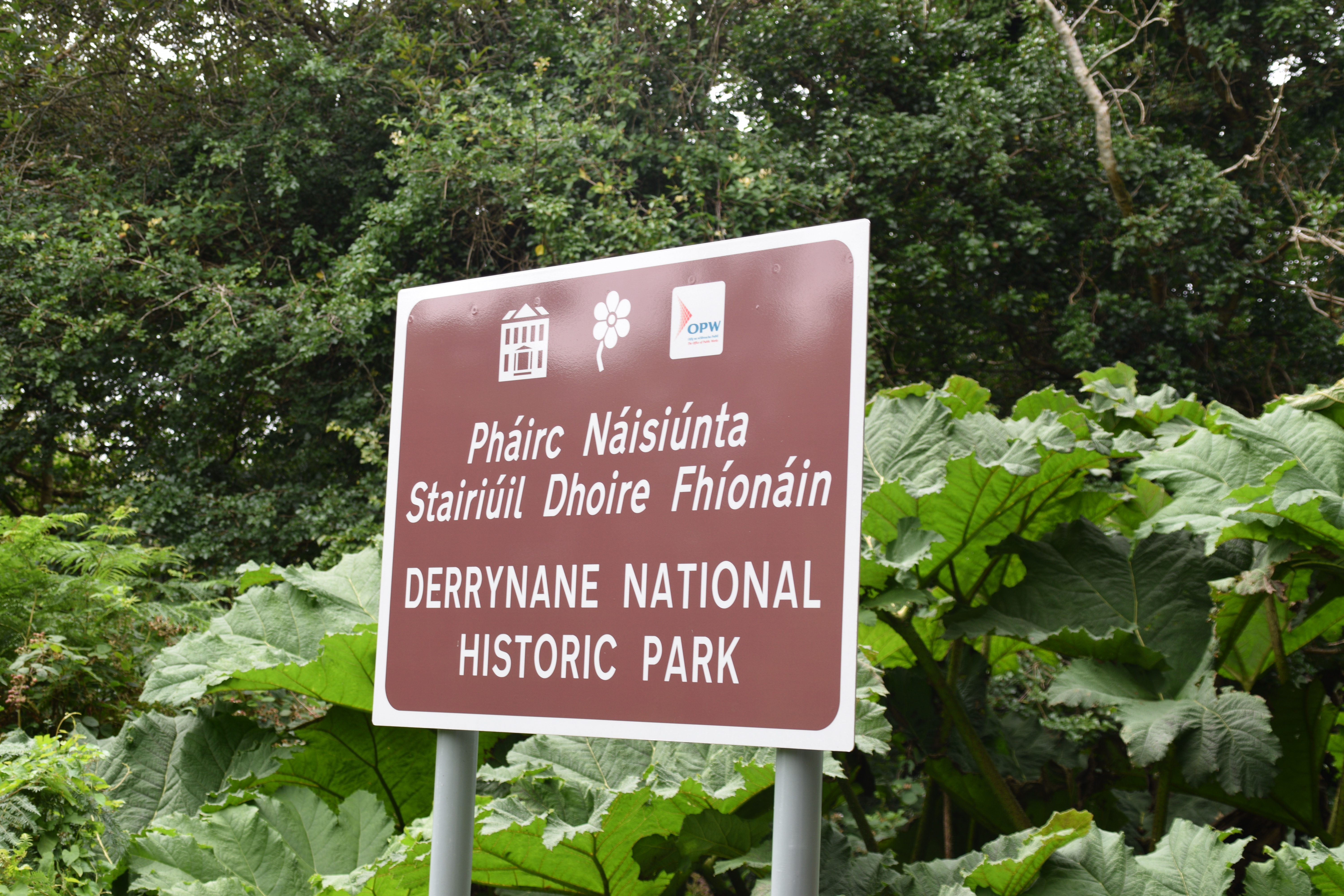
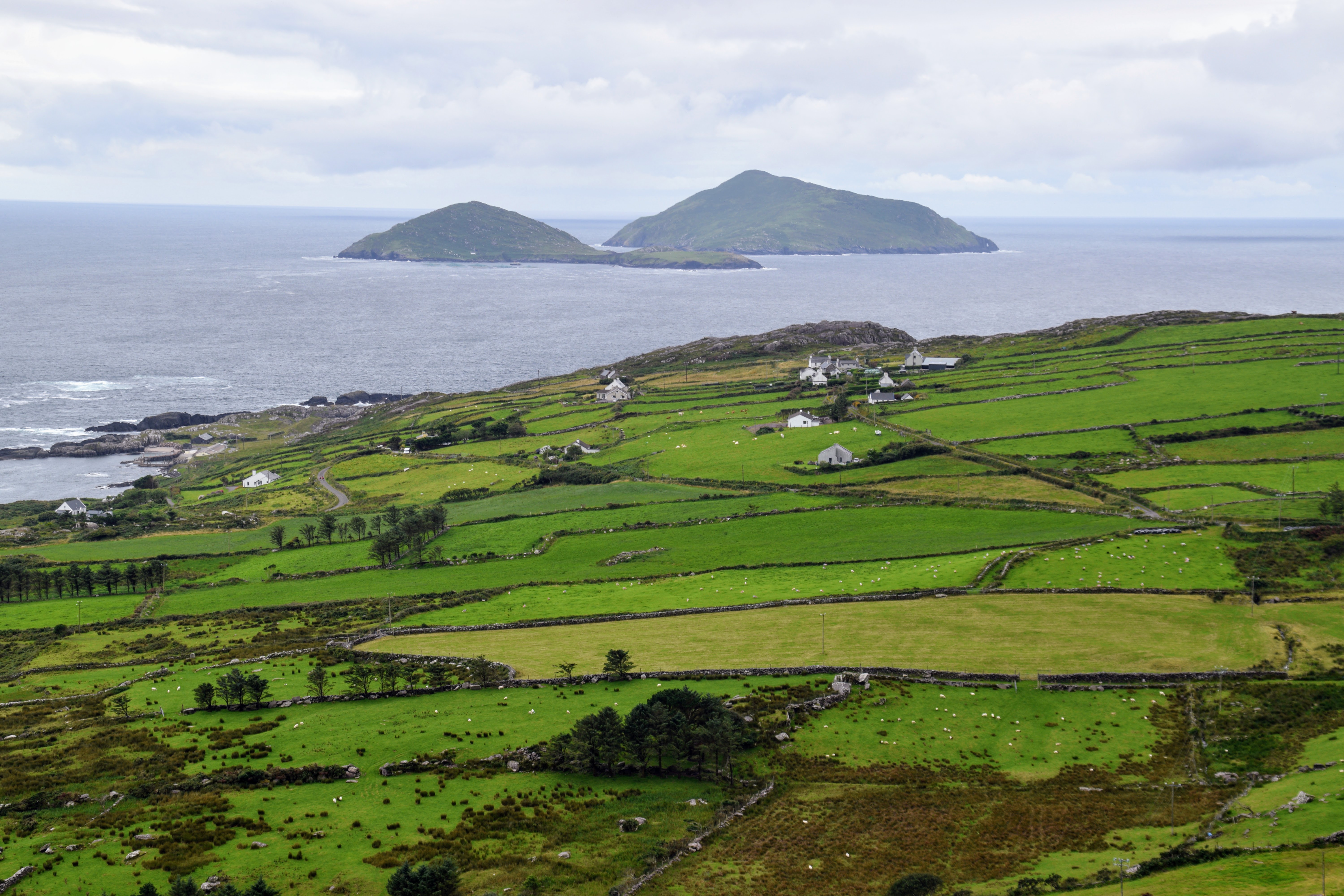
Derrynane National Park
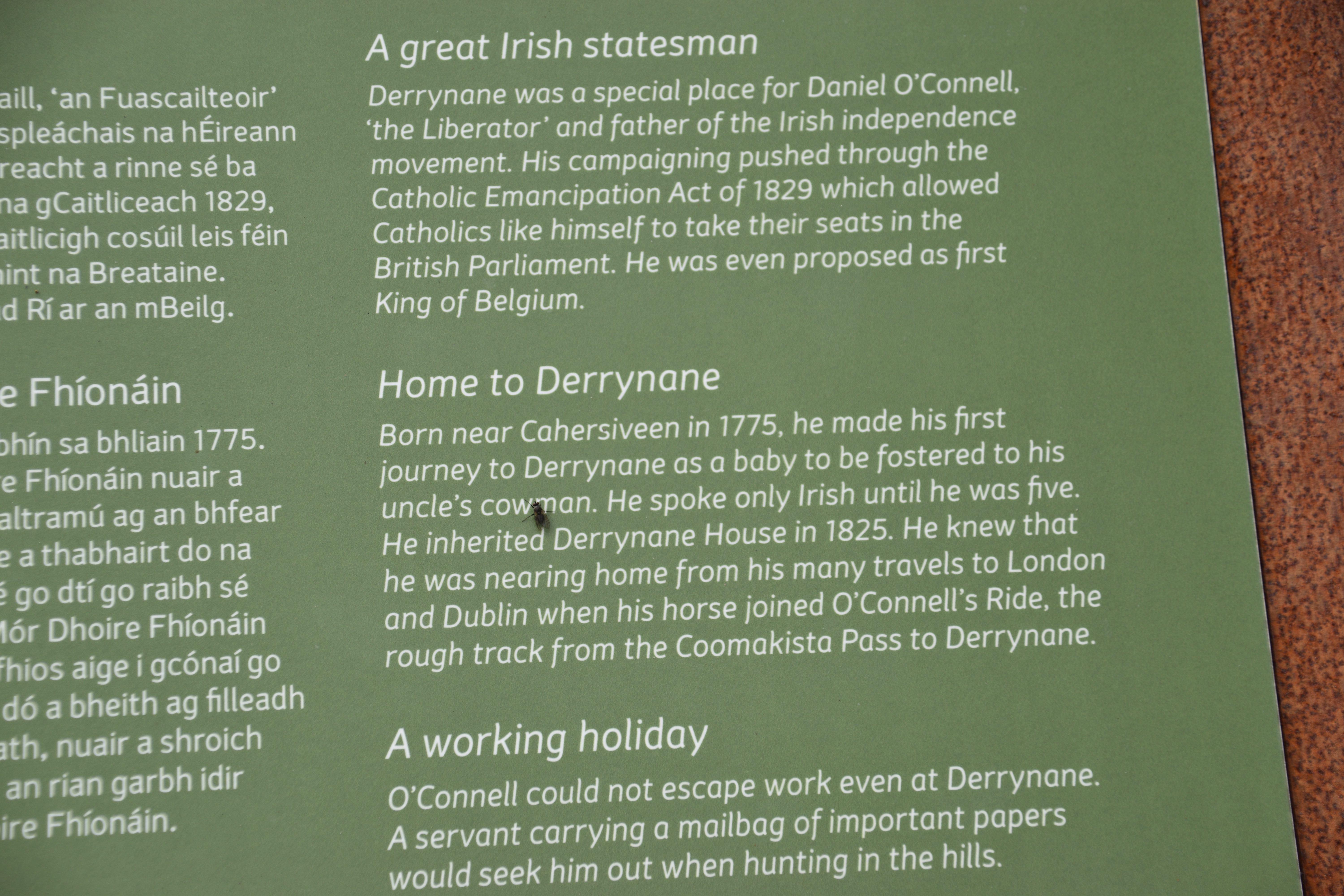
If its a good day, this makes for a great beach stop but if not, you’ll still want to spend some time here in the 300 acres of walks and gardens. The beautiful sheltered beach, stretching almost 1.5km, is backed by sand dunes, marsh and lagoons all of which are rich in vegetation and animal life. Close to the beach is Derrynane House, the ancestral home of Daniel O’Connell – one of Ireland’s great patriots. If you like historic houses then make sure to prebook a tour of the 19th century rooms and museum.

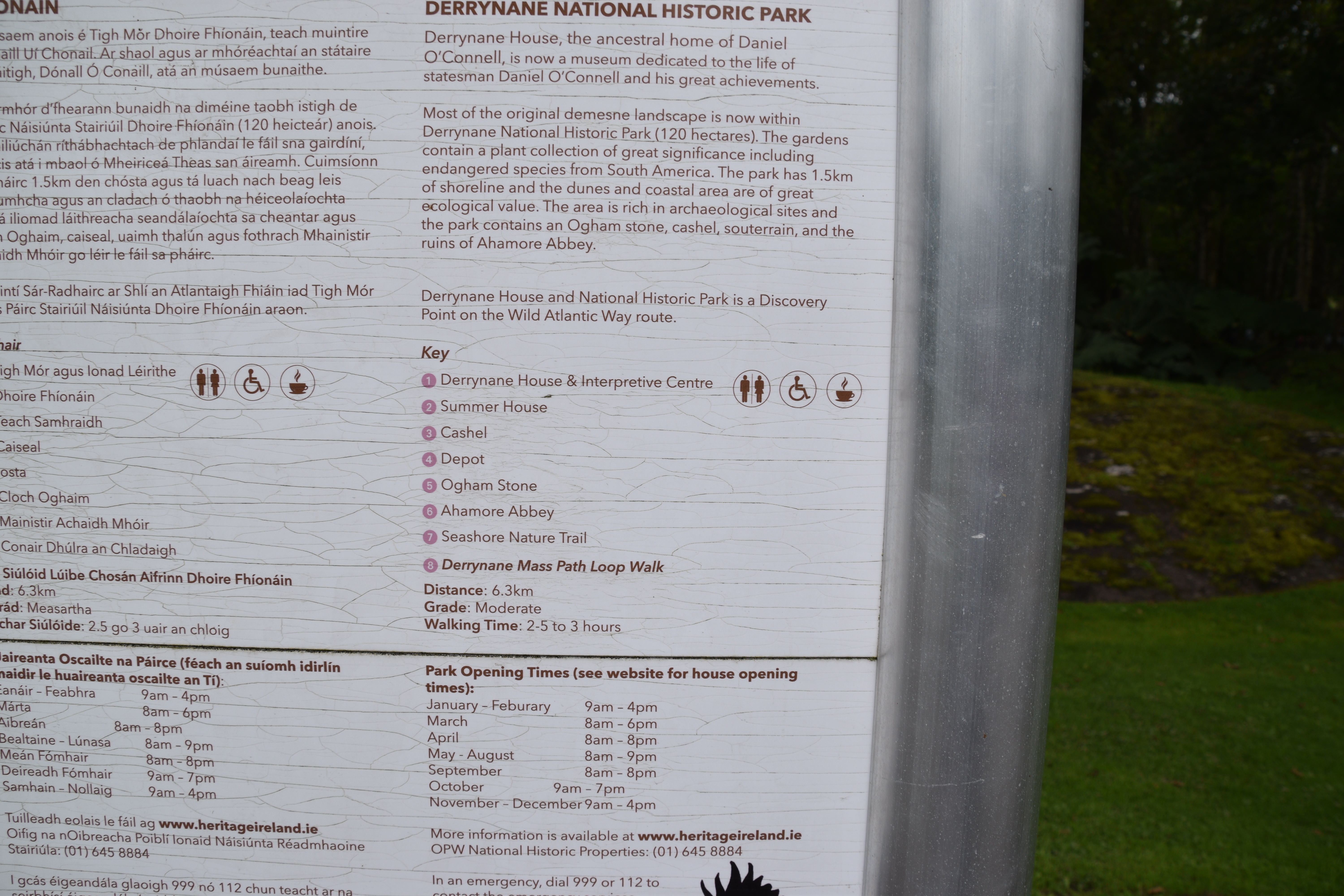

Abbey Island can be reached on foot across the sand except at high tide. The island offers great views of the surrounding mountains, coast and islands. This must be the most beautifully located graveyard in the country!!


You can wander through the Fairy Garden…

A cashel – or ring fort – is located close to the main house. It is probably from the fifth or sixth century.

If its not a nice enough day for the beach, you can still enjoy some of the nature trails…


Ogham Stone
Before you leave the bay, have a look at the easily accessible Ogham Stone close to the entrance of the park. There are about 400 such stones scattered throughout the country. Ogham was the earliest system of writing to appear in Ireland. Letters are represented by groups of between one and five strokes or diagonal lines, usually on the edge of a standing stone. They probably served as grave stones or territorial markers.
This particular stone did not always stand here. It was found some years ago lying behind the nearby sand dunes. The inscription is in bad condition but some letters can be deciphered – AM LLATIGNI MAQ M … N … RC M … Q … CI. The stone was compared with others in the region and a possible translation was deduced – ‘the name of Llatign son of Minerc descendent of Q…C’.


As we head off we can see Derrynane Harbour at the back of Abbey Island

40 shades of green
There is evidence of the region’s unique heritage everywhere – yet another ringfort in the field below.

On we go to Waterville – a favourite holiday spot of Charlie Chaplin! Your visit might coincide with the annual Chaplin Film Festival which is held here every August. This year, you will just have to settle for a photo or selfie!
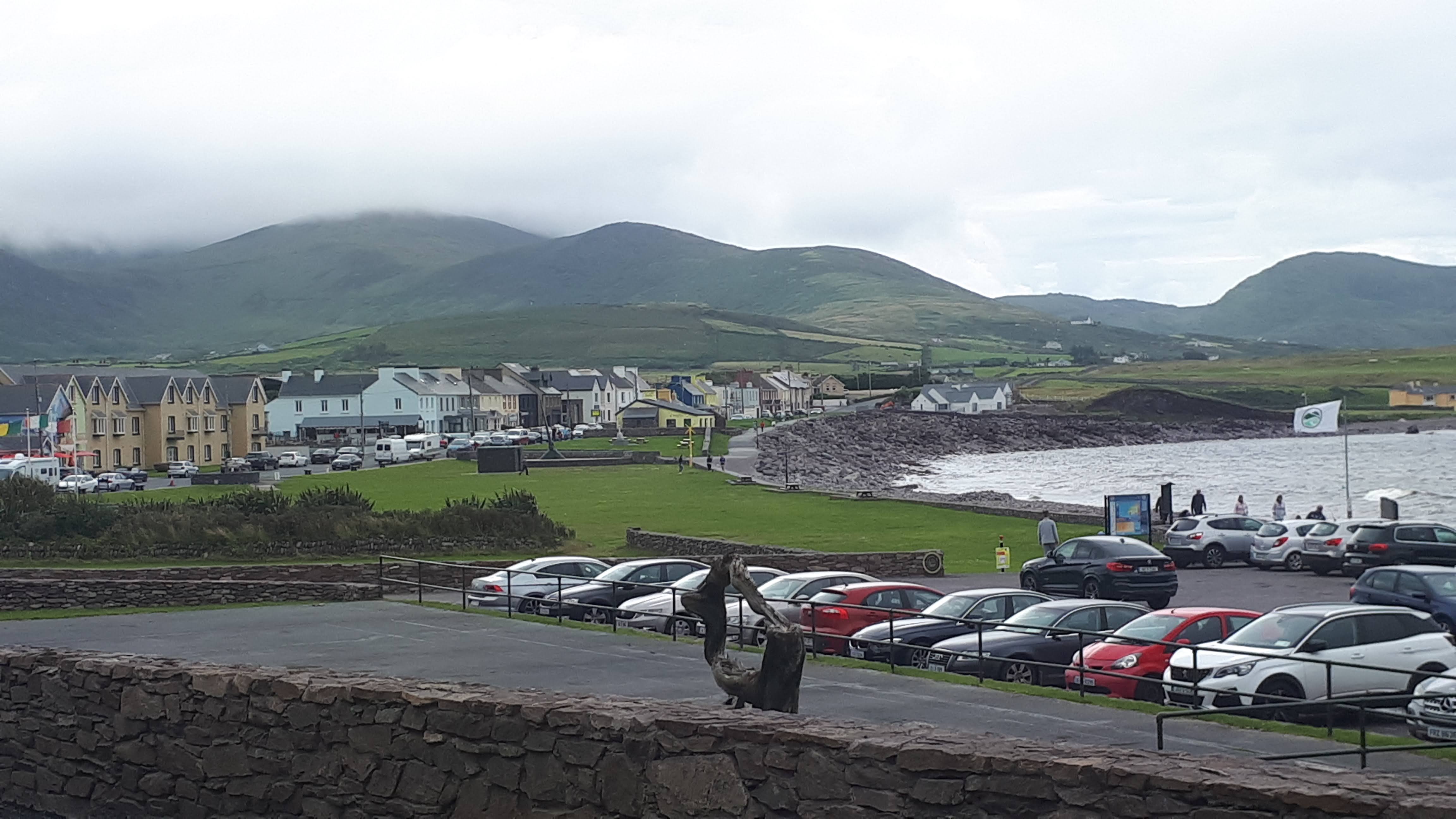

Its time to leave the route again for a fabulous detour – the Skellig Ring
Ballinskelligs
If you have time, stop off for a few minutes at the Augustinian Priory. What a location! When the monks out on Skellig Michael (more about that in a while) finally abandoned their island some time in the 12th century, they built their new monastery here on the shores of Ballinskelligs Bay.


Ballinskelligs Castle
Towers such as these were built along the Cork and Kerry coasts in the 16th century by the McCarthy Mór clan. They were probably constructed to protect the bay from pirates and to charge tariffs on incoming trade ships.

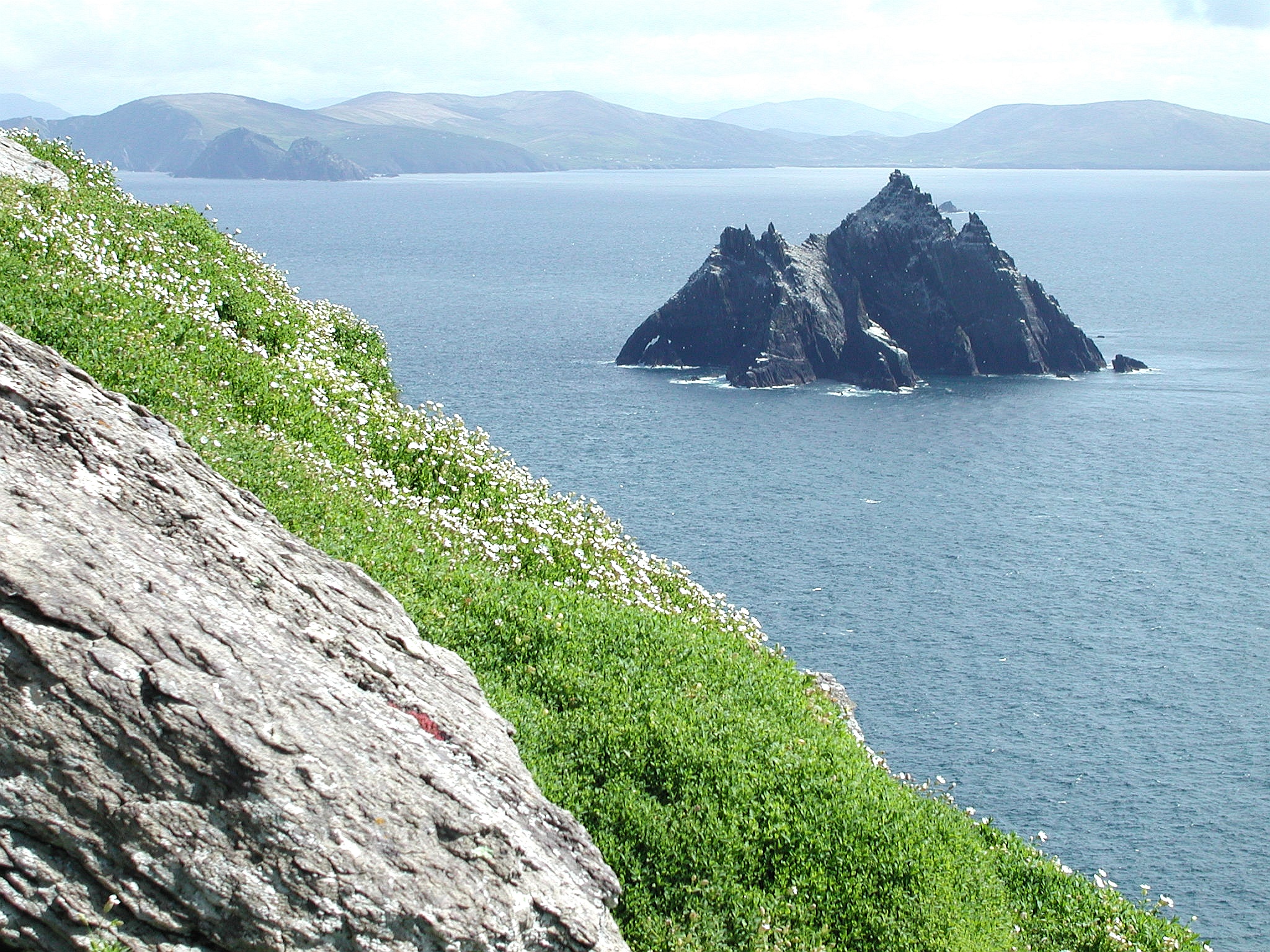
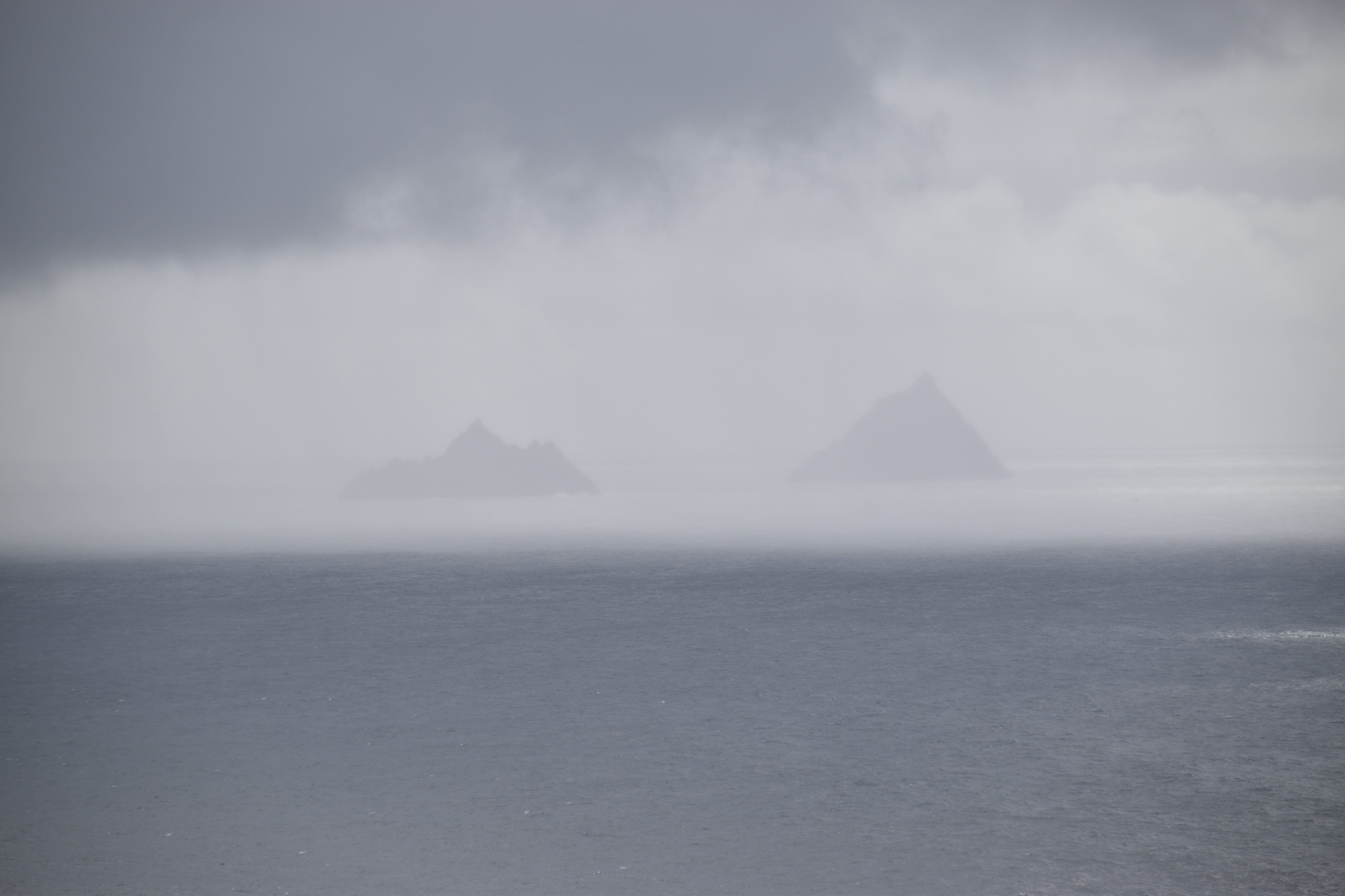
On we go and finally we can see the famous Skelligs…
(Skellig derives from Sceilg – meaning a steep rock. Well named don’t you think!)
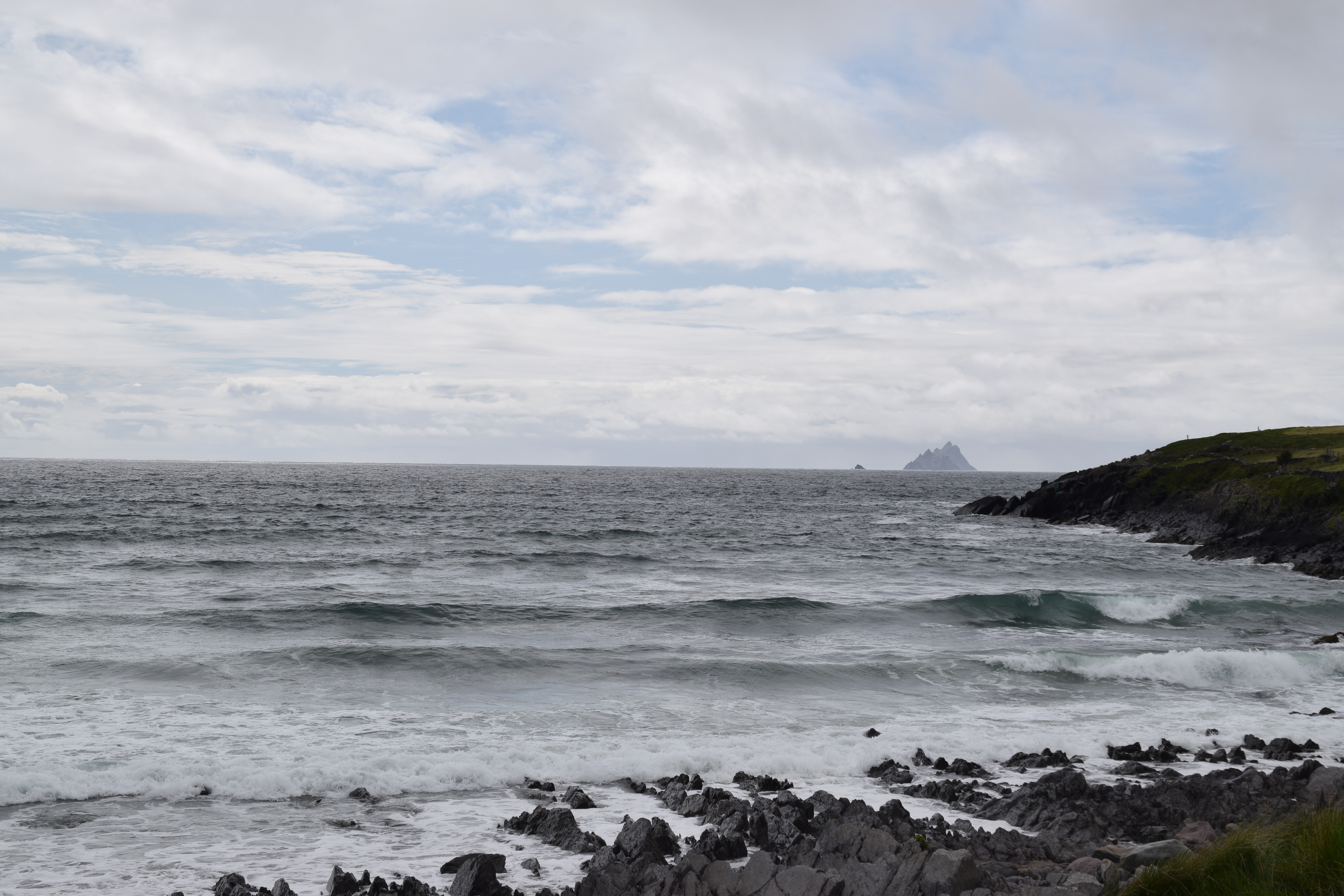
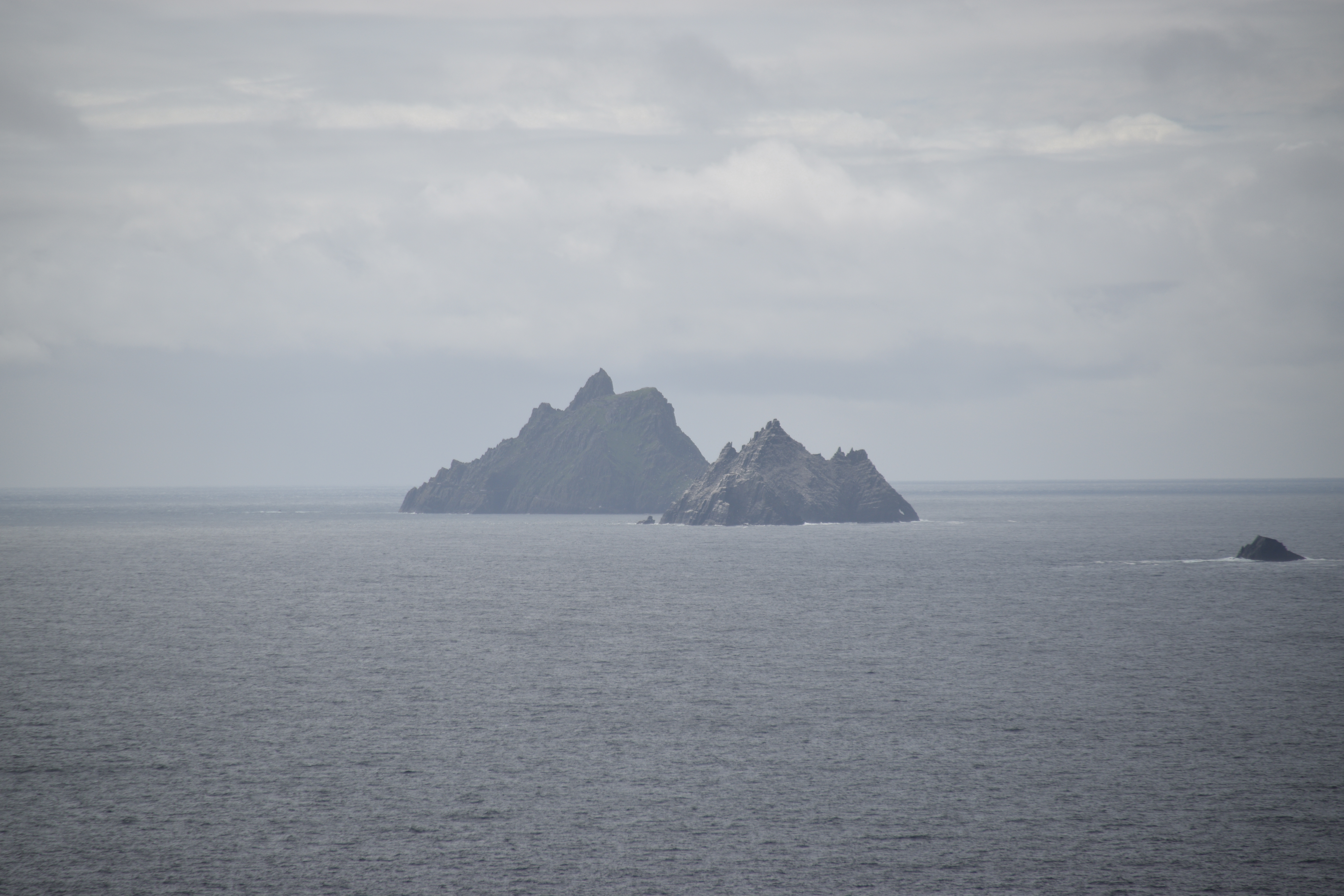
The Skelligs
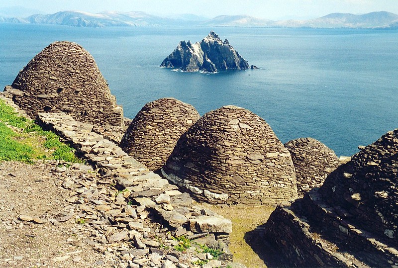
The larger of the two islands, Skellig Michael, is the site of an old Irish monastery. Monks occupied this isolated place from the 6th century. Situated about 12km from shore, conditions must have been harsh – especially in winter. Their days would have been filled with prayer and physical work. Their diet probably consisted of fish and bird eggs. By the 12th/13th century, the monks had relocated to the priory at Ballinskelligs but its thought that they continued use the island as a place of pilgrimage during the summer months.
It is a testament to the skills of those monks that so much can still be seen today in its original form. The monastery is accessed by over 600 steps and is made up of churches, the famous bee hive huts (where the monks slept) the cemetery and garden. There is a hermitage on the other island peak.
Visiting the UNESCO listed island is a challenge I’ve yet to face – but its a must-do! Boat sailings in the summer months are weather and tidal dependent and numbers are restricted – and that was before Covid!!! This is something that needs to be planned and booked well in advance – but the opportunity can be lost at the last minute if the weather is bad. If you ever do make it, the boat trip takes 45 minutes and you’ve about 2 hours on the island.
Of course, Star Wars fans will recognise the location from The Force Awakens and The Last Jedi.

(Attributed photo 1. )
Little Skellig is about half the size of Skellig Michael and home to huge colonies of gannets, puffins and seals. No landing is permitted.
We head over Coomanaspig Pass towards the Kerry Cliffs

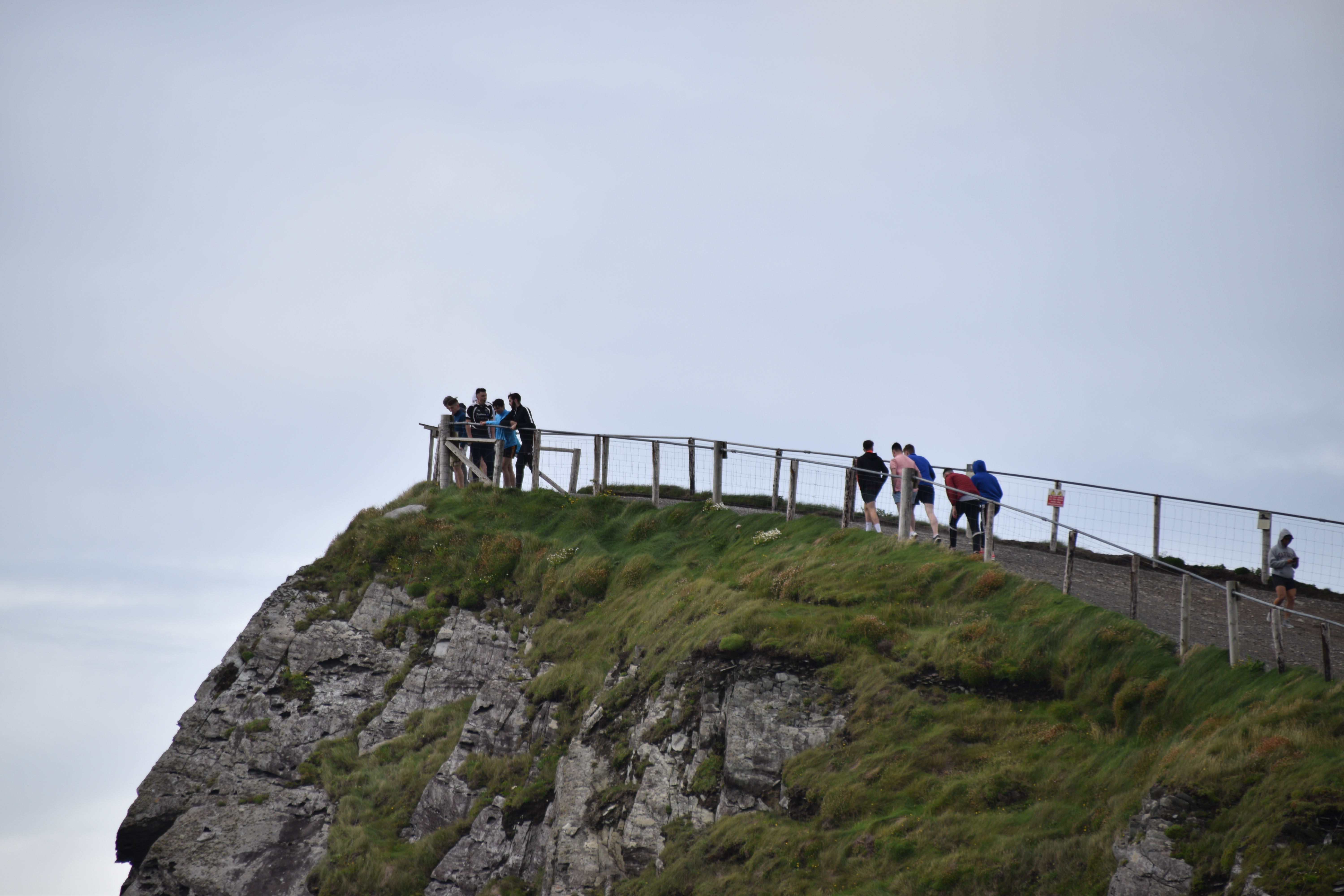
The Kerry Cliffs
The 1000ft high Kerry Cliffs (entrance €5) are worth a stop. You’ll get a chance to stretch the legs and enjoy great views of the Skelligs and Puffin Island (weather permitting of course!). You need to allow 30-60 minutes for the visit.

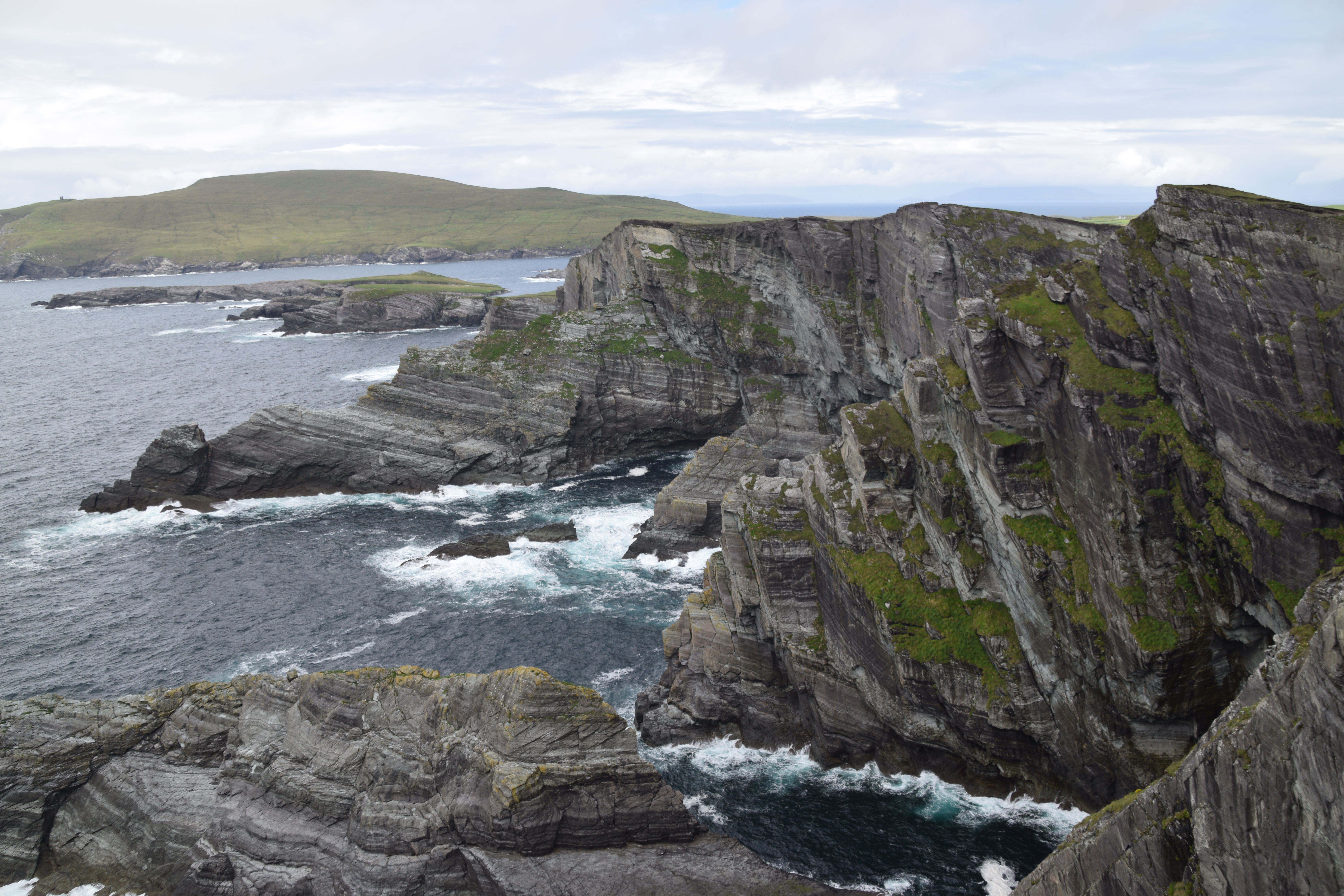

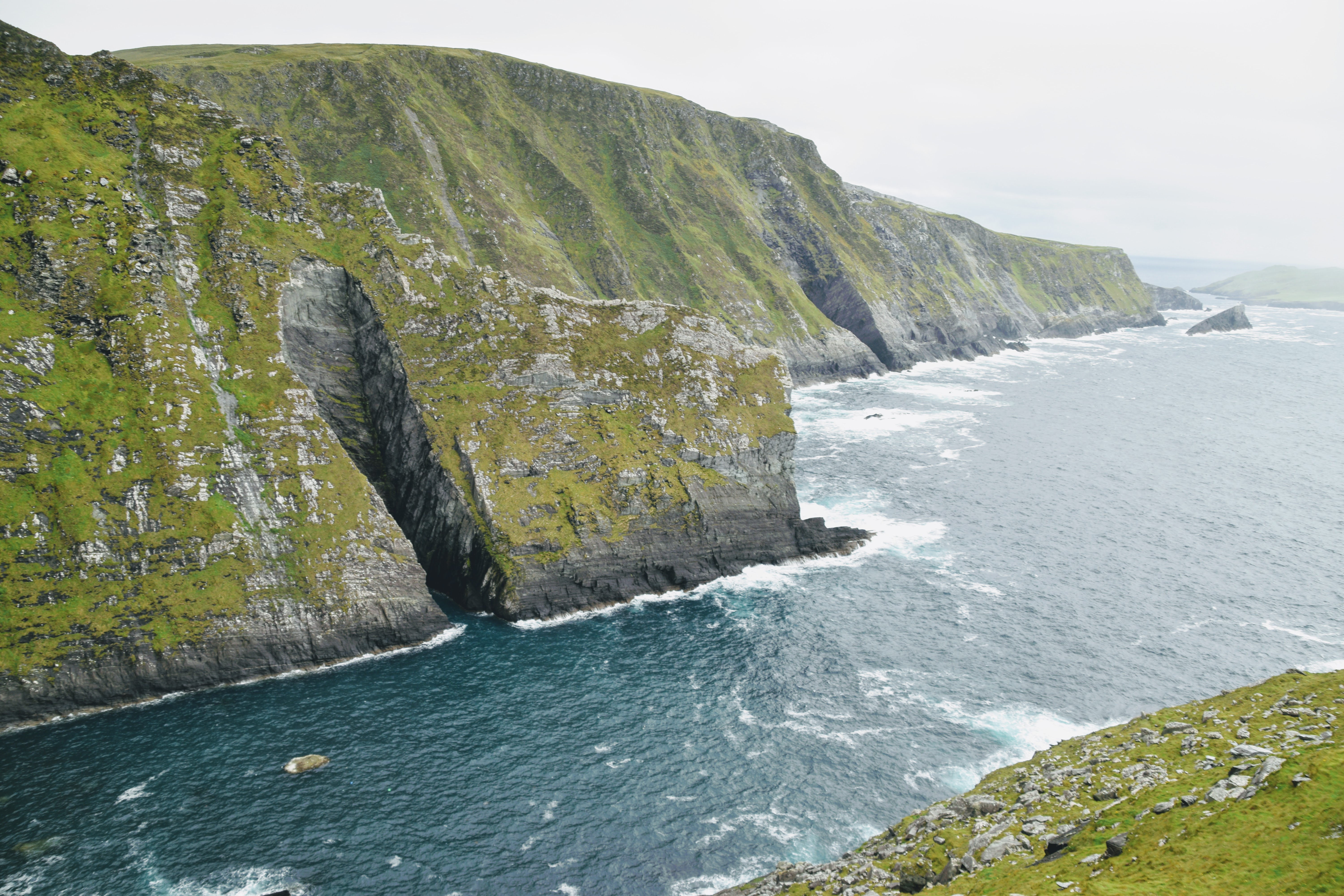
Conditions change pretty quickly around here!!

6 minutes later…..
5 minutes after that….

We leave the cliffs and head towards Portmagee – we’ll be crossing that bridge onto Valentia Island…

Portmagee
This lovely little fishing village is the departure port for the Skellig Michael boat and a great place for a bowl of chowder!
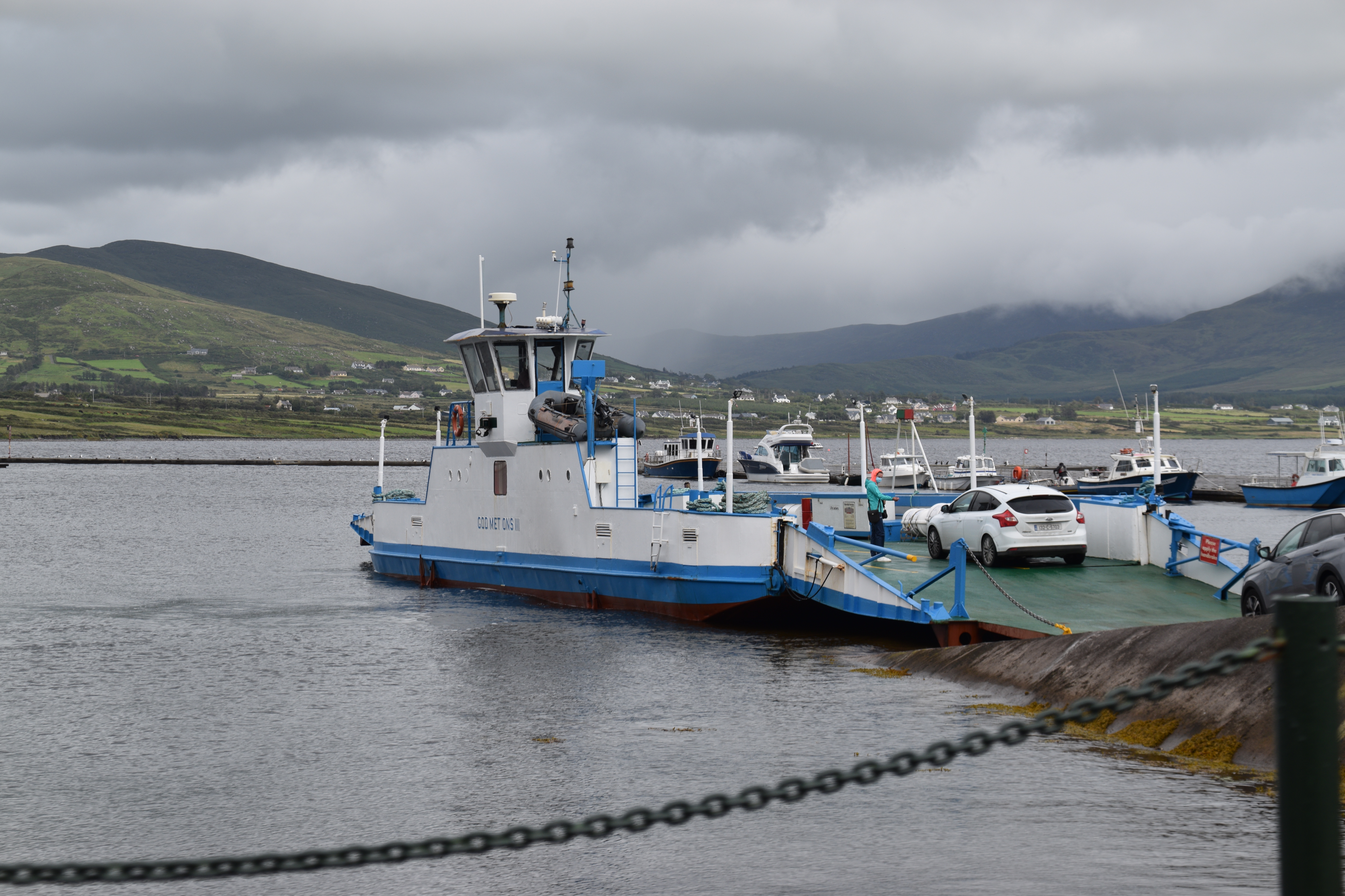
Valentia Island was connected to the mainland in just 1971

Valentia Island
Once you’ve crossed the bridge you might have time to stop at the Skellig Experience Center if you have a particular interest in the islands. You can then turn left for Bray Head and more Atlantic views. We went right instead and headed 7.5km for Knightstown. This rather unKerry sounding town has Norman origins which explains a lot!
The island’s main claim to fame is its connection to the first transatlantic telegraph cable that connected Europe with the United States in 1866. This is the location of the eastern terminus of the cable which operated from Valentia Island for one hundred years. Tetra pod footprints have been found on the northern part of the island dating back some 350 to 370 million years.
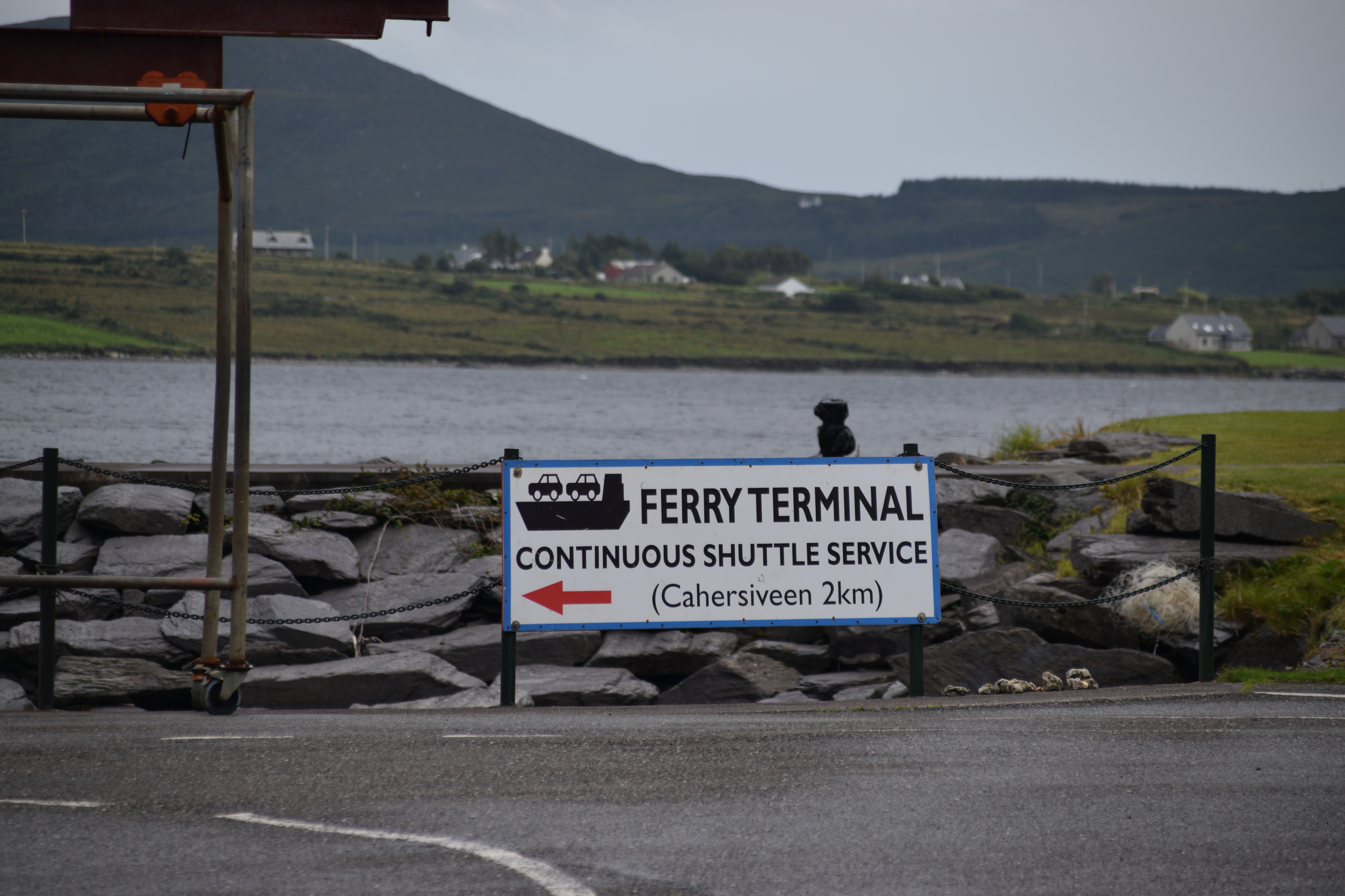
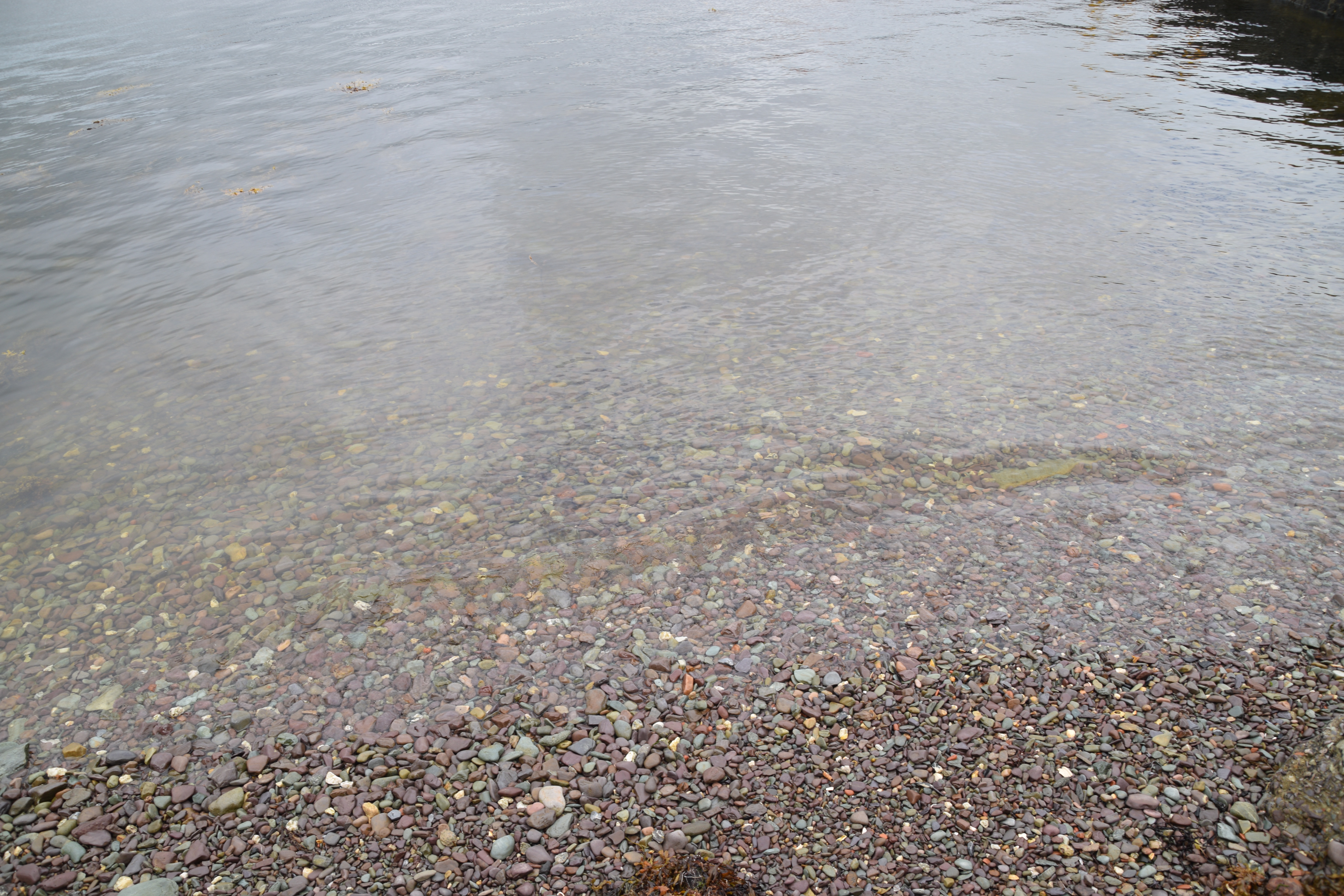
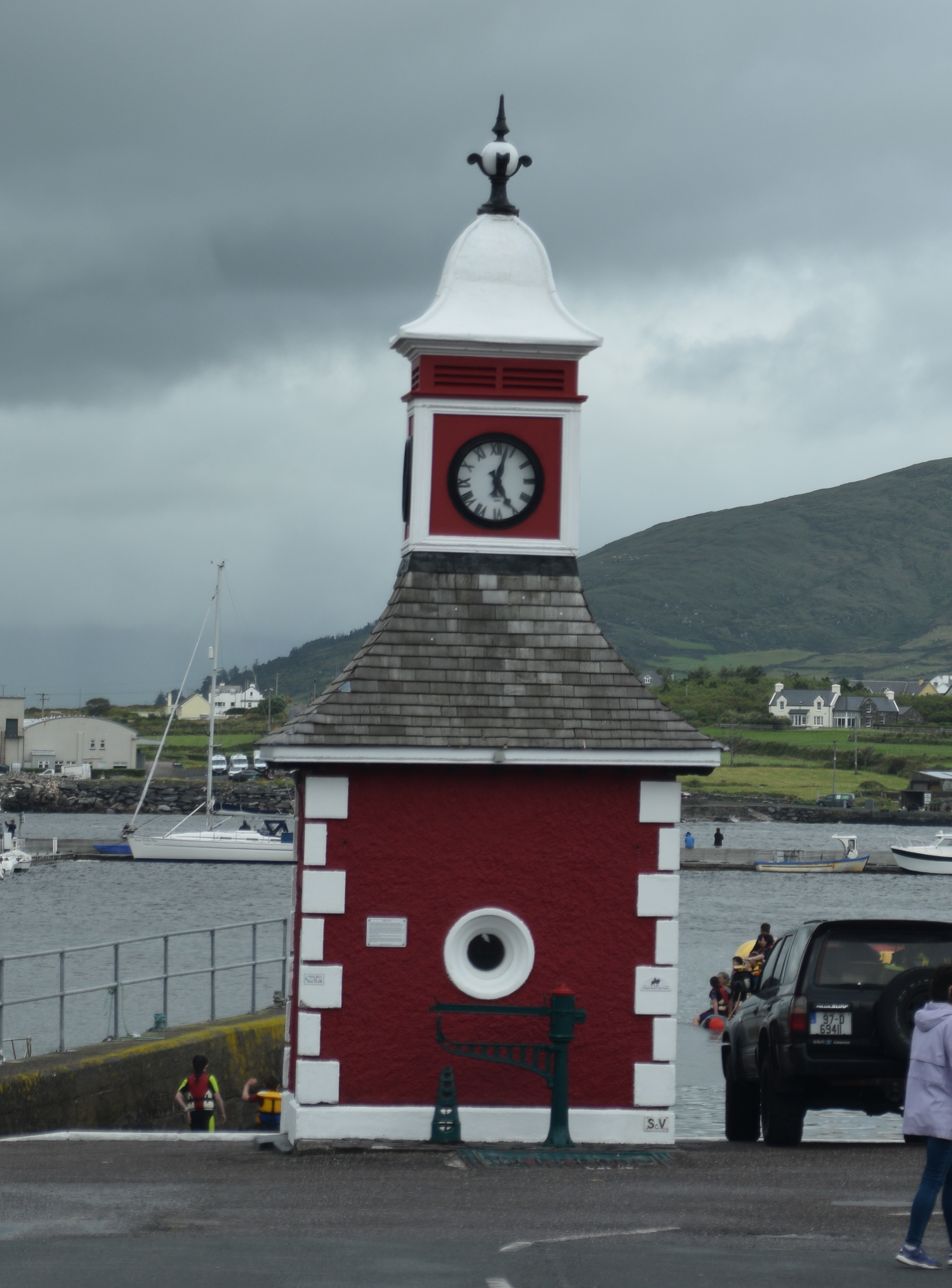
In Knightsown we found a small harbour with a busy car ferry offering an alternative way back to the mainland.
Look how clear the water is in the harbour…
Lots of activity – even on such a dull evening…..

I don’t know about you, but I think this Michael Egan must be a great man with words and I bet he tells a wonderful yarn…..
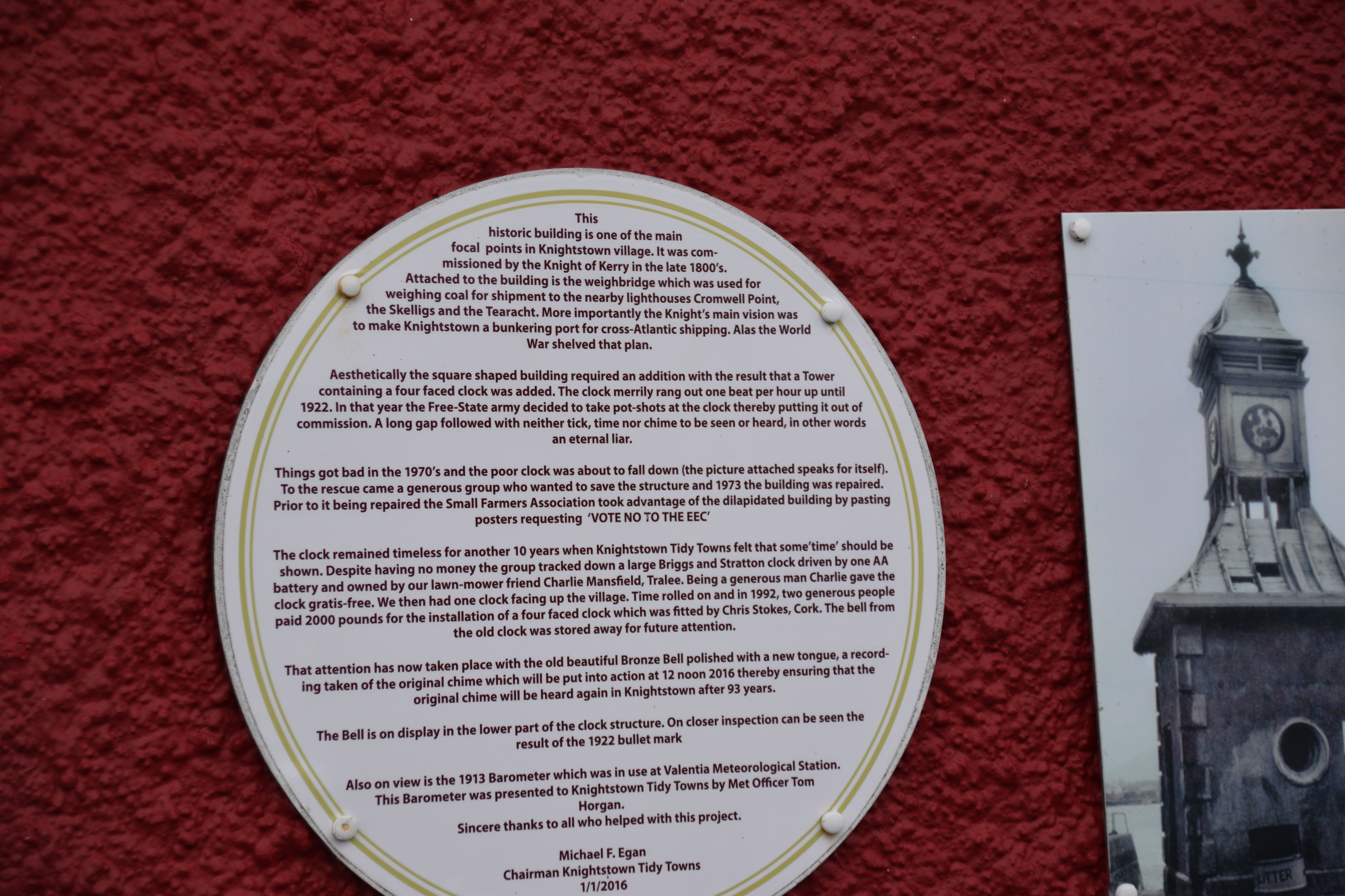
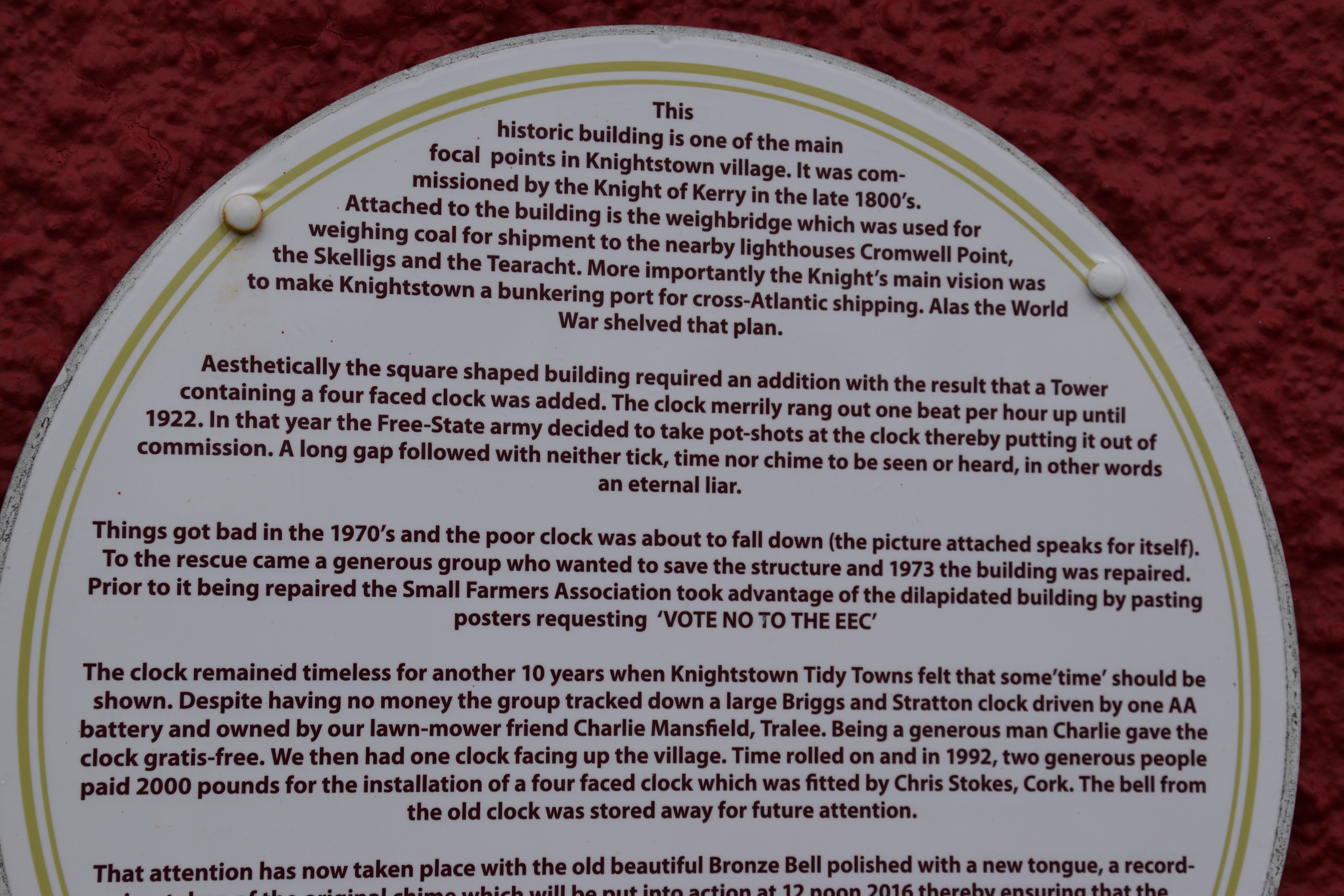
It’s getting late and we’re FAR from home – no time to linger reading plaques if you are on a one day odyssey!!
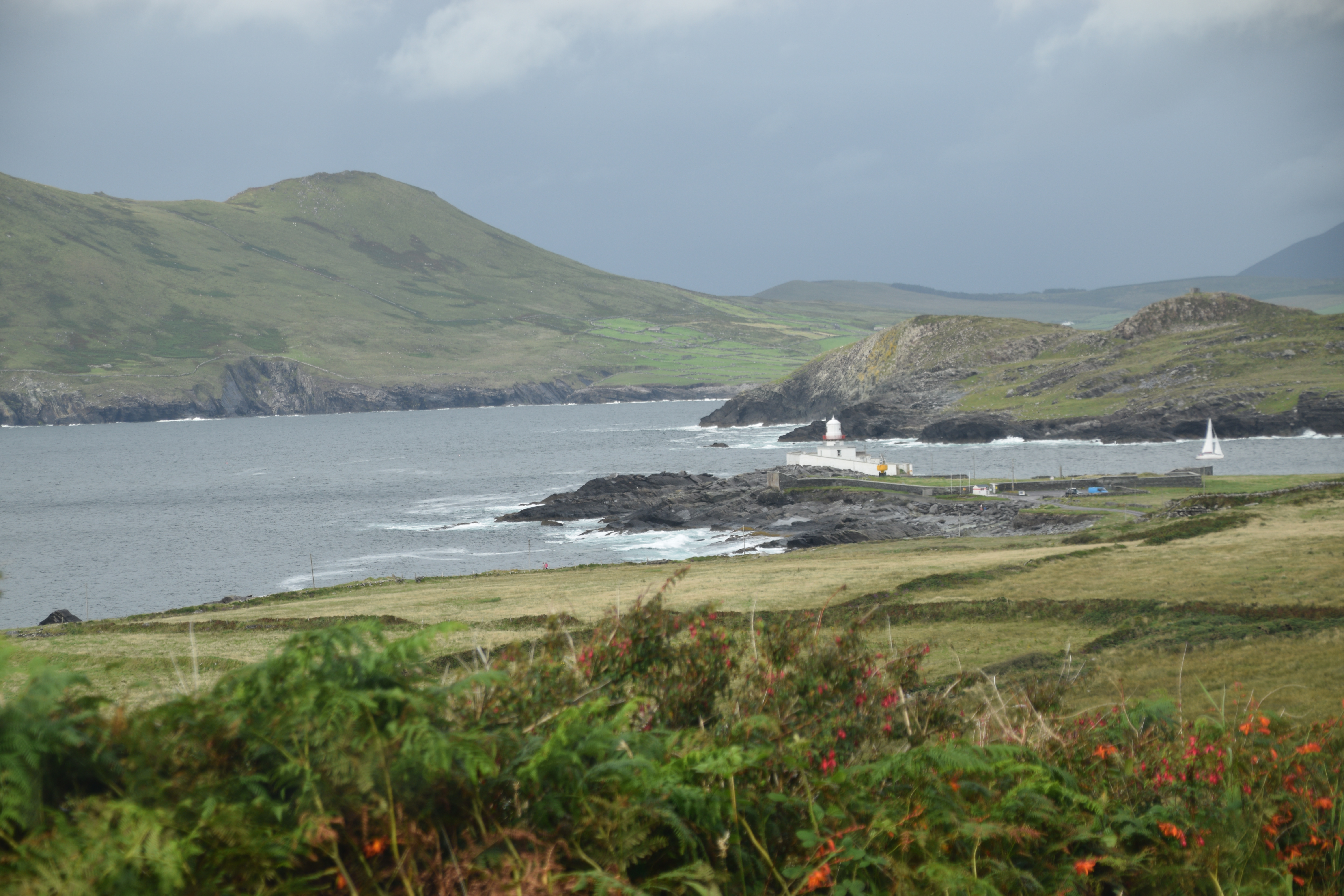
Valentia Lighthouse
This is another nice walk, time allowing…. Built as a fort in the 16th century, it was changed to a lighthouse in 1828.
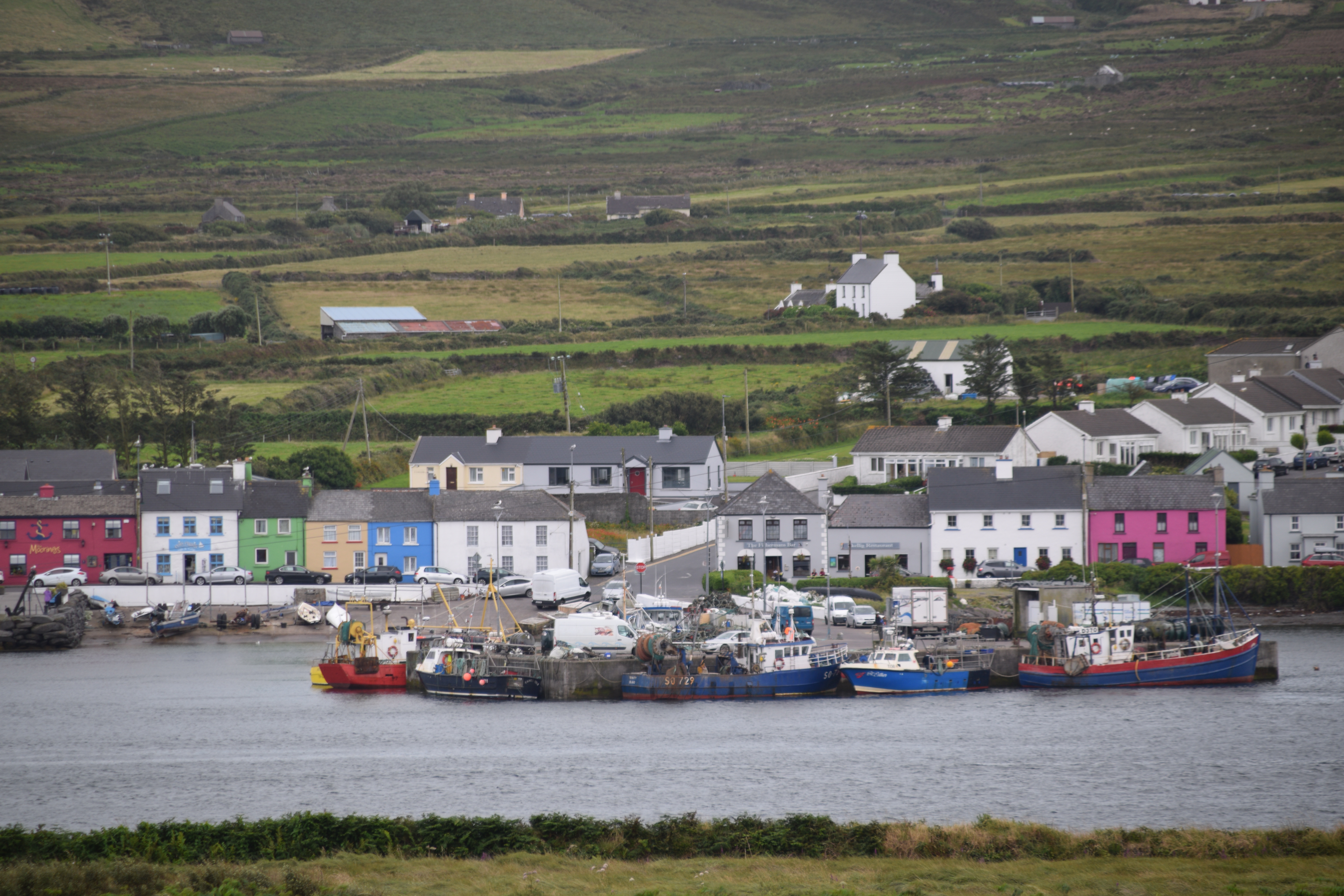
Caherciveen
This market town overlooking Valentia Bay deserves time but not today. There is a great castle for exploring and even more ring forts to photograph. However, I will draw your attention to their Catholic church – This is the Daniel O Connell Memorial Church. Anything strike you yet? Its not called after a saint or deity (the only one in Ireland!)


Before we leave town have a look at this unexpected construction! This is the Old Stone Barracks, built as a police station in the 1870’s. Seemingly it was built in error – the British mixed up the designs with those of a building planned for India! Great story – I hope its true!

(Attributed photo 2.)
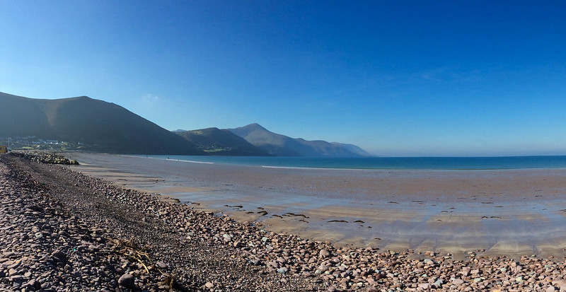
The road heads inland for a while before rejoining Dingle Bay for more stunning views. Ahead is Glenbeigh and the beautiful Rossbeigh strand. Usually on the last weekend of August, thousands head to the beach for the Horse and Pony Races as part of the Annual Glenbeigh festival. There’s a great 10km loop walk if you are staying in the area.

(Attributed photo 3.)
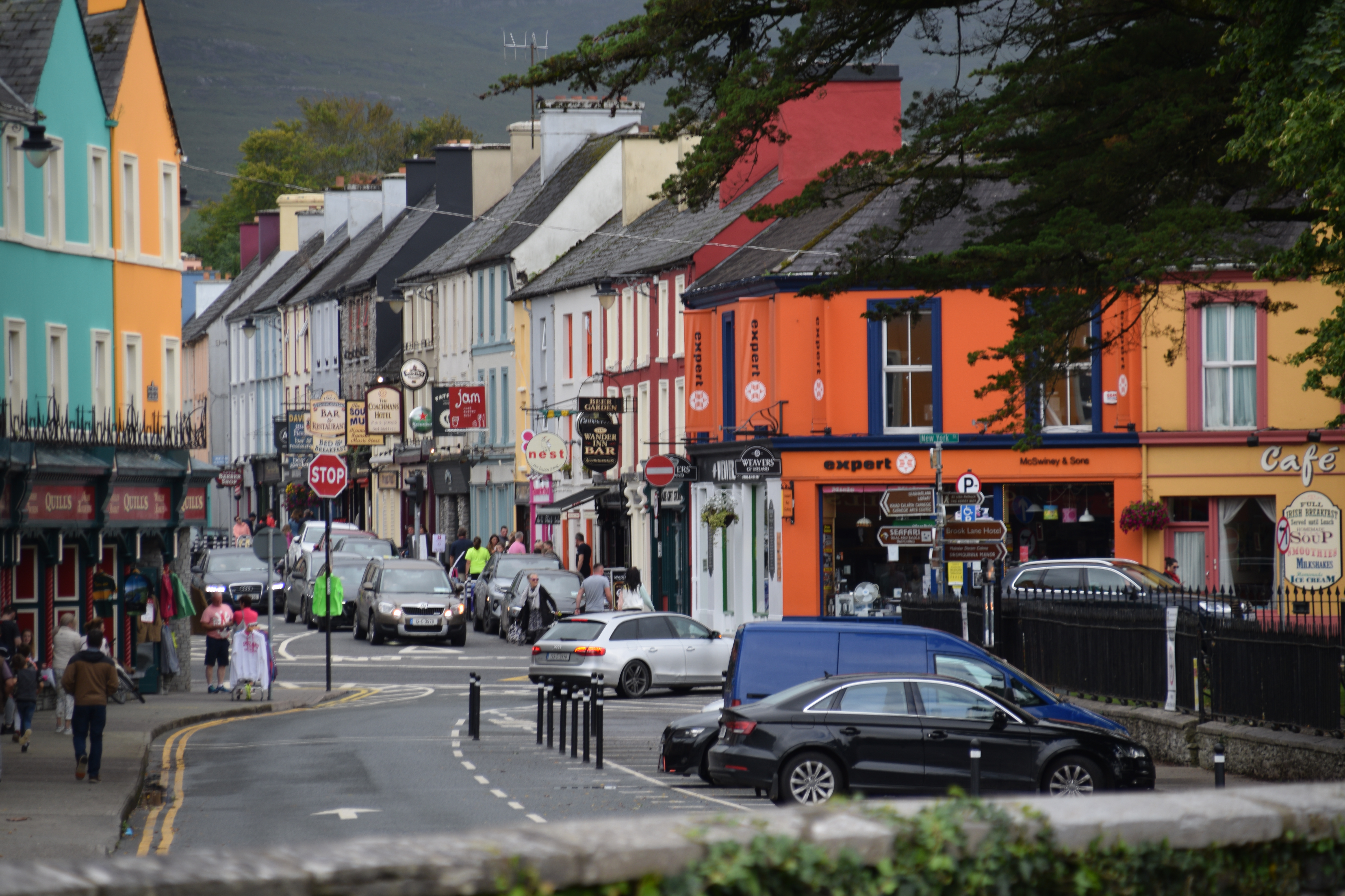
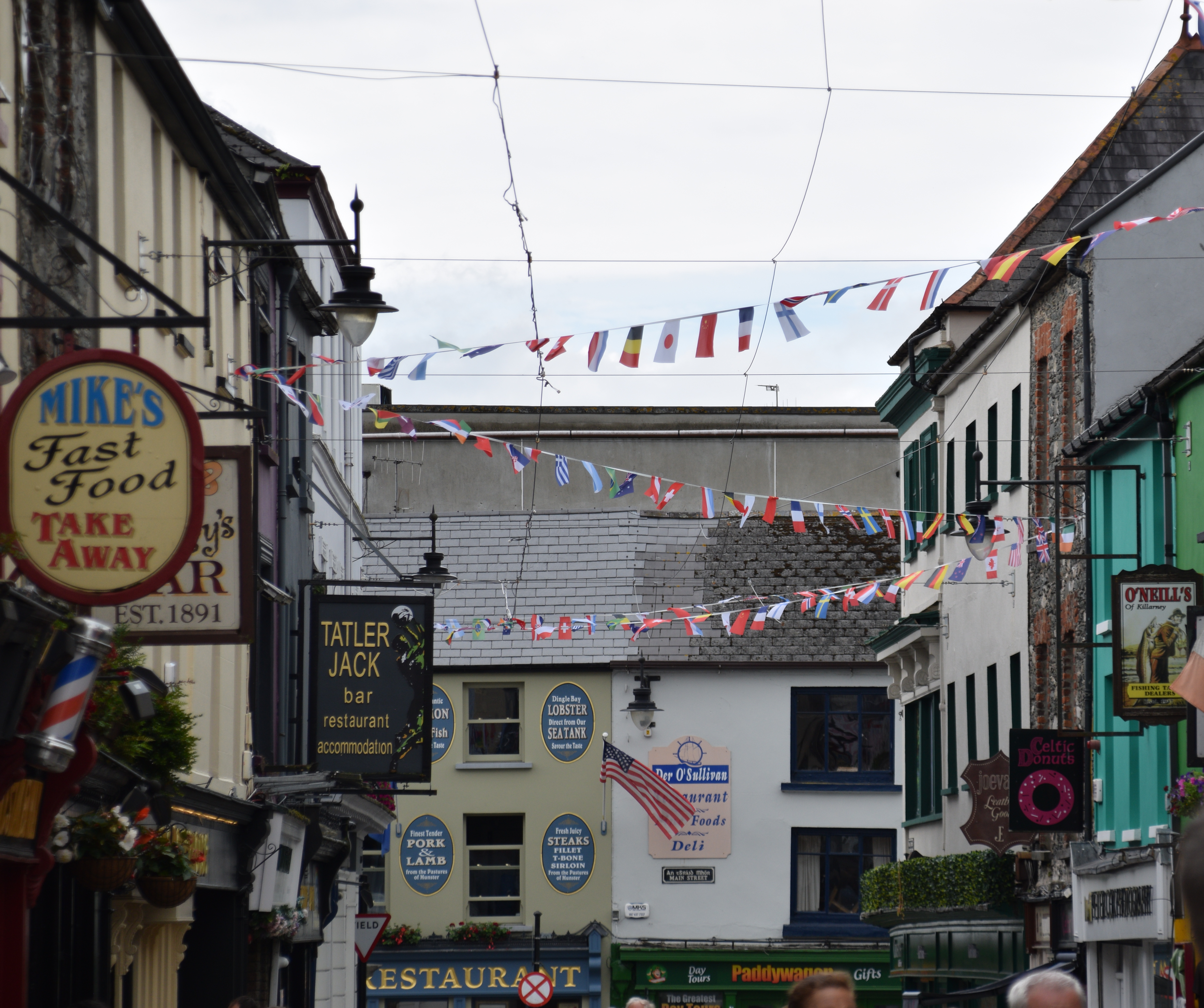
Killorglin
This town must surely be best known for Ireland’s oldest festival – Puck Fair. Every August, a wild mountain goat is crowned king and he is worshiped for 3 days with song, dance and booze before being released! Dating back to pagan times, the festival is presumably linked to Lughnasa – a Celtic feast marking the beginning of harvest.


(Attibuted Photo 4.)
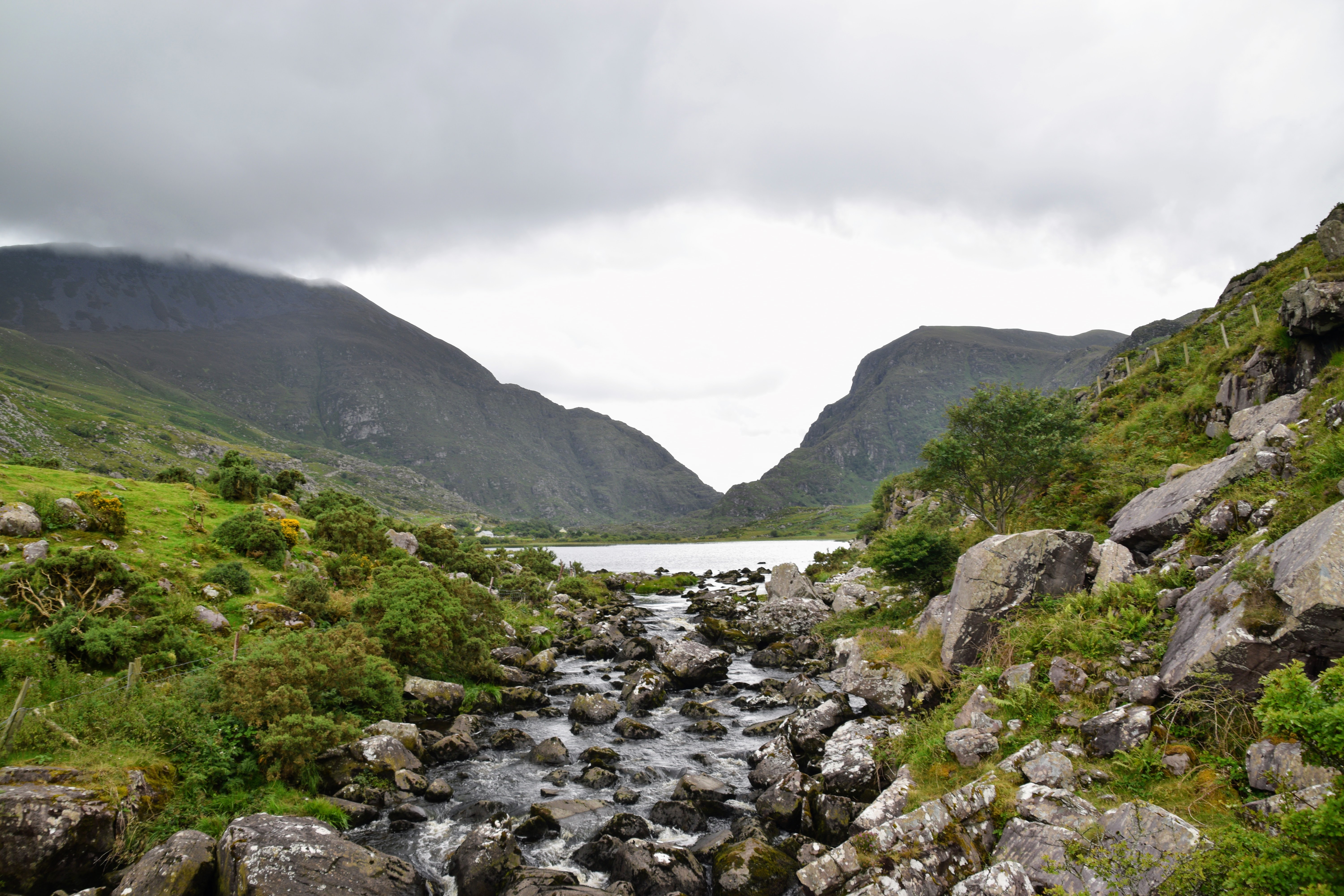
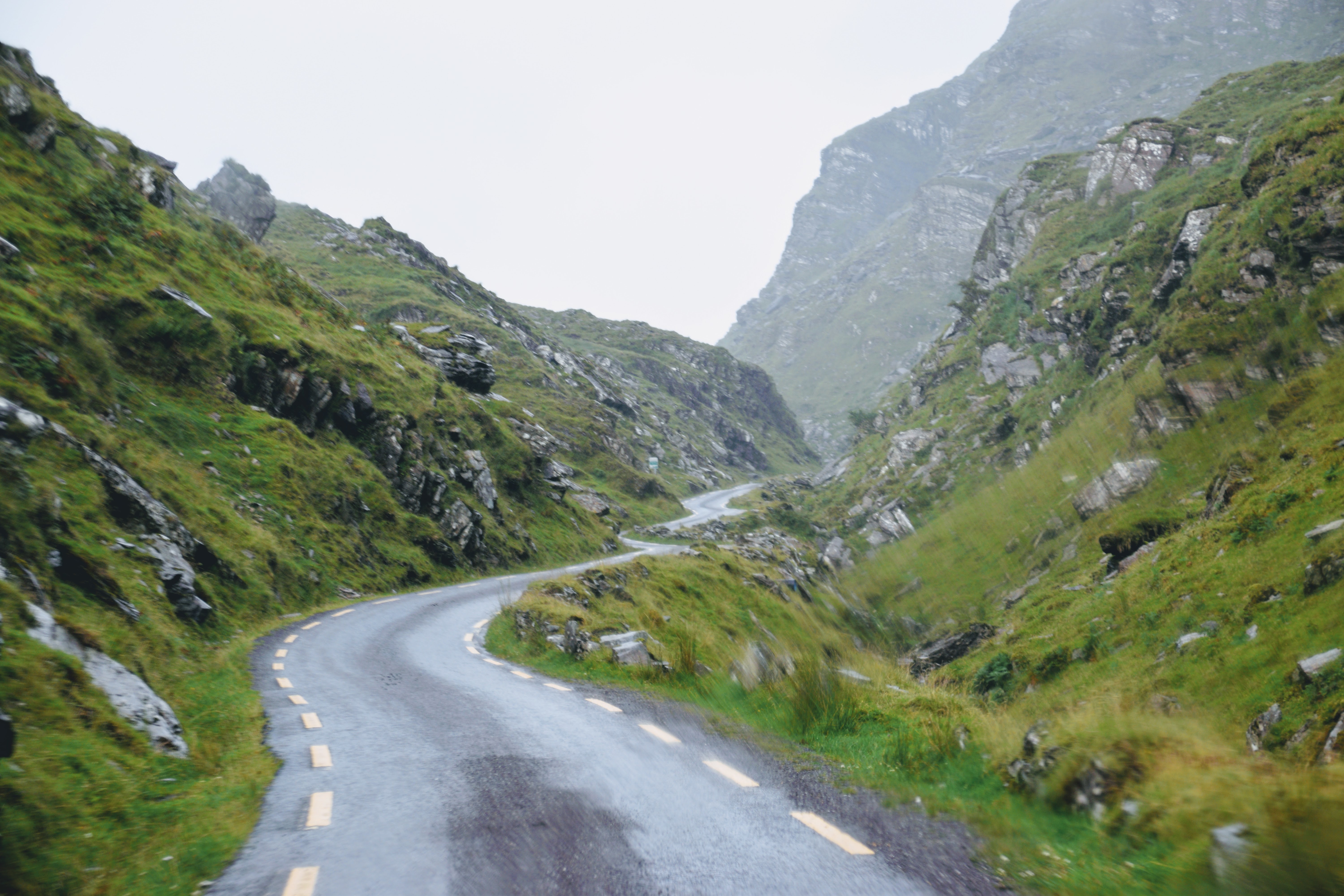
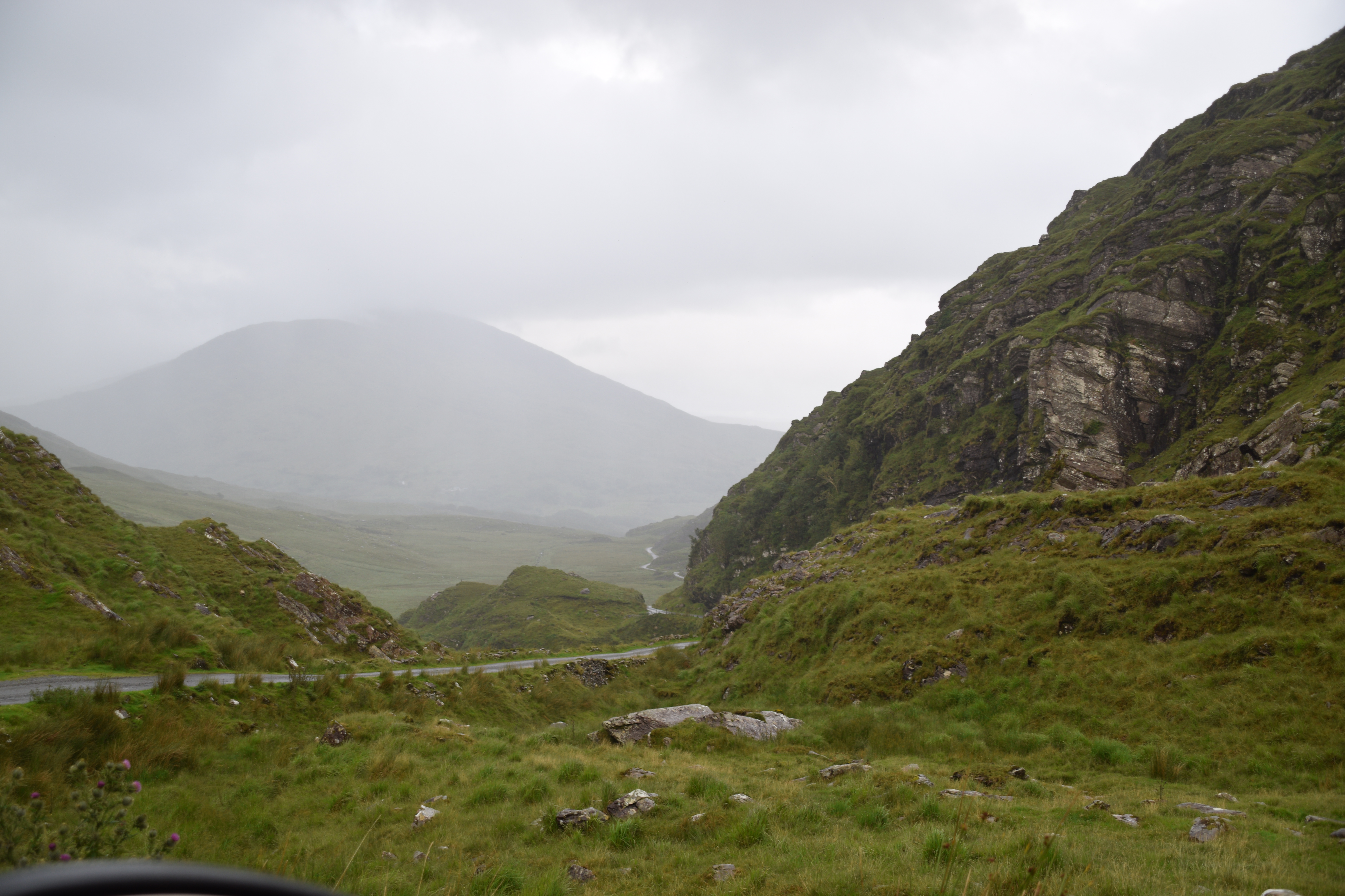
The Gap of Dunloe
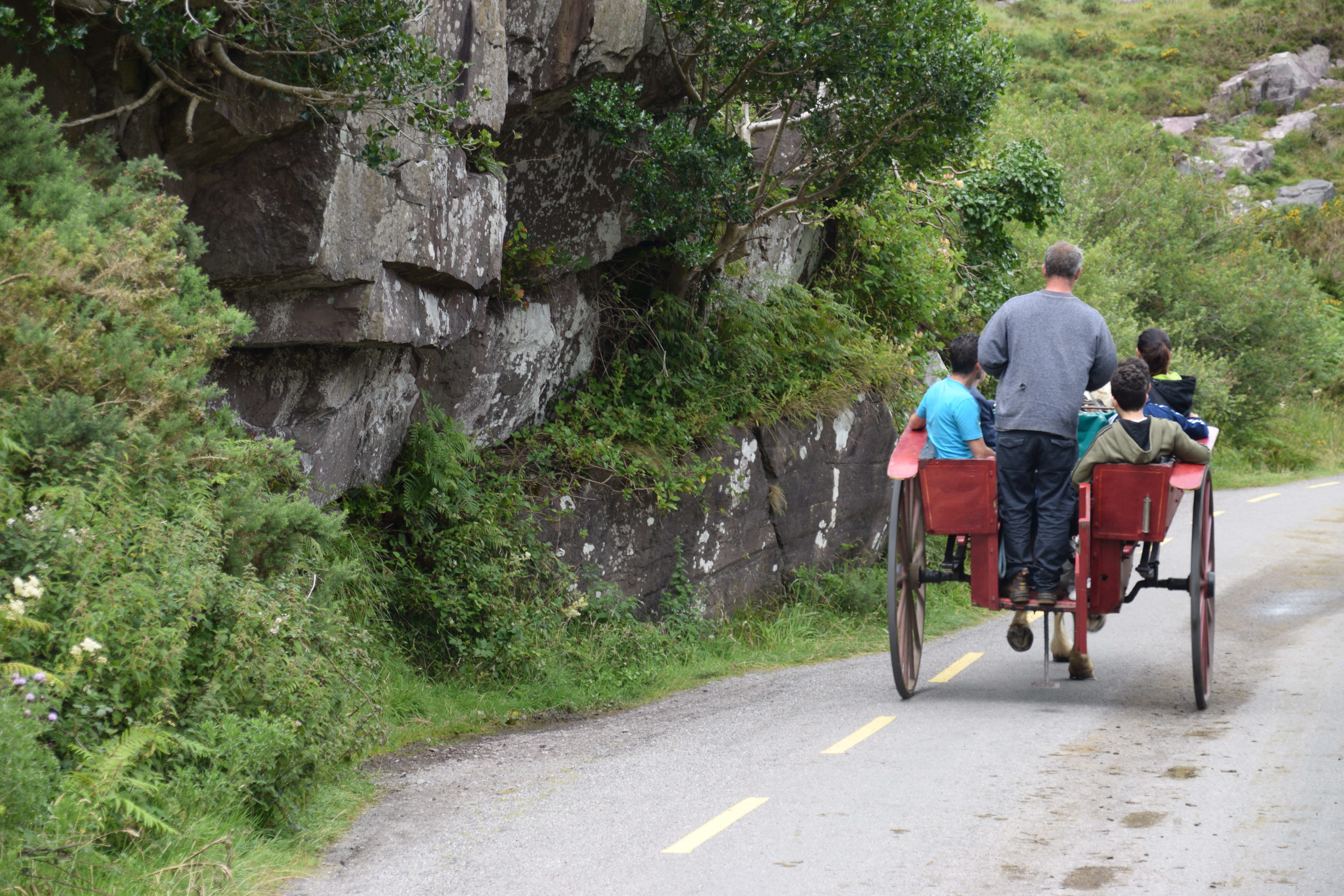
The Gap of Dunloe is a narrow Pass slicing through the MacGillycuddy Reeks which was forged by glacial flows. The Gap is about 11km long and makes for a great day trip from Killarney but if you are visiting as part of the Ring then you won’t have time for it all. Most people park at Kate Kearney’s Cottage and either walk the 20 minutes or take a jaunting car up to the Wishing Bridge for a view of the Gap (remember to make a wish because apparently they all come true!!). It is legal to drive through the Gap but access in high season may be only in one direction (and the jarveys don’t take kindly to sharing the narrow road).
If you have a few days in the area then you have several options. You can hire a jaunting car or bike to travel through the Pass and take a boat back through the 3 lakes to Killarney from Lord Brandon’s cottage. Or you could travel the opposite direction by taking a boat ride from Ross Castle with your bike to Lord Brandon’s Cottage and cycle back through the Gap to Kate Kearney’s cottage ( 11km). There’s a shuttle bus service twice per day from the Cottage to get you to or from Killarney (13km) as well as taxi options from the town.

Kate Kearney’s Cottage
Originally a síbín (an unlicensed premises that sold alcohol) where Kate distilled her famous poitín, this landmark is now a cafe, restaurant and pub.

The Ring of Kerry actually includes the tourist town of Killarney and Killarney National Park. Ideally, it would be great to visit them on a separate day but I know they have to be included in an organised one-day tour. I wrote about the Park in a separate blog –check here – so I’ll just recap briefly on the highlights .
Killarney
The tourist town of Killarney is a great base if you don’t have your own transport. There are lots of activities in the immediate environs and enough bars, restaurants and craic to keep you coming back again and again!
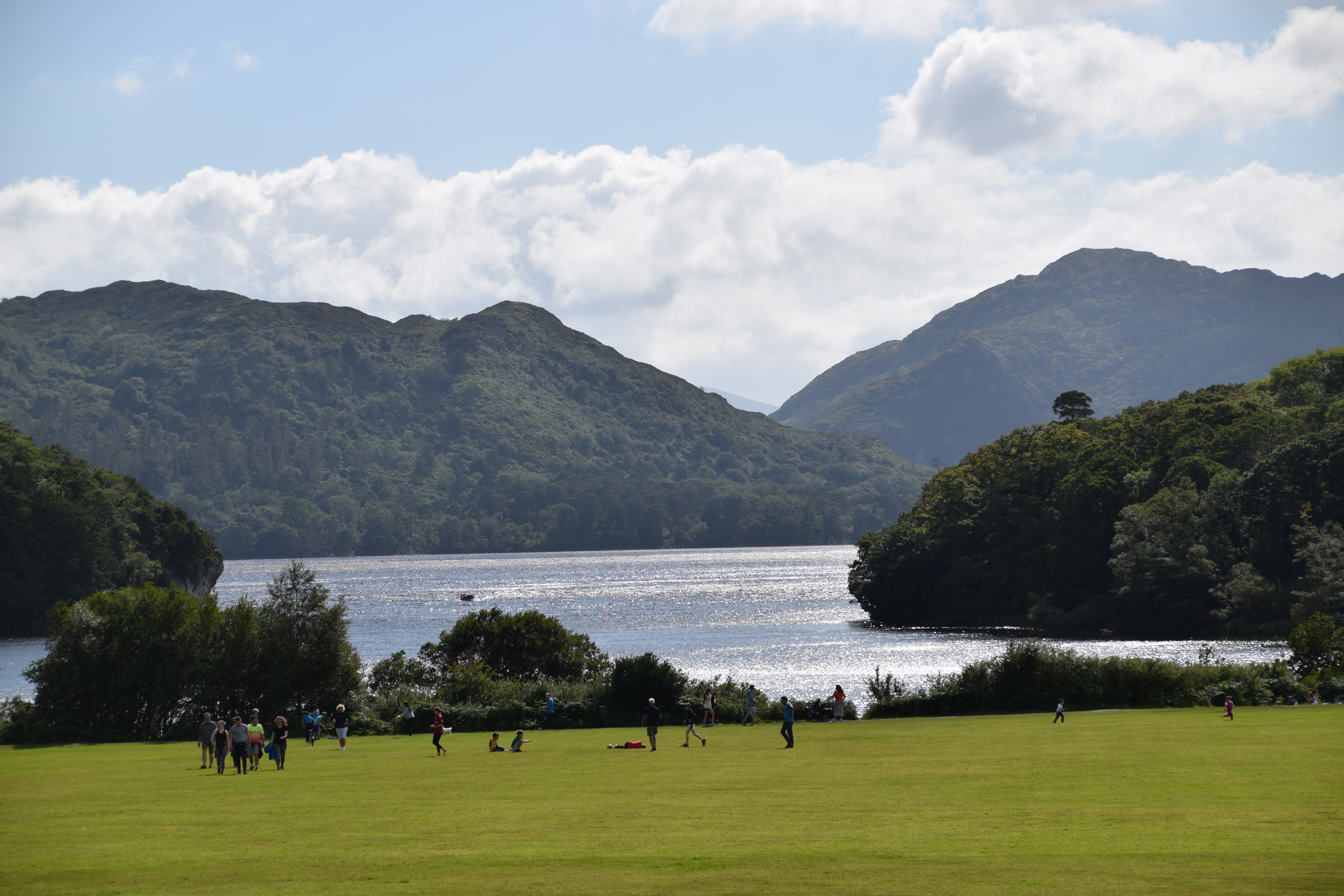
The Lakes of Killarney
Lough Leane, Muckross Lake and Upper Lake are linked together over about a quarter of Killarney National park area. You can enjoy boating tours but if you are ‘doing’ the Ring then you will just have time to admire from the shores.

Ross Castle
Ross Castle on the shore of Lough Leane has been beautifully restored – worth stopping for a selfie at least!

Muckross House and Gardens
Again, you’ll just have time for a photo and maybe a quick walk to the lakeshore.

Torc Waterfall
This is one of the main attractions on the Ring. You can park just a few hundred metres from the waterfall.

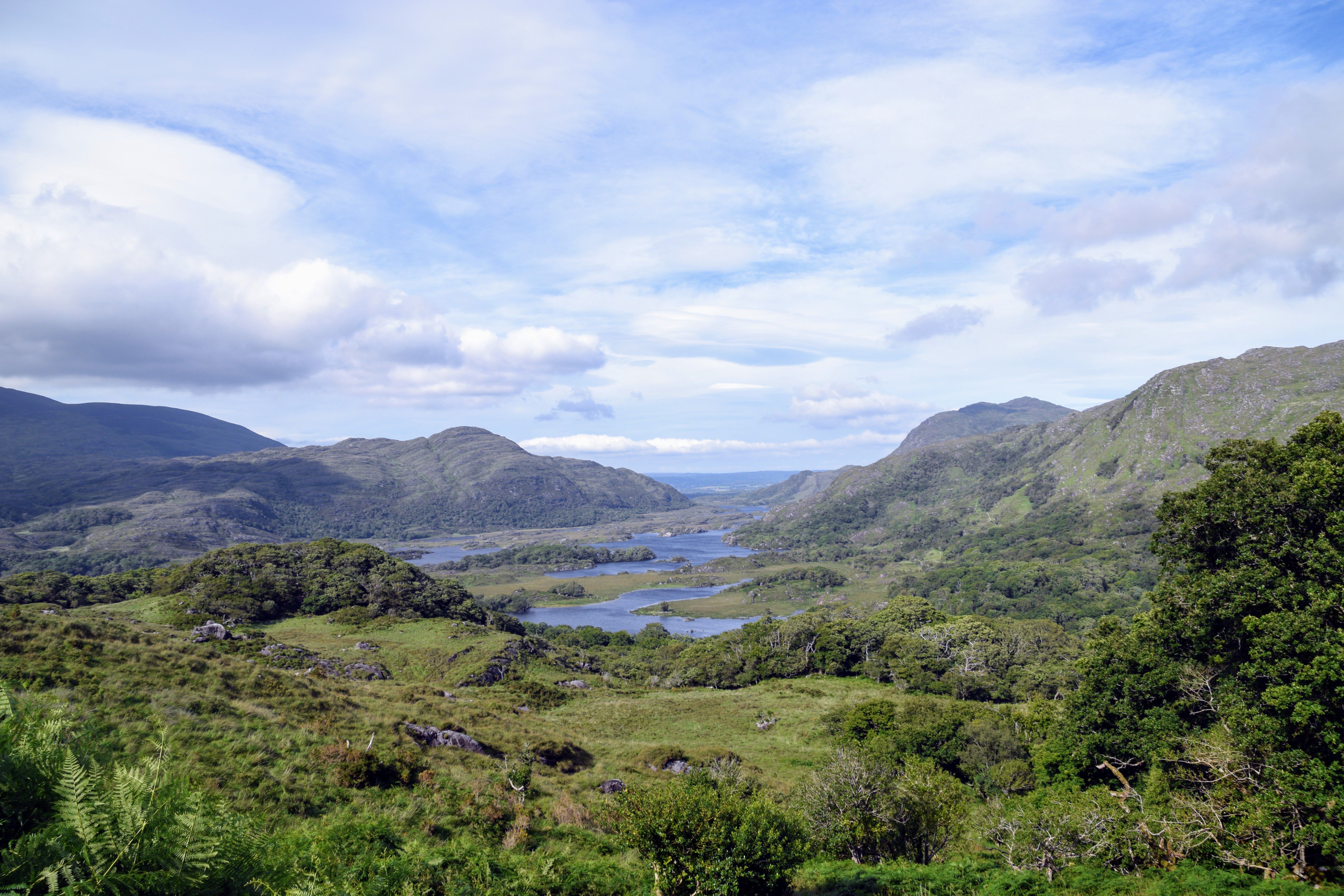
Ladies’ View
As you climb away from Killarney, your next stop will be Ladies View. This is one of the most popular landmarks on the Ring and on a clear day you will understand why. The panorama includes fields, mountains and the Killarney Lakes. The place was supposedly named after a visit by Queen Victoria’s ladies-in-waiting in 1861 who thought the view was amazing (they presumably got a good day!).

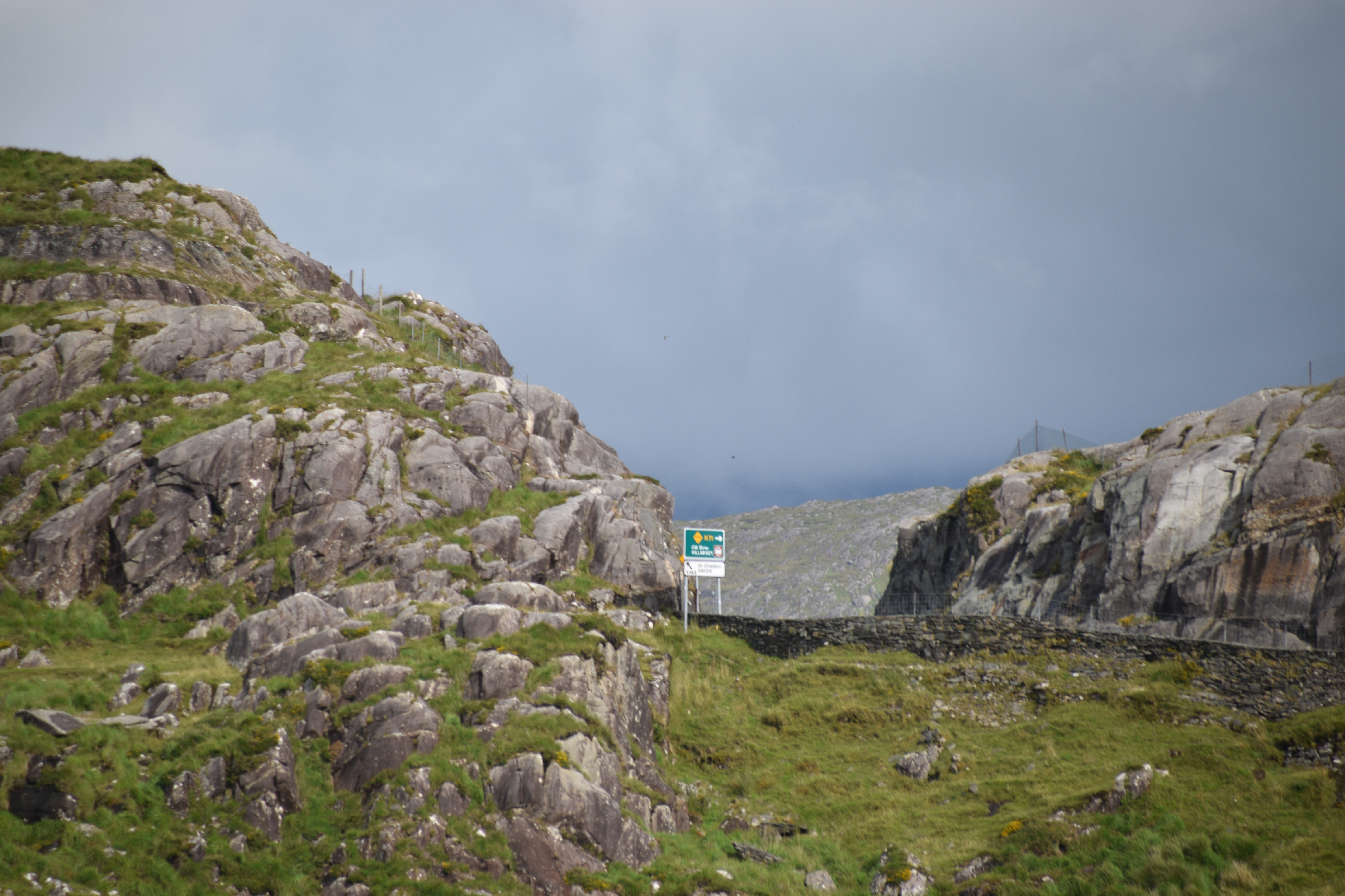
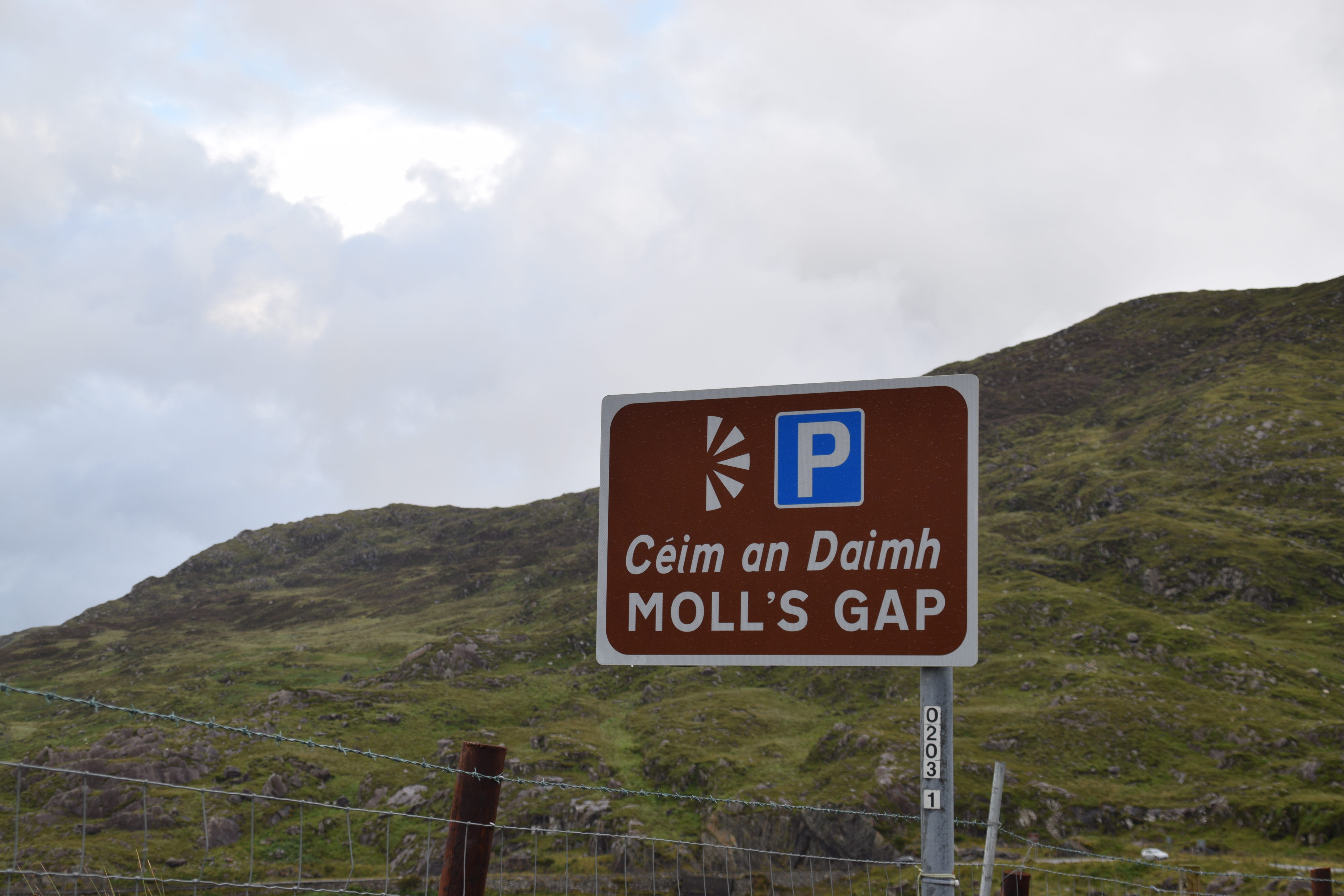
Moll’s Gap
Isn’t it wonderful that, after such a long day, the last stretch between Killarney and Kenmare is so beautiful.
Moll’s Gap is the highest point on the Ring of Kerry with a 235 metre climb. The winding pass offers spectacular views of the Macgillycuddy’s Reeks and the surrounding glacial valleys.
The Gap is named after Moll Kissane who ran a sibin (unlicensed pub) in the area during the construction of the original Kenmare-Killarney road in the 1820s.


And 10km from Moll’s Gap brings you back to Kenmare!!!
So now you know why you need to ignore those who say its a 3 hour drive!!!
But!!…..
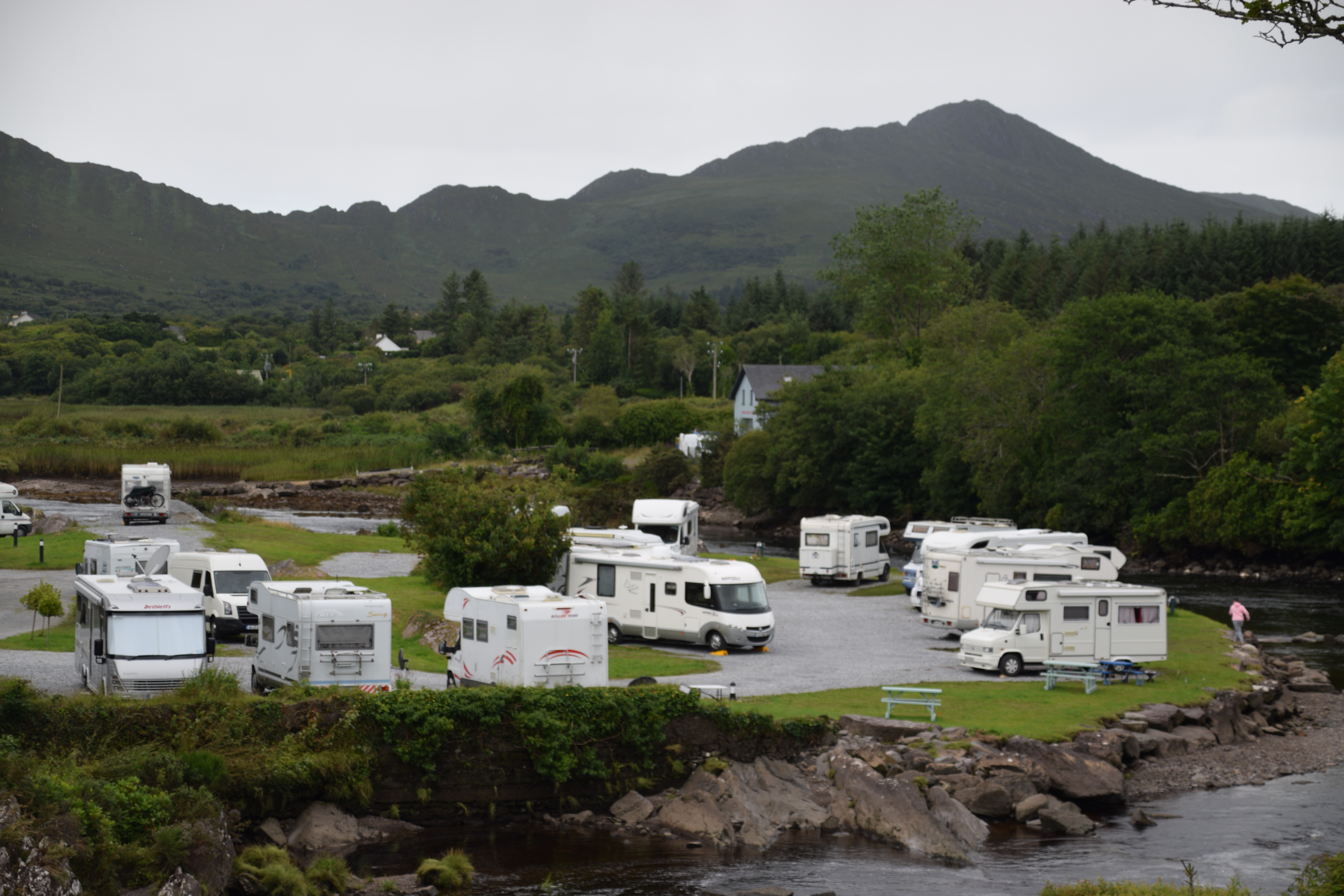
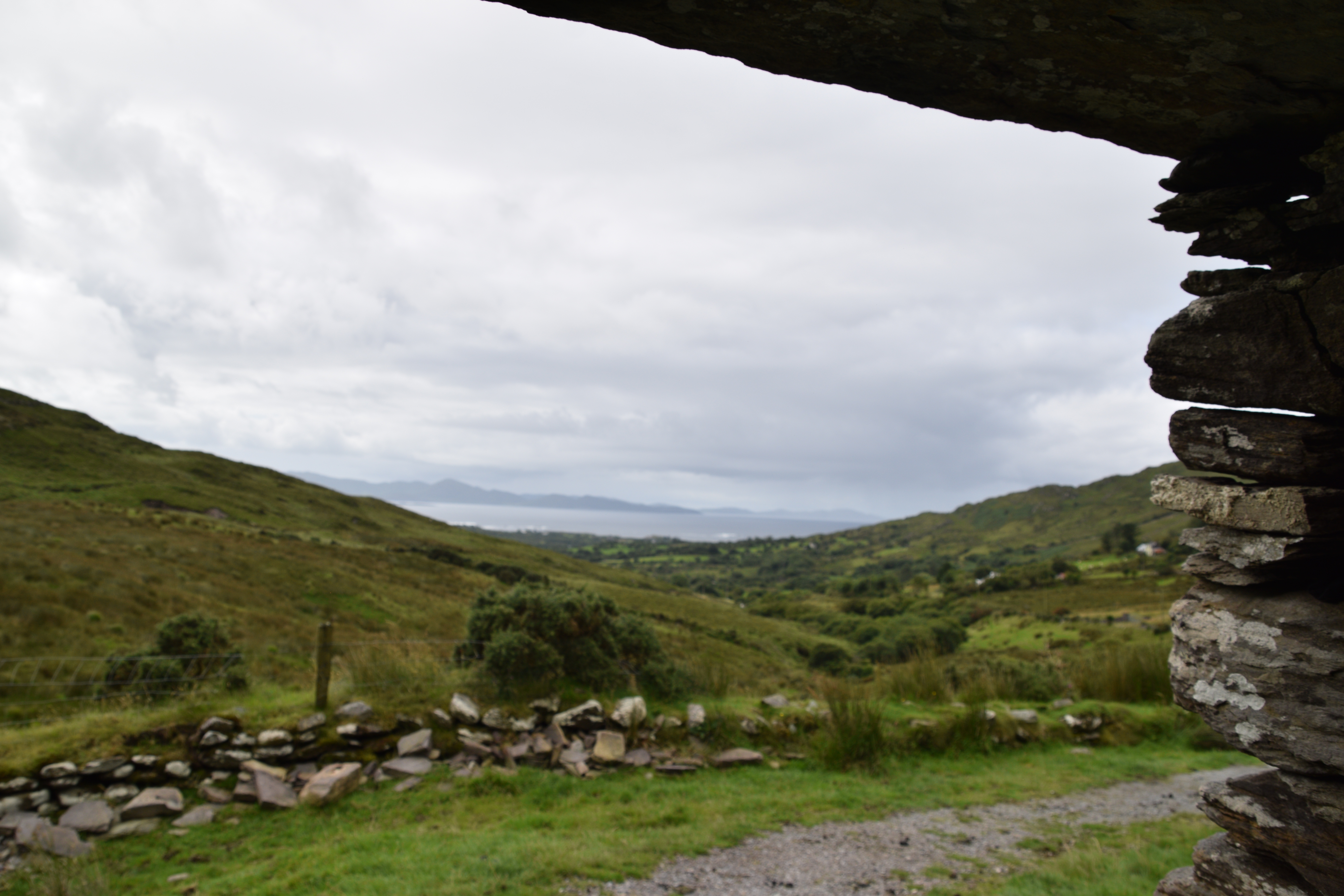
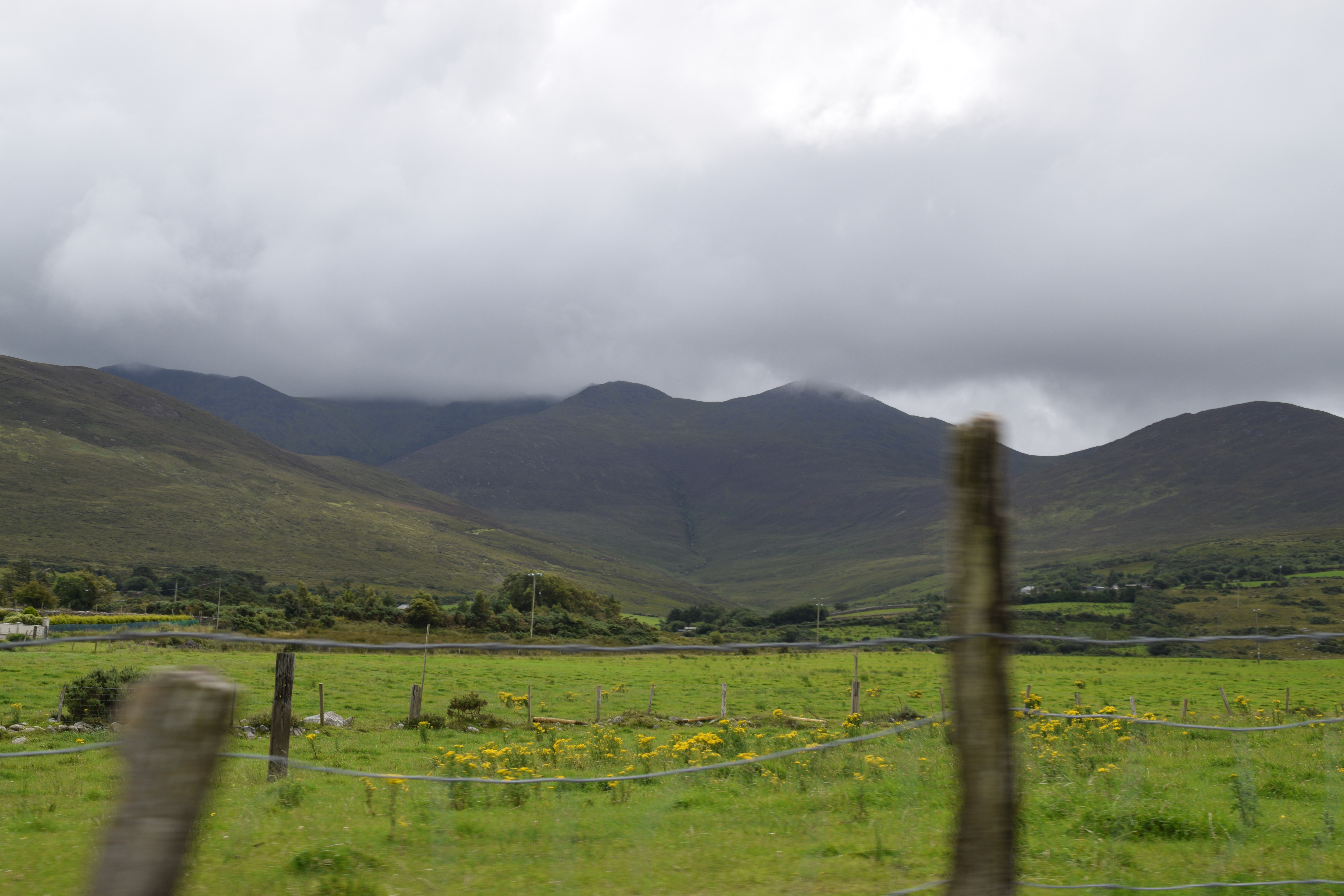
I can’t let you leave the Iveragh Peninsula without mentioning the interior – remember that the Ring of Kerry loops around by the coast. The rest of the peninsula is pretty much dominated by the magnificent Macgillycuddy’s Reeks – Ireland’s highest mountain range. A drive or cycle through the passes – Ballaghasheen and Ballaghnabeama – brings you through some of the most remote but stunning parts of the county.


Planning the Trip
We did not do this trip in just one day!
En route to Kenmare from Dublin we stopped in Killarney for lunch and spent time around the Lakes and Torc waterfall before continuing to Kenmare via Ladies’ View and Molls Gap.
We spent a full day (circa 10 hours) on the Ring – leaving the route after Cahirciveen and coming back to Kenmare by Ballaghisheen and Bealach Beama.
We spent another morning at the Meeting of the Waters, Ross Castle and Gap of Dunloe before taking the road up by Magillacuddy Reeks and rejoining the Ring near Rossbeigh Strand.
Other Considerations:
We didn’t get great weather so we left the beach stuff in the car and just enjoyed a few walks.
We were already familiar with the region so didn’t have to linger for too long at most stops.
As there are practically no foreign visitors about, we met no tour buses at all and we’d no problem parking anywhere.
Marie is right; the Ring is best done in a car. I was 16 & on a bus the first time I did it; it was beautiful, but so much more fun when I went back later and could take my time. Thanks for the post.
You’re very welcome. The best thing about having a car is that you can travel down those narrow roads that the buses can’t reach. Of course if its you’re first visit then you’ll still have a great time on the bus. XXXMarie
This post brings back so many memories, of weekends spent in what I call the Irish Fingers south of Co Cork and Co Kerry, all those peninsulas trying to reach America. These are landscapes still largely preserved from the sprawl that swept through the Irish countryside during the years of the Celtic Tiger. Thanks for the tour, but give it more than a day.
The landscapes are still fabulous but we couldn’t get over the number of BIG houses… not Dublin prices I know but still must cost a pretty penny…. XXXMarie
One of our favourite parts of Ireland. We spent a couple of nights in Killarney, but travelled the Ring in one day. Should have taken more time. Hope all is well Marie. Allan
Most people do it in a day. We’ve never spent a night out on the peninsula – maybe next time! All well thanks Allan – just back from a lovely few (but poor weather) days in Donegal. I’d LOVE a week in the sun and heat!!
I’d love to visit there! It’s on my list!
Its a beautiful corner of the country – you’ll get there some day I’m sure!! XXXMarie
It’s still on tbe list hopefully this year
Hope you get there…. XXXMarie
Sooo about that offer to switch places 😏
Stay where you are for the moment – the weather is terrible!!!!!⛈ 🌩☔️ ☂️
Looks like a fabulous part of Ireland. I love the ring forts spread throughout the green fields, the castles and the amazing landscape pictures. Thanks for the information Marie. Hopefully one day soon we’ll get there. Maggie
You can see why its so popular with visitors! Glad you enjoyed……
Wow…soooo much to see! I can see why you could spend more than a day here. The colours of green are gorgeous and I love that Old Stone Barracks building…looks like something from a fairy-tale.
Doesn’t it just!! A complete oddity in south west Ireland! Definitely mixed-up plans!!
Such an enjoyable read Marie – you’ve set out the sights so well. My husband and I spent 4 days or so based in the Ballinskelligs area and loved it best, of all the areas on the Ring. Never made it to Skellig Michael, our big plan, due to weather.
Ah that’s what I’d like – to spend a few nights away from the bigger towns – we’ve stayed in Kenmare, Kilaarney, Dingle etc – never seemed to have enough time beyond that. And I’m definitely going to try and get to Skellig Michael next year … they are supposed to open their booking in September so we’ll see…. XXXMarie
Fabulous post and tailor-made for prospective visitors. I drove around anti-clockwise, stopping in particular in Caherciveen and Derrynane. You’d need a lot more time to do the Iveragh full justice.
We were exhausted!!! And that’s only ONE peninsula! We’ve never stopped in Caherciveen – we’re always too late arriving there and still have to finish the drive…. We should go anti-clockwise next time…. Thanks for your kind words. XXXMarie