…….it is a country where there is not water enough to drown a man, wood enough to hang one, nor earth enough to bury them.
(Cromwellian Army Officer, 1651)
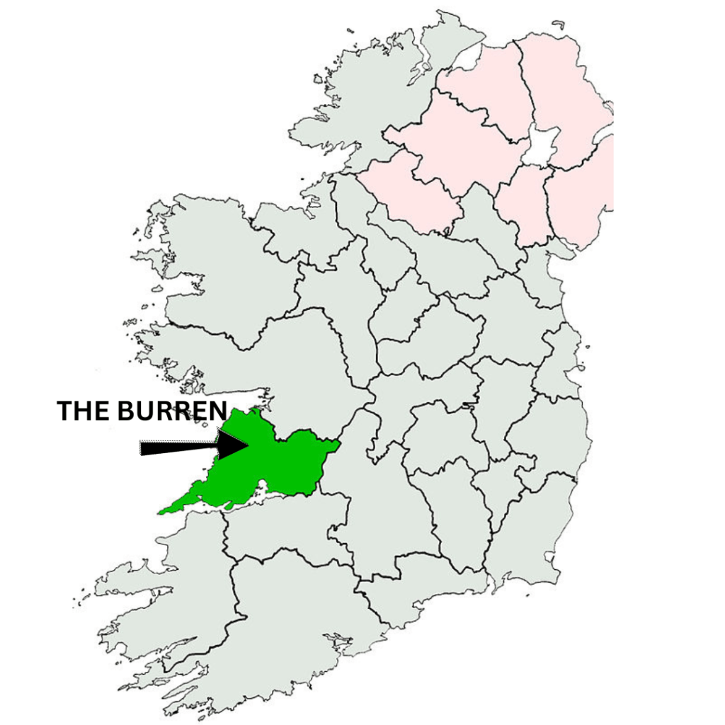
The anglicised name comes from Boíreann – the Irish for Rocky Place. I suppose none of our ancestors were going to waste time thinking up a romantic name for such a hostile, barren landscape – except – it’s NOT barren!


How it all began (in under 150 words!!!)
Some time ago – well, 350 million years or so – Ireland was covered by tropical sea close to the equator ( I know – who’d have thought!!!).
Limestone, containing fossil corals, sea urchins, etc. formed in the warm water over a long period of time.
Tectonic movement eventually saw Ireland drift northward.
By about 60 million years ago, Ireland was finally above sea level.
The original limestone was covered by further layers of limestone and shale.
Circa 2 million years ago, the ice age began in Northern Europe.
At least 2 glacial advances are known to have affected the Burren.
Moving ice sheets eroded the overlying soil, exposing the limestone.
Any soil left after that was subject to further erosion from rain sweeping in from the Atlantic.
Whatever woodland survived all that was removed for farming.
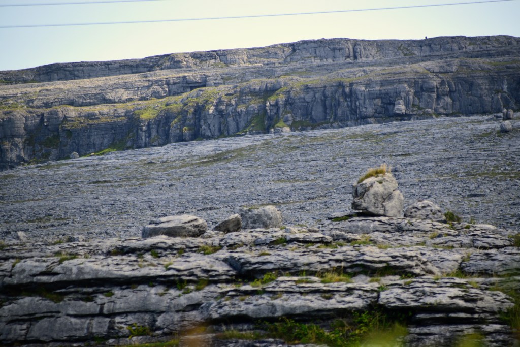
The bared limestone, exposed to this day to dissolution by rainwater, resulted in the classic glaciokarst landscape…
And that’s how you create an exposed limestone pavement (more or less!)
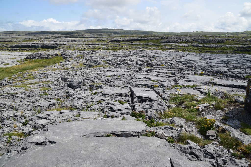
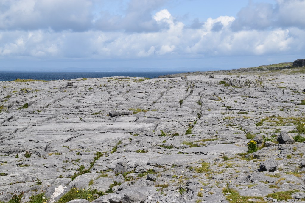

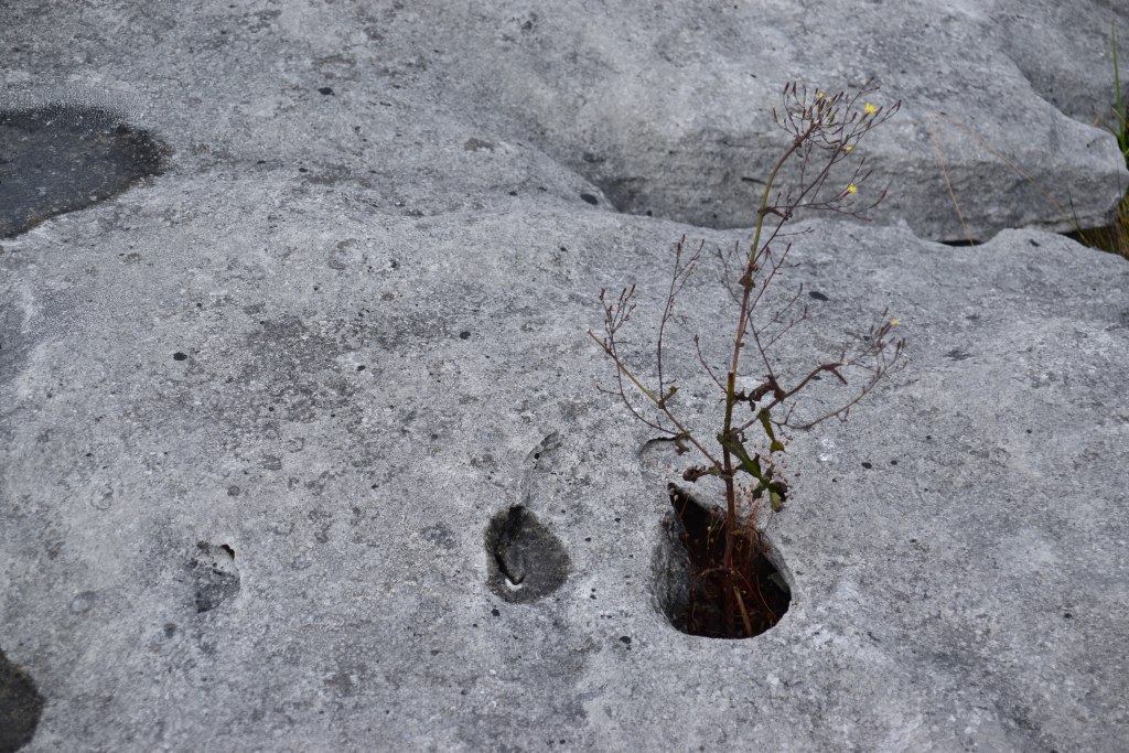
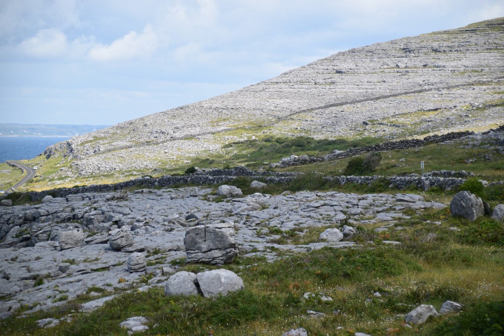
The limestone pavement consists of clints and grykes…..
The clints are the flat surfaces….

….and the grykes are the fissures or cracks that break up the pavement….

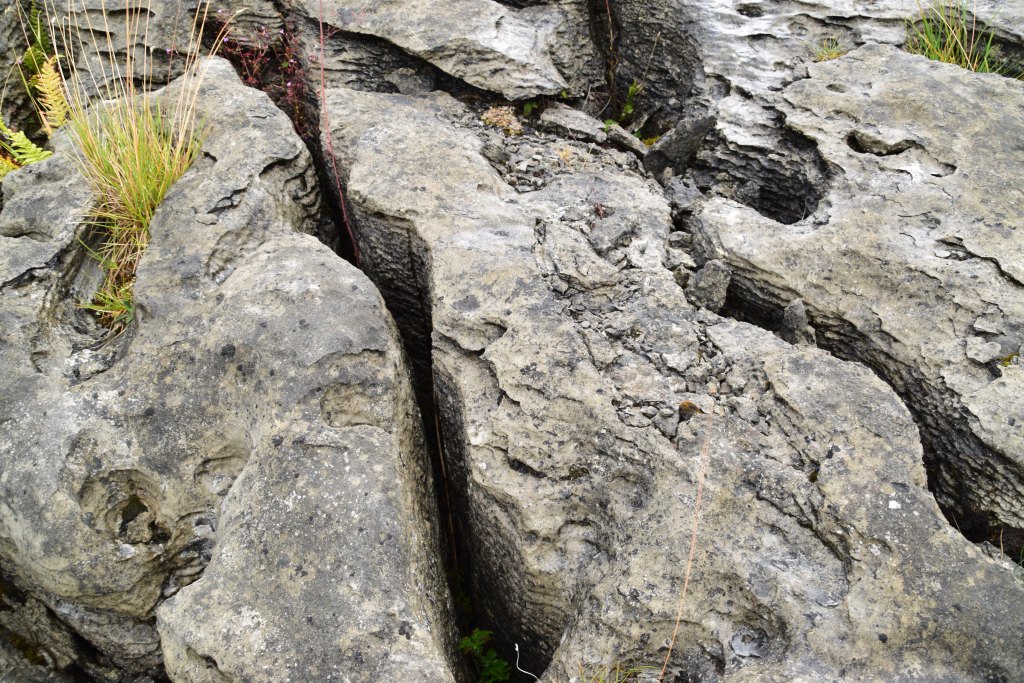
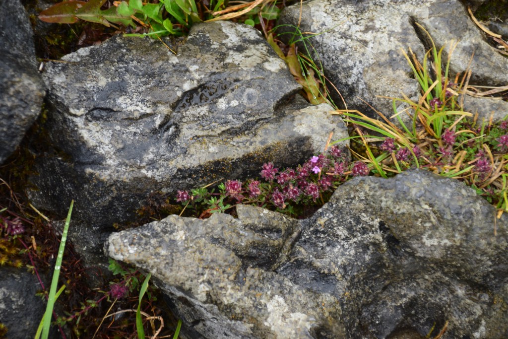
Soil accumulates in the grykes which also provide shelter from the winds. Today, the Burren is home to over 70% of Ireland’s native flowers and it’s the only place on the planet where Arctic, Alpine and Mediterranean plants grow side by side!
The first inhabitants arrived here about 6000 years ago. While they may have removed the trees, the farming techniques that evolved to eke out a living in such an inhospitable environment has helped preserve the flower-rich habitats of today. The ancient practice of winterage – allowing cattle to graze the hills in winter – to this day clears away the tough grasses thus allowing plant life to flourish come springtime.


Mullaghmore is the only part of the Burren that has been subjected to any major tectonic disturbance. Here, we can see substantial folding of the flat limestone beds.


There are many common fossils found in the Burren limestone including corals, snails, etc. Most fossils are broken,suggesting that the floor of the shallow, tropical sea was agitated by wave movement.


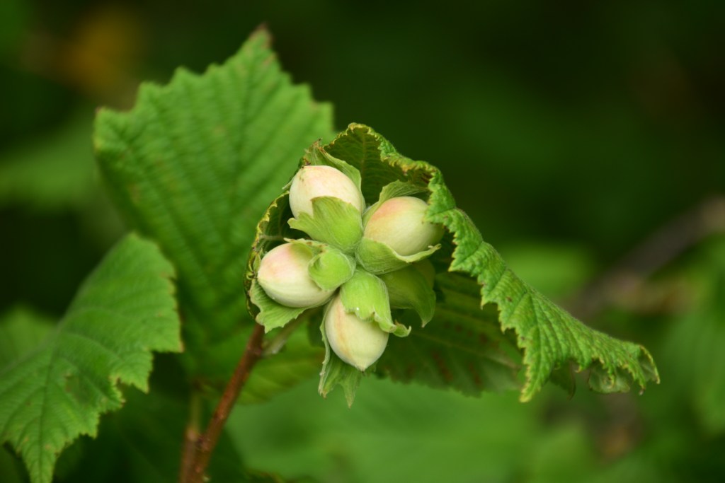
Hazel scrub is common and occurs anywhere with enough soil and shelter. It provides shelter not just for fauna (badgers, pine martens, foxes, red squirrels, etc.) but also for flora species including blackthorn, holly and willow.
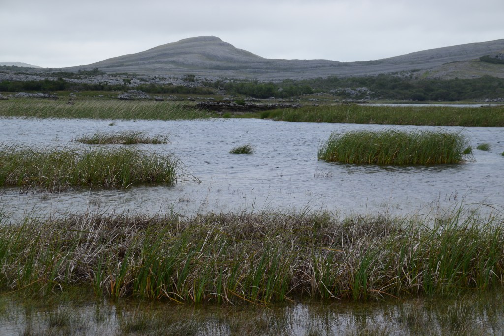
Due to karstification, drainage here is subterranean, emerging occasionally as a spring or in Turloughs. Turlough comes form the Irish Tuar loch meaning disappearing lake. There are also permanent lakes in the region as well as extensive areas of reed swamp.
The ice sheets removed a lot of the loose material but they also deposited large heaps of boulder clay in the form of rounded hills (called drumlins) and low ridges. They also moved and deposited large limestone boulders – known as Erratics – which can be seen scattered across the Burren
Along the coast, there are many rocks not originally from the Burren but carried by the ice from other areas.

The last Ice Age ended around 15,000 years ago but rain has continued dissolving the limestone and widening the fissures, creating caves all through the Burren.

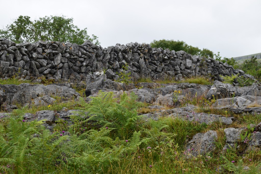
Most of the impressive stone walls were built in the early 20th century.

Around 5,500 years ago, settlers here began building large stone tombs. Poulnabrone Portal Tomb was in continual use for 600 years, excavations revealing the remains of 33 people.

Burren National Park was established in 1991 by the state for nature conservation and public access. Measuring circa 15 square kilometres, it comprises just about 2-3% of the Burren but includes examples of all major habitats – limestone pavement, turloughs, hazel scrub, etc.

A few Facts and Figures about the Burren:
It covers 1% of Ireland’s land surface (circa 360 sq kms).
23 of Ireland’s 27 native orchid species are here…
….and 28 of the country’s 30 native butterflies….
…and at least 70 species of land snail
Over 20 tower house or castles, built between 1200 -1600AD, are found here. They would have been occupied by the most powerful families in the region.

During the Great Famine, several ‘famine Roads’ were built in the area under the famine relief scheme
The Burren was awarded the UNESCO Global Geopark status in 2011.
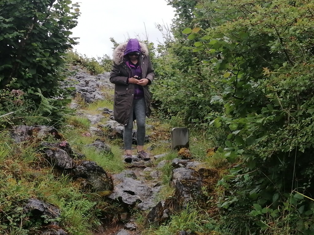
The Burren Way is a 114km walking route that takes in the best of what the Burren area has to offer.
The Burren can be found on The Wild Atlantic Way – that fantastic 2600km drive up the west coast of Ireland.

Was Lord of the Rings inspired by the Burren?
Tolkien visited the West of Ireland on many occasions and spent considerable time in the Burren. The landscape must surely have had a significant influence on his imagination!
and
It is said that Gollum may be named after Poll na gColm (pronounced Pole na Gollum meaning Cave of the Rock Dove) .
Before you go…
Its not all about rocks and plants! This is a fabulous part of Ireland for music, tradition, pubs, food and sport. You’ll have the BEST time here!!!