

Is there any end, you ask, to the natural beauty of this rock I’m proud to call home…. In a word ….NO! So seatbelts fastened, we’re off on yet another spectacular drive!
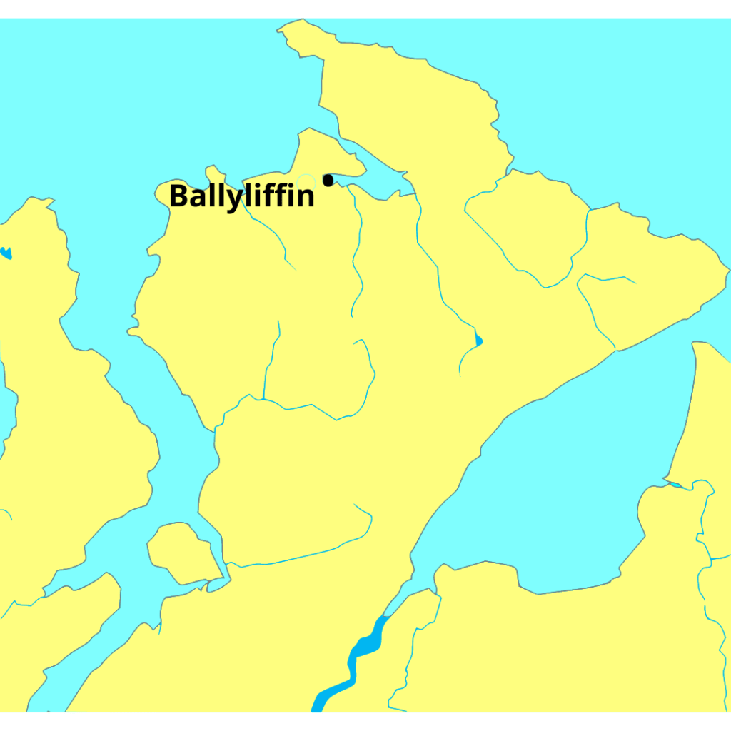
Even by Donegal standards, Inishowen is remote! At the very north of the county (and country!) this peninsula doesn’t get the attention it deserves but offers landscapes, heritage and culture to match any of our more popular tourist centres.

Almost triangular in shape, the peninsula is bounded by Lough Swilly, the Atlantic Ocean and Lough Foyle.
The Inishowen 100 – yes it sounds like a race – is a signposted scenic drive that loops around the peninsula. Its roughly 100 miles (160km) in length. It can be done in a day but, if like us, you whizz around trying to fit everything in, you’ll definitely come away saying I must go back!!!
It being a looped drive, you can obviously begin from anywhere. We started and ended in Ballyliffin and travelled in a clockwise direction. As with all such trips, you have to allow extra time for detours that might catch your attention along the way.
Trivia Moment
Inishowen means ‘Island of Eoghan‘. Owen was a son of Niall of the Nine Hostages (who supposedly captured St. Patrick and brought him to Ireland).
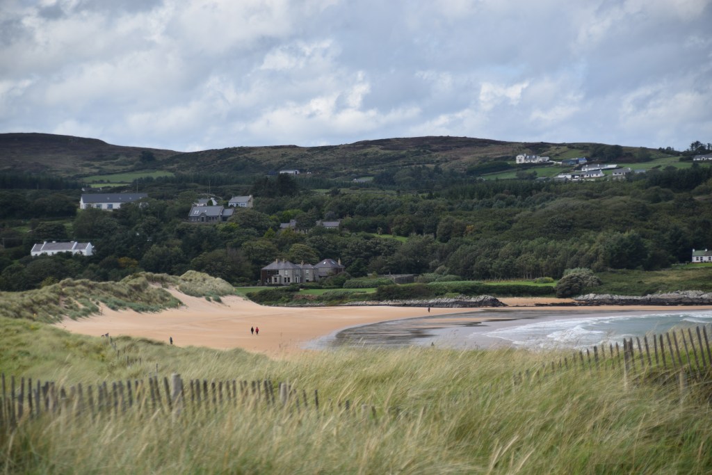
Pollan Bay
This lovely 2 mile long beach at Ballyliffin looks out over Glashedy Island. Its very tempting to go for a walk but we’ve too far to travel today!!!


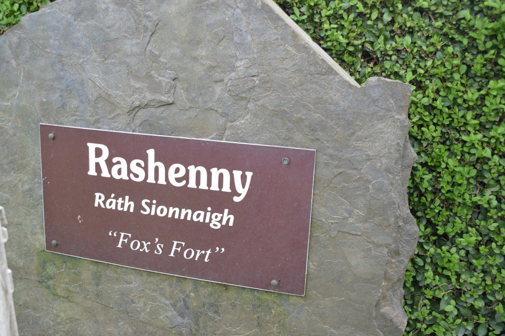
I love the great effort that has been made throughout Donegal to record the names of local areas and townlands. Up around here, they’ve added the entymology – the origins of the name before its anglicisation.
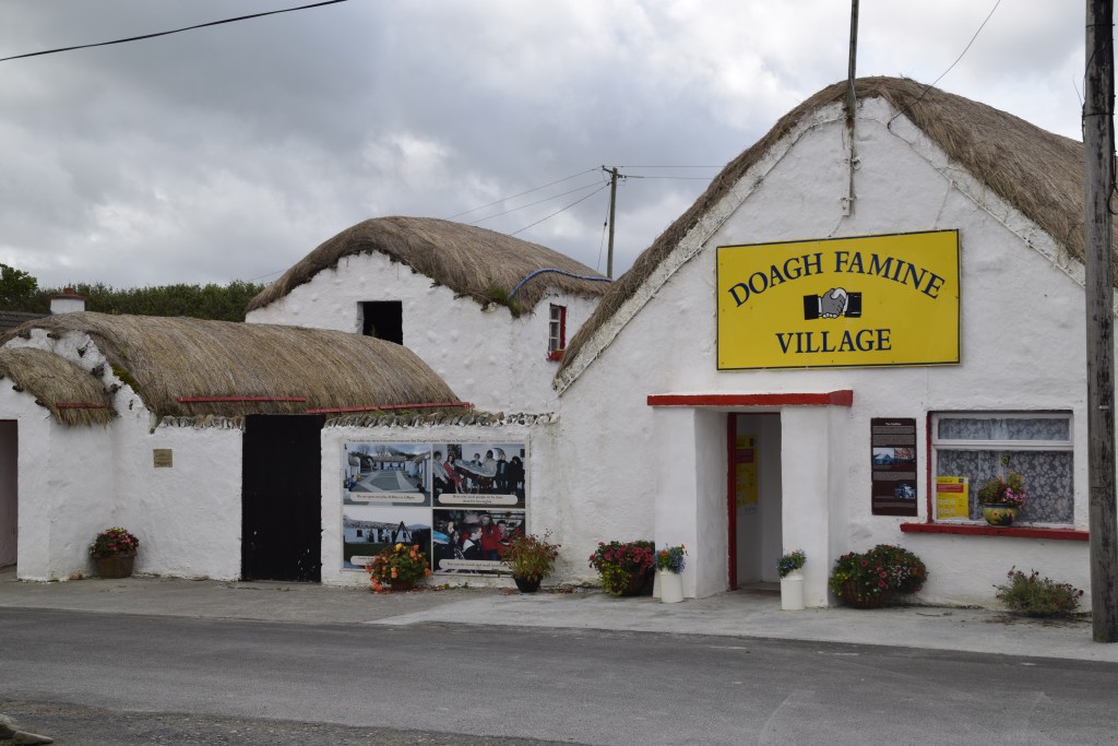
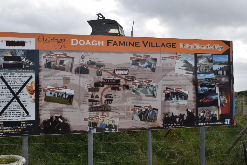
Dough Island
During the Great Famine of 1845 -49, Ireland’s population dropped from 8 million to 4 million due to starvation and emigration. At the Doagh Famine Village, there are exhibits, restored buildings, re-enactments of scenes from times gone by, etc…..


Canny’s House
Nearby is Canny’s House. John Canny was a hermit who lived in a local cave. He had worked in the US for many years but was unfortunately robbed of everything on his way back to Ireland ( story is that he was robbed by a black haired woman and he hated the sight of black haired women ever after!). He existed mainly on fish and birds – including seagulls and crows. One harsh winter, the locals feared for his life. Farmers collected stones and everyone came together and built him a house in a day. He eventually agreed to leave his cave and move into the house.

Carndonagh
Carndonagh is famous for its 7th century Donagh Cross which is one of the earliest Christian crosses outside mainland Europe. It is decorated with Celtic knotwork and a crucifixion scene. As with other early crosses, Christ is portrayed in triumph after having defeated death – it was only on later crosses that the agony of the Crucifixion was portrayed. One of the smaller pillars shows an engraving of a harp – thought to be the first engraving of the instrument in the country.


Malin
We approach the town across a ten-arch stone bridge which you will definitely want to get out of the car and photo. The area is a designated wildlife sanctuary and a great place for bird watchers. The town was planned around a triangle shaped green and has won the National Tidy Towns competition twice.


Five Fingers Strand
Five Fingers gets its name from the rock formations at one end of the beach. The sand dunes here are among the highest in Europe. Unfortunately the beach isn’t safe for swimming but is great for walking, fishing and birdwatching.


Lagg Church
Close to Five Finger Strand is St Mary’s – or Lagg – Church. Built in 1784, this is one of the oldest Catholic churches still in use. By the late 18th century, Catholics were allowed to practice their faith freely but Catholic churches had to be built outside towns!

The road curves up over the cliff and offers great views of Five fingers and Lagg Church below…


We haven’t travelled far as the crow flies – There’s Doagh Famine Village across the bay…its good to see so many visitors there..


Our timing was perfect – we spotted this sign… and then the Alpacas coming back from their trek! Certainly makes a change from sheep!


Trivia Moment
Inishowen is the best place in Ireland to witness the Northern Lights – Aurora Boealis – known locally as Rory
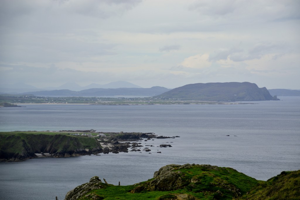


Malin Head
Malin Head is Ireland’s most northerly point and Banba’s Crown marks the the tip of the peninsula (Banba was a mythological goddess and an ancient poetic name for Ireland).


The signal tower was built in 1805 during the Napoleonic Wars. In 1902, the Marconi Company sent a wireless message from here to a passenger ship, making Malin Head the earliest Coastguard Station in the world.

Incredibly, Malin Head is statistically the sunniest part of Ireland (obviously not when we were there!!) It is also – which I can vouch for – the windiest part of the country!! On a clear day, you can see as far as Scotland.

Several of these giant stone markers were laid out along the Donegal coast during WW11. They served as navigation signs for American pilots but also the word ÉIRE (Ireland) was a warning to bomber pilots that they were flying over a neutral country!

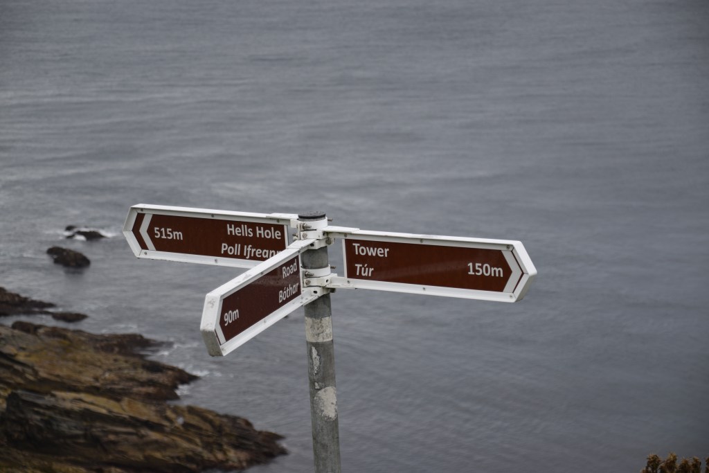
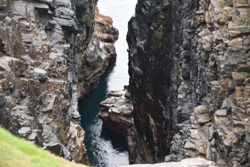
After a wander around the tower, its worth taking the coastal path which follows the cliff for about 750m. Natural features with names such as Hell’s Hole and Devil’s Bridge sum up the nature of this rugged, unforgiving coastline. There are more sunken liners and German U-boats off Malin Head than anywhere else in the world.


Soaked after a downpour.. but its August so the sunglasses stay on!!!

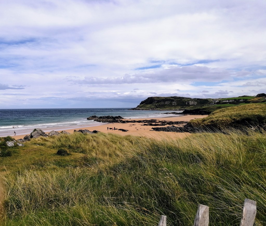
The weather changes fairly quickly up here! As soon as we left the Head the sun came out again for a while. This is a popular area for family holidays – there are a number of beaches like this one at Portmor and plenty of water sport options.

This is as good a spot as any to stop for lunch. Farren’s was closed but the Seaview Tavern (Ireland’s most northerly restaurant) was perfect for chowder and sandwiches…..


Moving on….
So, typically for a day trip such as this, we’ve been 4 hours on the road and have covered about 20 miles of the actual route!!!!! There have been short beach walks, a look around Malin Head (including a 20 minute shelter from a storm!) and a quick lunch. We are going to have to rush through the rest of the day which is rather annoying (and why we have to come back!).

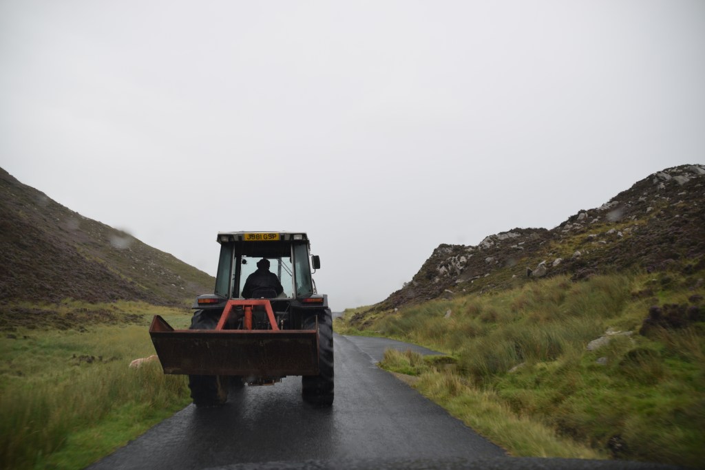
Roads are narrow but this won’t happen very often…


Magilligan Point View
From Magilligan Point View, you can see across Lough Foyle to County Derry.


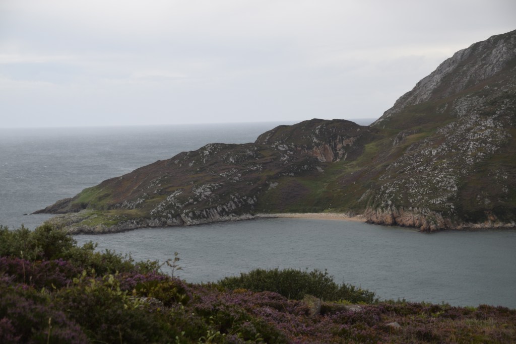
Stroove Beach and Lighthouse


Greencastle
During the summer months, the Lough Foyle Ferry links this fishing port with Magillan in Northern Ireland, offering an alternative to the drive around the estuary.


Oyster and mussel harvesting is big business in the Lough.


Most of today’s drive has followed the Wild Atlantic Way – a 2,500km route up the west coast of Ireland. It ends (or begins!) here, just beside the Northern Irish border.

Buncrana
Back on Lough Swilly, we pass through Buncrana, the largest town on the peninsula. Unfortunately we don’t have time to stop but the beautiful St. Mary’s Oratory caught my eye.

Amazing Grace?
I’d no idea what this was about – the only Amazing Grace reference I could think of was the hymn. And guess what – that is the reference!
So … cutting a very long story short….
Englishman John Newton was a fowl-mouthed slave trader.
In 1748, his ship was caught in a storm at sea. For weeks the damaged vessel was tossed around the ocean. Newton began to pray for mercy and to read the bible.
The ship eventually found safety here in Lough Swilly where it was repaired while the crew were housed and fed by locals .
Newton changed his ways and eventually became a clergyman.
He wrote poems and hymns – including ‘you know what’….
Inishowen is taking full credit with a sculpture, park and annual festival!!!!

Fort Dunree
This place definitely warrants more than a tag on at the end of a long day. You could happily while away several hours here in season but its always going to be a rush job if its part of your Inishowen 100 drive. Whoever built this defensive structure certainly had an eye for a view! Even if you’re not into military history, just come up for the panorama.
Built in 1798 and restructured in 1895, the fort continued to play a strategic role through both world wars. Accessed by a small bridge, the fort now houses a military museum and there is plenty of info and memorabilia to keep one occupied for quite a while. Its worth climbing the path up to the top fort where guns are still in place and the views are amazing….


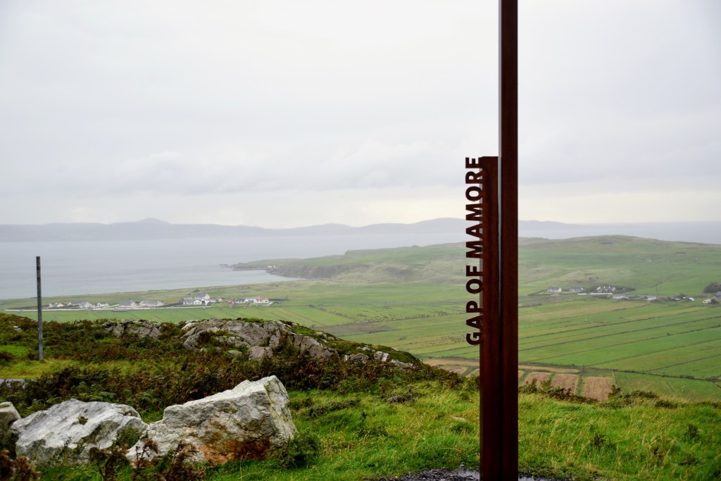
Mamore Gap
This section of the route brings us away from the sea and through the Urris Hills with their spectacular bleak landscapes. Once through the Gap, the Atlantic reappears in the distance.


And so … we’re back at Ballyliffin ….time for a well earned pint I’d reckon!

Before you go…..
If You’re considering a trip to Donegal, why not have a look at these:
I liked your post so much, it was like retracing the road myself, I recognised certain places, as if nothing had changed for 10 years, but actually nothing has changed for much longer.
You’re absolutely right. There is a better selection of places to eat now and a huge drive on promoting attractions and cultural sites but otherwise – there’s a sense that little has changed – which is wonderful. Of course, locals will probably disagree!
Great post Marie. I’d love to live around there for a few months (assuming there’s broadband and pub). No need for anyone to travel beyond the British Isles, in my view anyway 🙂
Yes Inishowen is actually a place I would stay for a while. The whole county is like that – still relatively cut off from the rest of us…
These isles have everything anyone could ever wish for …. except…. heat!! 🌞… and warm sea water!
You are truly blessed to live in such a beautiful and historic country. Thanks for providing yet more fodder for my bucket list. Mel
Hope you make it there some day Mel! XXXMarie
Me too! I just saw something on FB saying that Australians may not be able to travel to Europe until 2022!! I am not sure how I am going to cope!
With the way things are going here at the moment I’d say 2022 is more realistic than next year. I’m trying not to think about it but I’d say we’d be lucky to be travelling anywhere abroad by this time next year at best. This time last year, I was just back from Bruges and had trips organised for Malaga, Morocco, Mexico and the USA! … I thought it would last forever!!!
I guess the upside is that our domestic tourism industry is BOOMING! Got to look on the bright side! 🙂
Absolutely … sure what else can we do…. XXMarie
When can I come??
Not for a while!!
But the great thing is that the place won’t have changed much when you eventually do get here!!! XXXMarie
What a beautiful part of Ireland. While we have been to Donegal, we have never been those route. Marking it down for next time. Love the Irish optimism with the raincoat and sunglasses. Thanks for sharing Marie. Allan
Sure you know we leave the house prepared for every season!
It is like us in the winter. We have 4 different coats and 3 sets of footwear in the front closet. And it is really cold, long johns upstairs. If you go outdoors in Ireland or Canada, you have to be prepared. 😁
That habit never leaves – no matter where I travel to, and no matter what the heat is like, I set off in the morning with scarf, wrap, probably socks, maybe umbrella … just in case!!! 😅 😂