

I’ve romanticised the Beara Peninsula ever since watching Deirdre Purcell’s Falling for a Dancer with the gorgeous Liam Cunningham many years ago – for him I’d forsake the city and go live in the wilds!!! Whilst familiar with the major tourist sites at the ‘mainland’ end, I’d never ventured out along the peninsula itself – until this summer…..
…. and it’s gorgeous! Without the traffic and hype of its neighbours (the Ring of Kerry, Dingle Peninsula, Sheeps Head, Mizan Head), this underrated part of the country is just beautiful, tranquil and unspoiled.
The Ring of Beara hugs the coastline and follows the Wild Atlantic Way, offering up magnificent scenery around every bend and passing through the cutest towns and villages. It’s not a long drive (about 150kms ) but to fully appreciate the region you need to leave the Ring and make a figure of eight – you’ll have to cross the Healy Pass twice – but that’s OK!!
If, like ourselves, you already know Kenmare, Glengariff, Garinish Island, Healy Pass, etc., then you can manage the drive in a (long!) day. But this little corner of the country deserves more than a flying visit and you could easily pass two or three days here – driving, walking, shopping, eating and drinking!
It doesn’t matter where you begin – or the direction you choose to follow (although I prefer an anti-clock direction – I’ll show you why later on…)
Before we set off ..…
I’m very much aware that my posts, especially those from around Ireland, might often evoke a comedy sketch – you know that badly spliced police interview where the clock above the desk is all over the place and the interviewee is in a non-consistent state of repair! I often use photos from different trips to the same location – so a vista with lovely blue skies may be followed by dirty grey clouds and mist-laded hills although supposedly just a few kms apart. Or, a scene may be illustrated with both morning and evening shots…
The following jumble of photos were taken in June 2020 and July 2021….
Kenmare
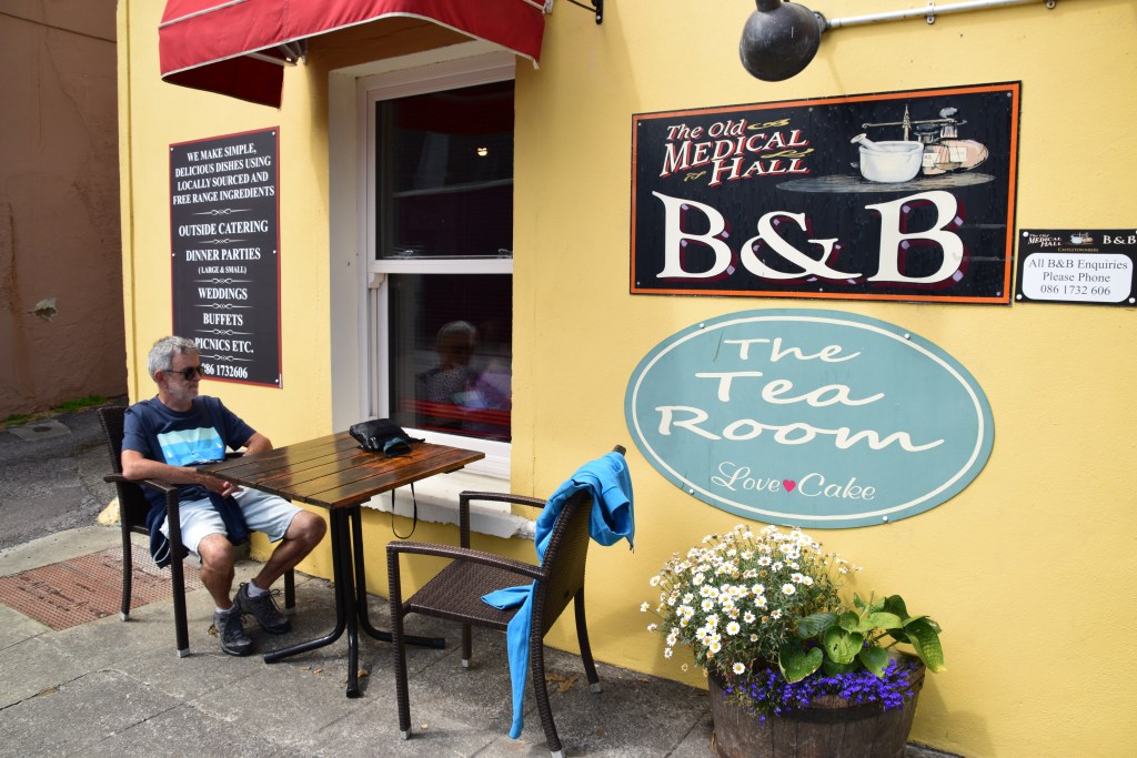
Kenmare (in County Kerry) is a good base for this region, with direct access to Beara and the Ring of Kerry. Supposedly the only town in Ireland with more restaurants than pubs(!), this foodie haven will definitely guarantee a great night out after your long day.


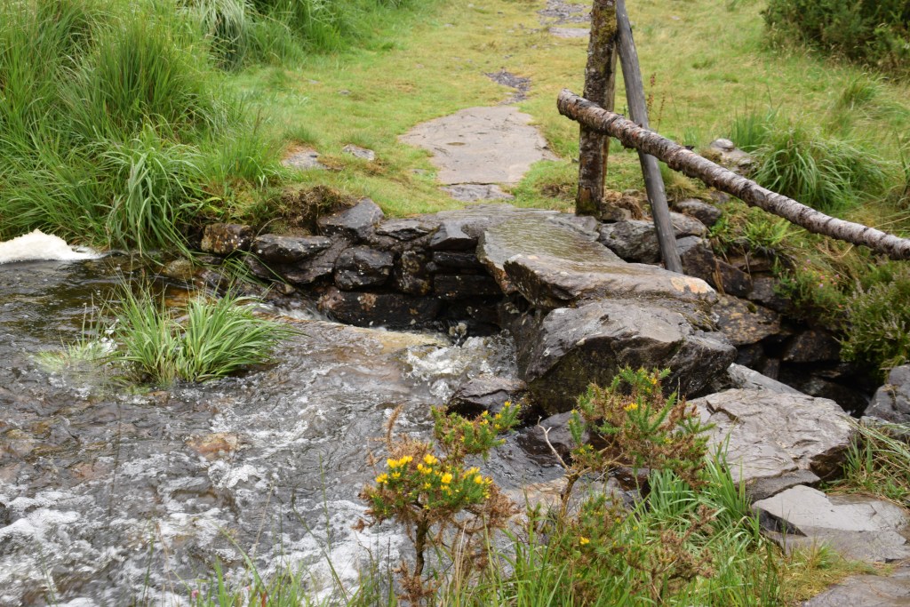
Bonane
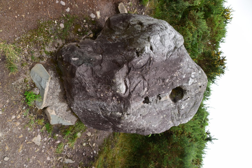
The Beara Peninsula is thought to have more archaeological sites by area than anywhere else in Europe so you’ll see plenty on your travels. But, if you’ve time, its worth making your first stop of the day at Bonane Heritage Park, just about 10km from Kenmare. The park has over 250 sites from the Stone, Bronze and Iron Ages right up to pre-famine times and a 2km loop trail takes you past the highlights – a stone circle, ringfort, standing stones and a fulacht fiadh (a mound used for cooking) .


A Fulacht Fiadh (cooking pit) was basically a pit filled with water which was brought to the boil by placing heated stones in it. Meat was wrapped in straw and put into the water where it was braised slowly…. sounds good!

A Bullaun Stone was a flat topped rock where a bullaun – or basin – was carved out (this one is unusually on its side). Their exact purpose is unknown – perhaps used as part of a pagan ritual or something as mundanely domestic as grinding corn.
The rainwater that accumulated in the basins was often considered to have curative powers. Here in Bonane, it was believed that washing your hands in the water would make warts disappear.


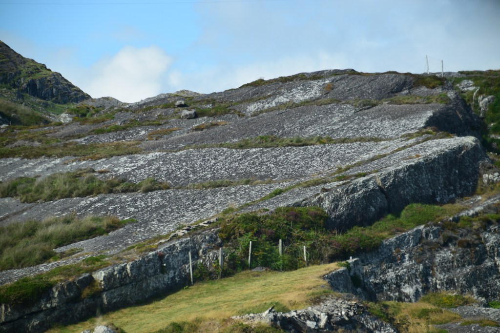
Caha Pass
Imagine what a feat of road building this was in the 1840’s – the two tunnels being blasted out of the rock and then hand-hewn to link the towns of Kenmare and Glengarriff. The mountain track was eventually paved in the early 1900s, making way for horse drawn coach tours for rich English visitors. Roll on to the 22nd century and today the tunnels are too low for most tour buses to pass through – a good thing! – significantly reducing traffic along the route.

While most of Beara Peninsula lies in County Cork, a fair bit is located in County Kerry. We cross boundaries a few times today. Despite intense rivalry between the two counties, no passport is required!!


First glimpse of Bantry Bay….


Glengarriff
I don’t love Glengarriff – a bit too touristy for my taste – but everyone stops here for at least a coffee or a pint and most people think it’s great (so maybe they’re all right and I’m in the wrong!!). Lying in a sheltered harbour and warmed by the waters of the Gulf Stream, locals proclaim their town as the sunniest and most sheltered in the country. There’s certainly something at variance in the air because species of plants grow here that are not normally found in Ireland. I’ve never hung around long enough to enjoy local walks but Glengarrif boasts 300 hectares of trails including river walks and scenic climbs.


Garnish Island
Garnish Island is a paradise with magnificent gardens and lush exotic trees, shrubs and flowers. Throw in a Greek temple and an Italian villa and you’re convinced that you’ve fallen into a painting. Part of the charm is actually getting there in the first place. The little ferry sets out from Glengarriff Pier and the short trip passes a colony of harbour seals basking on the rocks and offers glimpses of local birdlife.


On the island, a self-guiding trail will direct you around the lovely gardens….


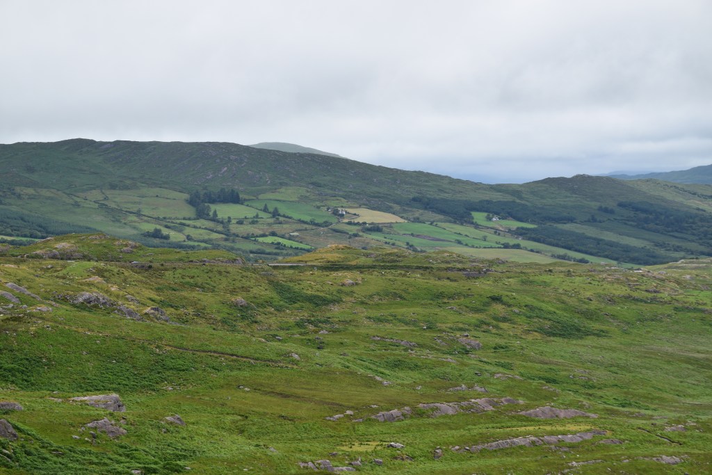
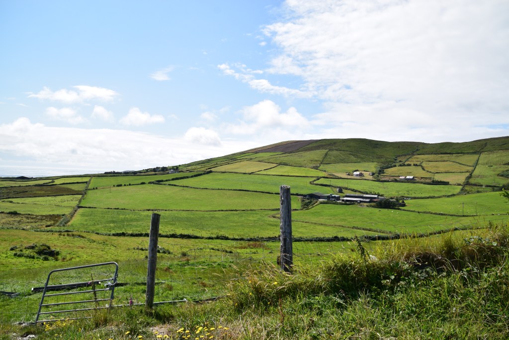
Once you leave Glengarriff, you’re really on the peninsula. Tapering about 50km out into the Atlantic, there’s Bantry Bay on one side, Kenmare River on the other and the Caha and Slieve Miskish mountain ranges running down the centre.

Adrigole
Its SO difficult to make any headway on these trips – its stop, stop, stop….. either for photos, galleries, shops , cafes or pubs! Here we are – just 18kms from Glengariff and stopping again for another coffee break and a bit of a browse!!

This is where we turn into the figure of eight and leave the coast for a while.
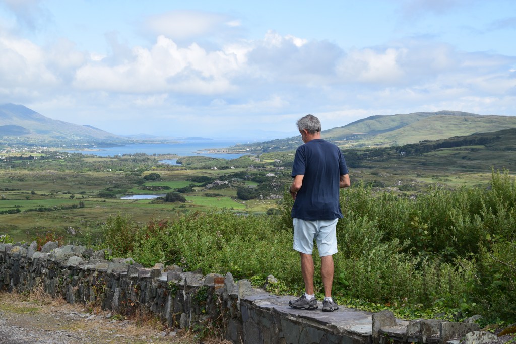
Healy Pass
Ah – the Healy – a mere 13kms in length but one of Ireland’s great driving routes. Now you are really getting away from it all!! Winding between two of the highest points in the Caha Mountains, a series of hairpin bends gradually ascend towards the top of the Pass. I mentioned in the intro my preference for travelling anti-clockwise – I think the Pass is more spectacular when approached from the Cork side.
This was one of Ireland’s famine roads – constructed as part of an ‘initiative’ for creating jobs during the famine years (1845-49). The original track though the mountains was known as Bealach Scairt (the way of the Sheltered Caves). Tim Healy was a Cork politician who served as the first governor general of the Irish Free State. When retiring, Healy asked that the route be upgraded and improved. Upon his death in 1931, the road was named in his honour.
At the summit, as you scan the dramatic landscape, cast your mind back to a time when funeral processions used to stop at the top of the Pass and push coffins over the border to the awaiting party in the opposite county!!


From the top of the Healy the road heads back towards Kerry and the Kenmare River, offering great views of Glanmore Lake and Ireland’s highest mountain range – The Macgillycuddy Reeks – away in the distance.


Trivia Moment…..
Kenmare River is obviously a bay – like its neighbours Dingle and Bantry. It was classified a river by its landlords many moons ago in order to secure salmon and other fishing rights!!
Back on the (other) coast, the road brings us out along Kenmare River towards the tip of the peninsula.


Ardgroom
Just look at this for a setting! Our ancestors could sure pick a location! This wonderful Stone Circle still stands tall after 3000 years!


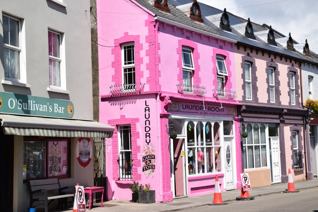
Eyeries
Colour, colour, everywhere!


Allihies Copper Mines
This was a bustling mining community in the 1800’s, employing 1500 men at its peak. When the price of copper dropped and the mines were no longer viable, many miners headed off to try their luck in the mines of Butte, Montana. There is still evidence of ruined buildings on the hillside.


The last village on the peninsula, Allihies is just about as far from Dublin as one can go! Here, you can learn about the lives of the miners at the Copper Mine Museum which is housed in a former Methodist Church.


The Skellig Islands away in the distance…

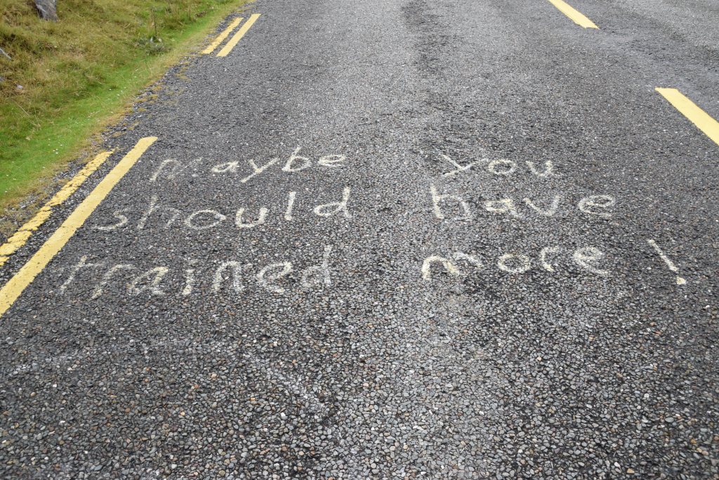
Roads are a bit narrow in places but you just have to keep the head and not panic!! (and look on the bright side – you’re not sharing them with big tour buses!!)


Garnish Bay


Dursey Island
If Beara isn’t remote enough for you, there’s always Dursey! The most westerly of West Cork’s inhabited islands (population 5 plus some holiday homes), at 230mts from the mainland, it doesn’t sound particularly remote.
Strong currents in the sound make boat trips hazardous to say the least so access is via Ireland’s only cable car! This lifeline for the island’s residents has a capacity for six people at a time and makes the trip in about 10 minutes. Once on the island, you can enjoy the walks, birds and the Atlantic. You will find the ruins of a castle and a signal tower as well as several standing stones. It takes 4-5 hours to walk the length of the island and back – better bring a picnic though – there are no shops over here!


This is a far as we can go – its time to head back up along Bantry Bay….


A rare sight in these parts….


Puxley Manor
Remember the copper mines back at Allihies? The Puxley family made its fortune there and built this Gothic pile in the 1860’s. The original building was a square keep – still standing at the back of the mansion. Legend has it that the house is cursed by the Gaelic Chieftain whose clan were evicted by Elizabeth I in the 1600’s. The keep was granted to the Puxley family in the 1700’s. The story goes that the spiraling costs of the ‘extension’ caused Henry Lavillin Puxley to sell the mines in 1868. When his wife died at childbirth, he is said to have left Ireland, never to return to the house.
In 1921, the IRA – fearing the place might be used to house English troops – burned the mansion. The Puxley family received compensation and left the area for good. The ruins were sold to a local in 1927.
Roll on to 1999 and the estate was put up for sale again. An investment company began restoration and built some apartments with the intention of opening Ireland’s first six-star hotel. Alas it was not to be – the curse of Donal Cam O’Sullivan Bere struck again! The 90% restored hotel opened its doors briefly in 2007 but the financial crash of 2008 put an end to all plans. The project was abandoned, a high fence erected and there she languishes!


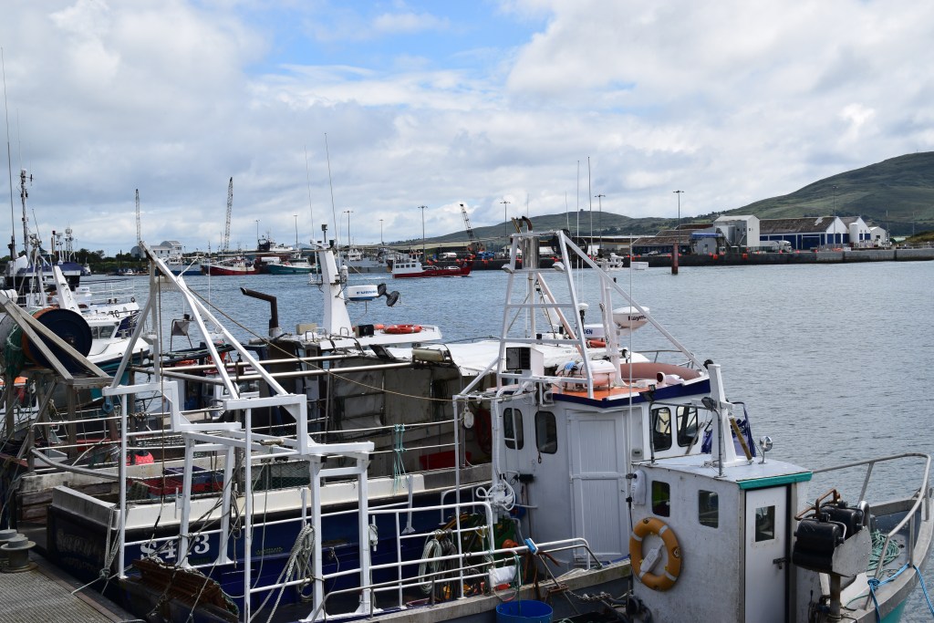
Castletownbere
If Beara has it’s own capital then it’s Castletownbere. This is a working town – the largest whitefish port in the country – so it’s not entirely reliant on tourism. The fish served in the restaurants here is as fresh as you can get – and there are some great pubs – so it must serve as a good option if you are dividing your journey over a few days….

lots more colour of course….


…and yet another pit stop!!

This pub was made famous by English writer Pete McCarthy who wrote about it in the best-selling McCarthy’s Bar.

Bere Island
Just 2kms and a 15-minute car ferry away from Castletownbere lies Bere Island. Unlike Dursey, 22kms down the road, Bere has a strong vibrant community (some 200 residents) and boasts enough facilities to encourage visitors to come and stay a while. Rich in archaeological and historical sites, there is plenty to discover here from ancient ring forts, standing stones and burial mounds all the way up to the remnants of ‘British imperialism’ – Martello towers, barracks and other fortifications.
There are lots of trails to suit all fitness levels. Many walks begin at the two ferry points so you can head straight off as soon as you land. If you’re up for it, a 19km trail connects both ferry points and taking in many different sights.


The Bere Island ferry departs from Castletownbere and also from Pontoon, about 2kms up the road.


Bit of seal watching out there in the bay……

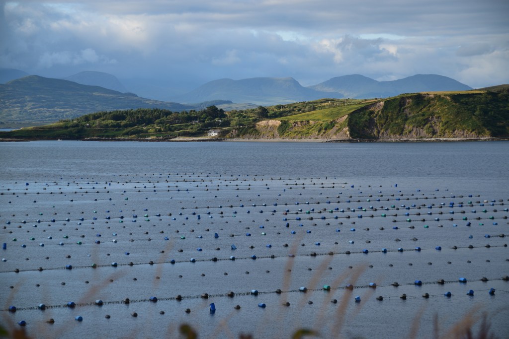
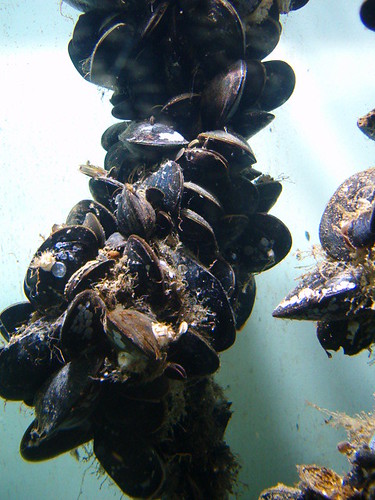
Aquaculture
It’s impossible to ignore the aquaculture activity in both bays. Apparently, the controversial industry includes oysters in bags and trestles, rope mussels, salmon in pens and scallops and clams on the sea floor.
The blue barrels – that are everywhere – mark the locations of rope-mussel culture. In a nutshell, thousands of ropes are put into the water. Millions of mussel larvae are born and float in the water, looking for something to cling to. They attach themselves to the ropes and feed on phytoplankton (microscopic marine algae). A mussel pumps an average 4 pints of water per hour through its system and takes about 24 months to grow to harvesting size.
This controversy doesn’t belong in the middle of a travel blog but enough to say that almost everyone around here – local community groups, fishermen, environmentalists, tourism industry – has objections for differing reasons.

The road brings us back to Adrigole and over the Healy once again –
This time we make a right turn at Kenmare River.

Derreen Gardens
It was rather ambitious on our part, hoping to fit in a visit. Created in 1870 by the 5th Marquess of Lansdowne, the estate boasts some 60 acres and 12kms of paths. The collection includes tree ferns, azaleas and the gardens are particularly known for their rhododendrons. You can lunch at the Garden Cafe if you time it right or at least enjoy (another!!!) coffee and some home-made cakes.
Ah well – next time!

Kilmackillogue

Uragh Stone Circle
What a backdrop!!!


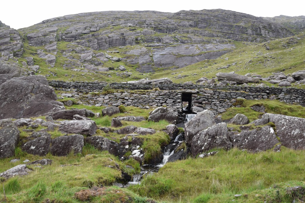
Gleninchaquin
In a long narrow glacial valley, a working sheep farm runs the private Gleninchaquin Park which features six trails of varying difficulties, ranging from 40 minutes to seven hours hiking time. Here, pathways lead you past streams, rock pools, lakes and sheep but the centrepiece has to be the 140metre-high waterfall cascading down the rock face.


Hopefully, there’s enough light left to enjoy the last 20kms back to Kenmare!!!

Small Stuff
Having already visited Garnish Island, the Healy Pass and Gleninchaquin Park on previous occasions, this day out included Bonane Park and then the Beara Drive. We didn’t have to spend time in Kenmare or Glengarriff. We didn’t go onto either Bere or Dursey Island. We didn’t visit any museums or linger over a leisurely lunch. We didn’t go for a swim or enjoy any long walks. We didn’t get to Dunneen Gardens. And we were still on the go all day!!
2 day suggestion ..
Stay in Kenmare.
Day 1 – Glengarriff / Garnish Island / Healy Pass/ Gleninchaquin / Kenmare
Day 2 – Beara Ring Drive – Bonare Park / Castletownbere / Dursey / Allihies / Eyeries/ Kenmare
3 Days?
You could spend a night in Castletownbere and take a trip out to either Bere or Dursey Island
The Beara Way
You don’t have to drive – The Beara Way is a stunning 184km walking trail. You’d probably need about 9 days minimum to do it justice ….
Before you go….
If you are thinking of visiting the region, have a look at the following….

What a fantastic place to see..
Highly recommended!!!
Those houses are just beautiful and the scenery, so many places to explore
The whole place is gorgeous…. we could have lingered all day at any one of them…
I would definitely need more than a day to do this as I’d be constantly stopping to take photos! I love the dramatic scenery of the Healy Pass and the coastline, and the colourful houses 🙂 The Bronze and Stone Age sites would fascinate me too and the waterfall at Gleninchaquin would be a must-stop!
Don’t worry about mixing up photos from different visits, I suspect many of us do the same. And it enables us to see the landscape in different lights. Talking of which, the light in your photo of Kilmackillogue is especially lovely 🙂
I’d forgotten how beautiful it all was until I went back through the photos for the post. I wish we had more time – but we’ll go back. That photo was taken in the evening on our way back to Kenmare….unfortunately by that stage we were exhausted so didn’t stay to enjoy the fading light…
Fantastic post and beautiful photos, Marie 🙂 A trip around Beara Peninsula and a boat trip to the lovely Garnish Island is still fresh in my memory due to the astonishing variety of things and places we had a chance to see along the way. I was in awe. Thanks for sharing, and have a lovely day 🙂 Aiva xx
Don’t we live in a beautiful country Aiva!!
Don’t know where to start with praise, the photos or the great prose which brings the place to life. Tell you what though, I’d go like a shot if you were to arrange the trip, being guide and facilitator. I’m not great at walking these days (age and arthritis) but just love looking at scenery such as this while at the same time hating coach tours. So what to do? Stay home or find a local who would arrange such a tour! When you retire, maybe you could think about it!
Ah Mari!! The stress!! I panic if I even have to book a restaurant for other than ourselves! I’d never cope with the responsibility of someone else’s holiday! I’ll just keep on writing and you just keep reading!!!! XXXMarie
Excellent post! If only I could teleport there, how gorgeous!!
It’s a lovely place Lissy – all of it… I think we’ll be heading back there sooner rather than later…XXXMarie
As always Marie, great post. I loved your joke about a sunny shot followed by a cloudy one. As one who has been to Ireland, I know that a few miles in one direction make a lot of difference to the weather. Love the area. We have not done the whole route, but, loved our visit to Kenmare. Stay well. Allan
Because I was adding bits from last year’s visit, I thought I’d better own up from the beginning! Yes – things change quickly here – we’ve seen islands and mountains disappear before our eyes!
Wow, spectacular scenery and cute towns. You had me sold at Kenmare and then it just continued to look amazing 🙂 Maggie
Because there was so little traffic, we could literally stop the car anywhere and get out for a view or a photo. Unfortunately it’s a bit too far for a weekend break from Dublin but we’ll hopefully return next summer and stay out on the peninsula itself for a night or two… XXXMarie
Looks wonderful, thanks for sharing.
Very welcome – glad you enjoyed. XXXM
WOW! What a gorgeous road trip. Stunning scenery at every turn.
There literally was! – bend after bend – all beautiful… XXXMarie
Gorgeous colours!
We were lucky with the day so the landscape was at its best – the green fields looked lovely – and then the villages offer up every colour on the spectrum – it’s impossible not to stop!!