

‘Because there’s nothing more beautiful than the way the ocean refuses
to stop kissing the shoreline, no matter how many times it’s sent away
‘
(Sarah Kay)
And what a shoreline! With the mighty Atlantic pounding against the cliffs or lapping the sandy beaches, this remote and rugged north coast, hanging off the edge of Europe, makes for a great mini road trip.
From end to end, it will probably cover less than 100km but be prepared for plenty of walking – not to mention stopping every 5 seconds for a photo! – this is going to be a long day!!
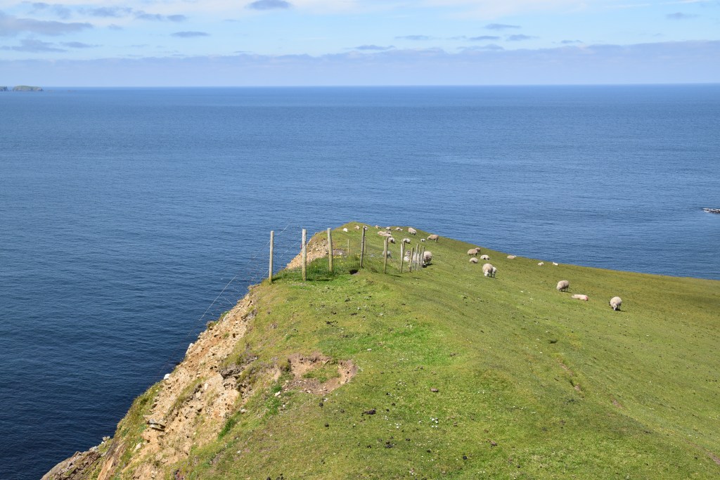
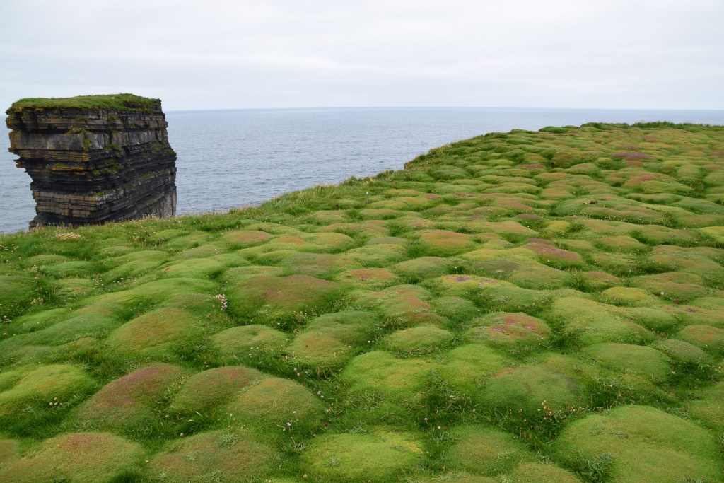
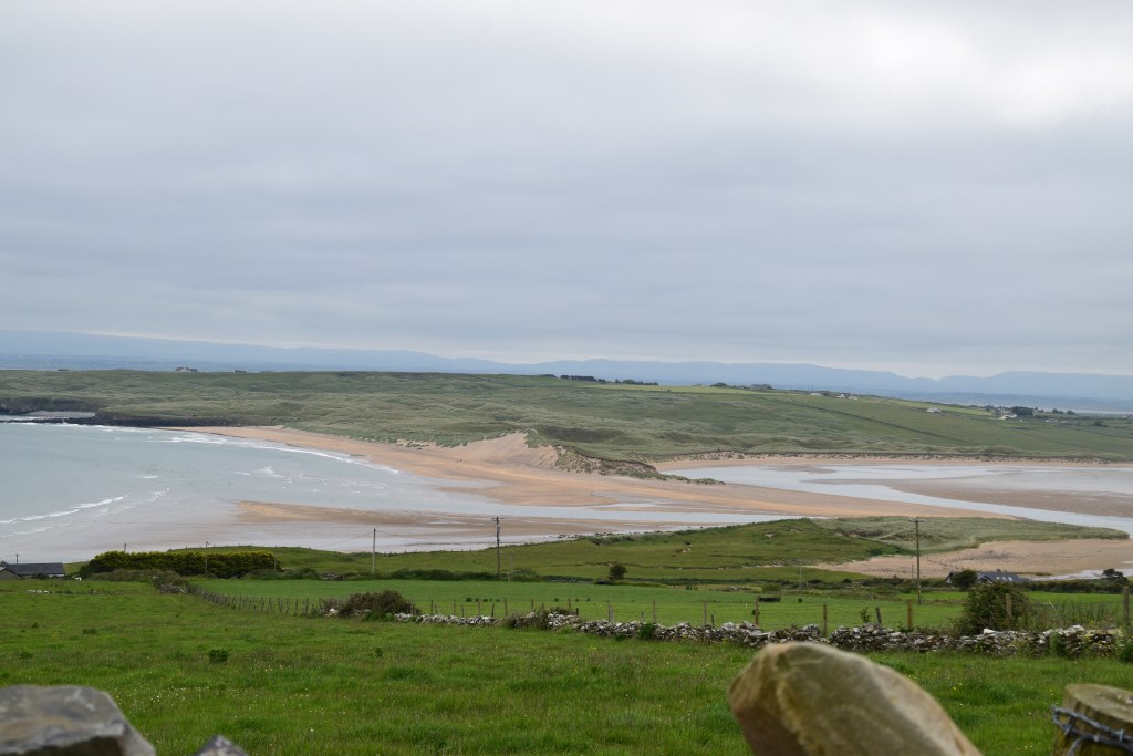
Carrowteige Loop Walks
We’re starting with a good one – the spectacular Carrowteige Loop Walks ( even Lonely Planet loves this place!). There are four walks in total, varying in difficulty.
The popular 10 km Children of Lir Loop will take at least two hours – The thing to remember though is that you can’t stay here all day!!
You can park in the village, at the trailhead, and take the road down to Carrowteige beach….

Wish I could stay a while……
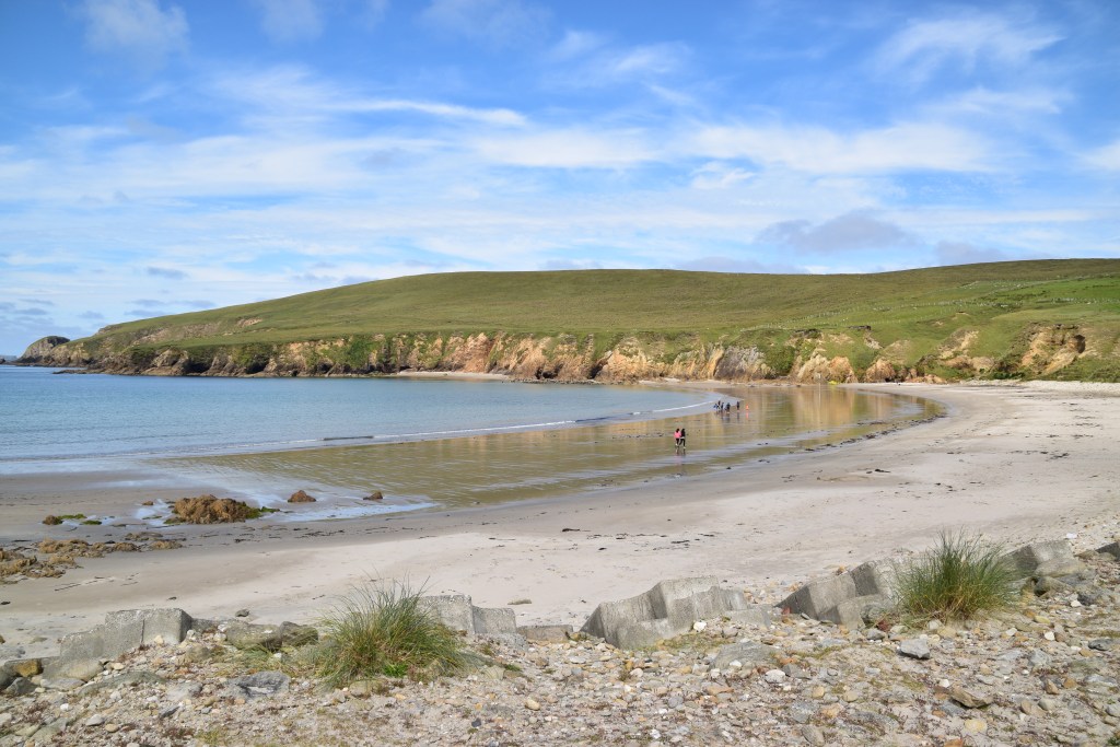
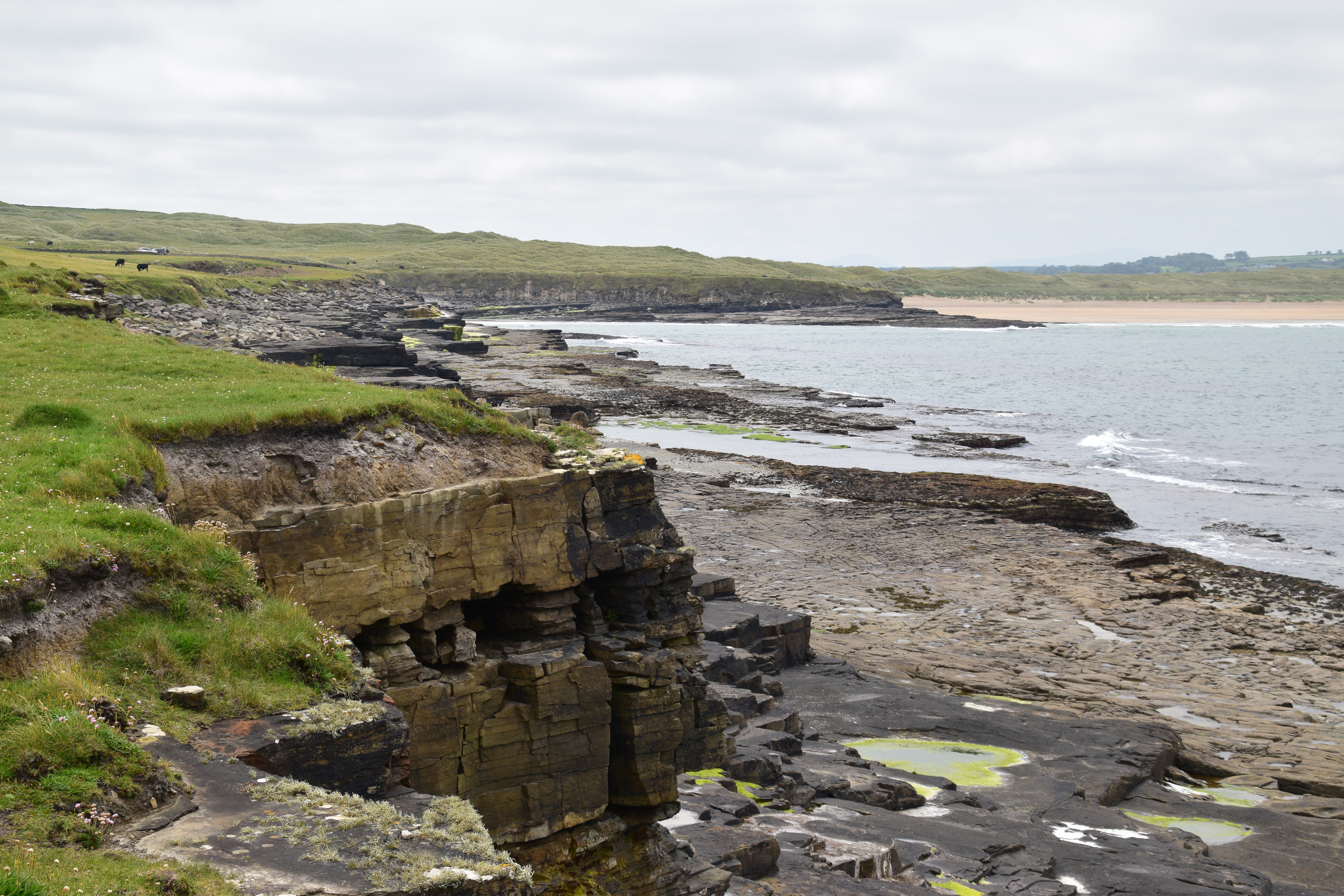
The route takes us away from the beach and up into the hills….


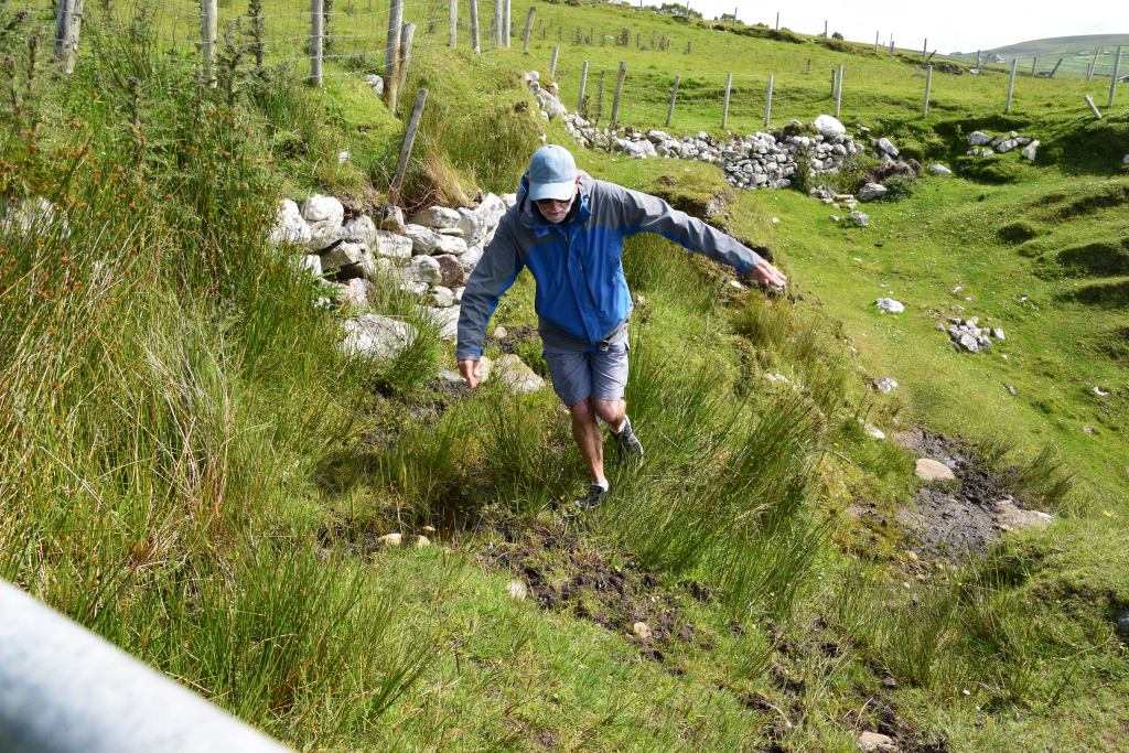
Mostly easy going…..


…. although the occasional bit of scrabbling is required!!!
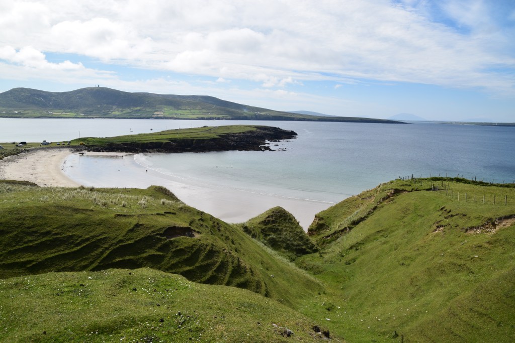
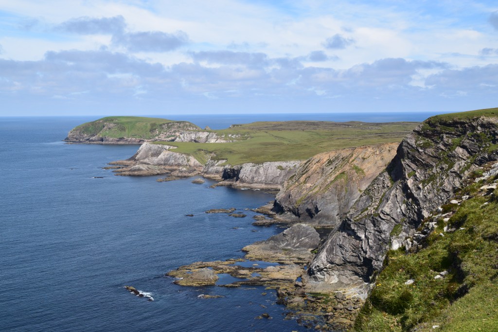
It’s just gorgeous up here….
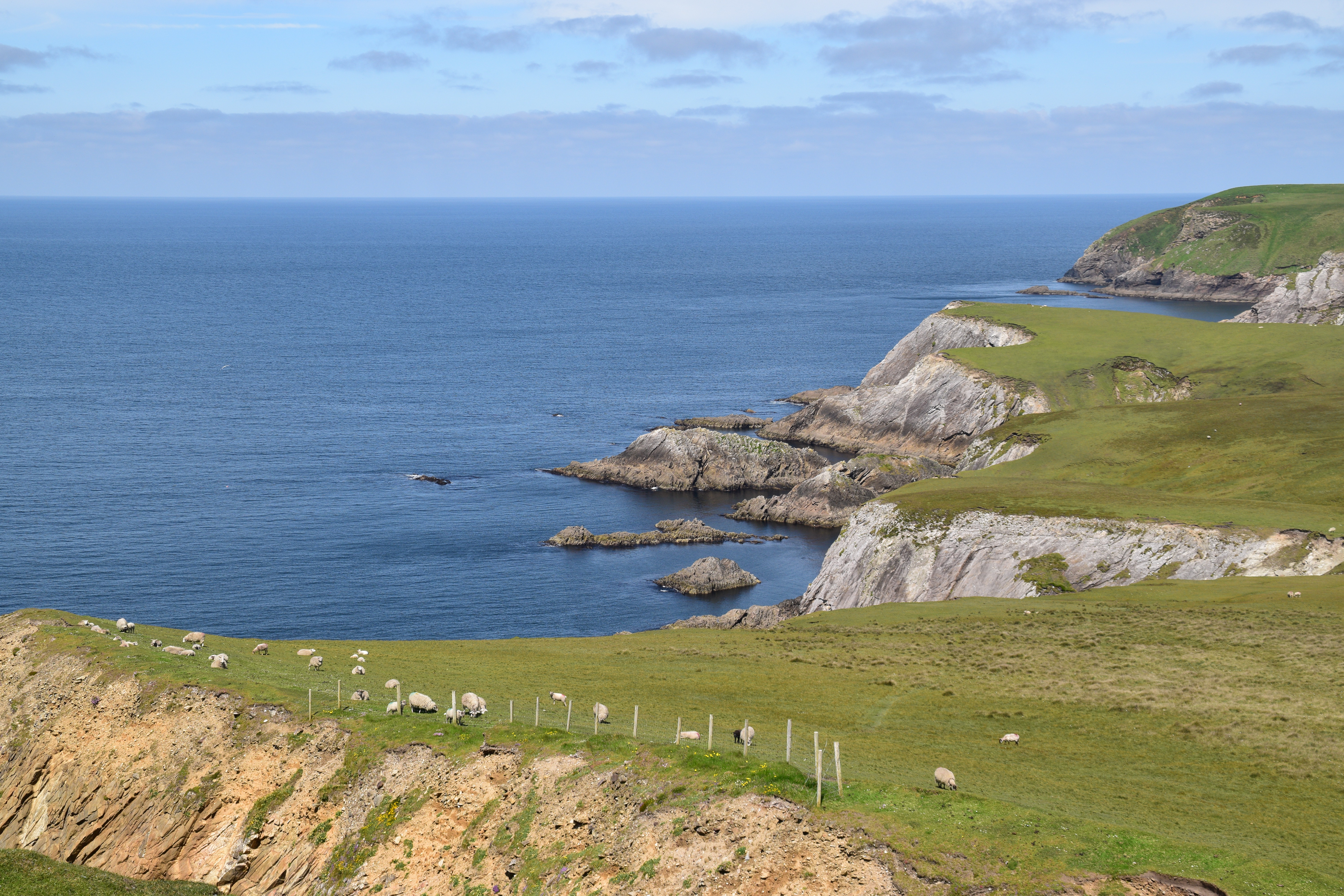

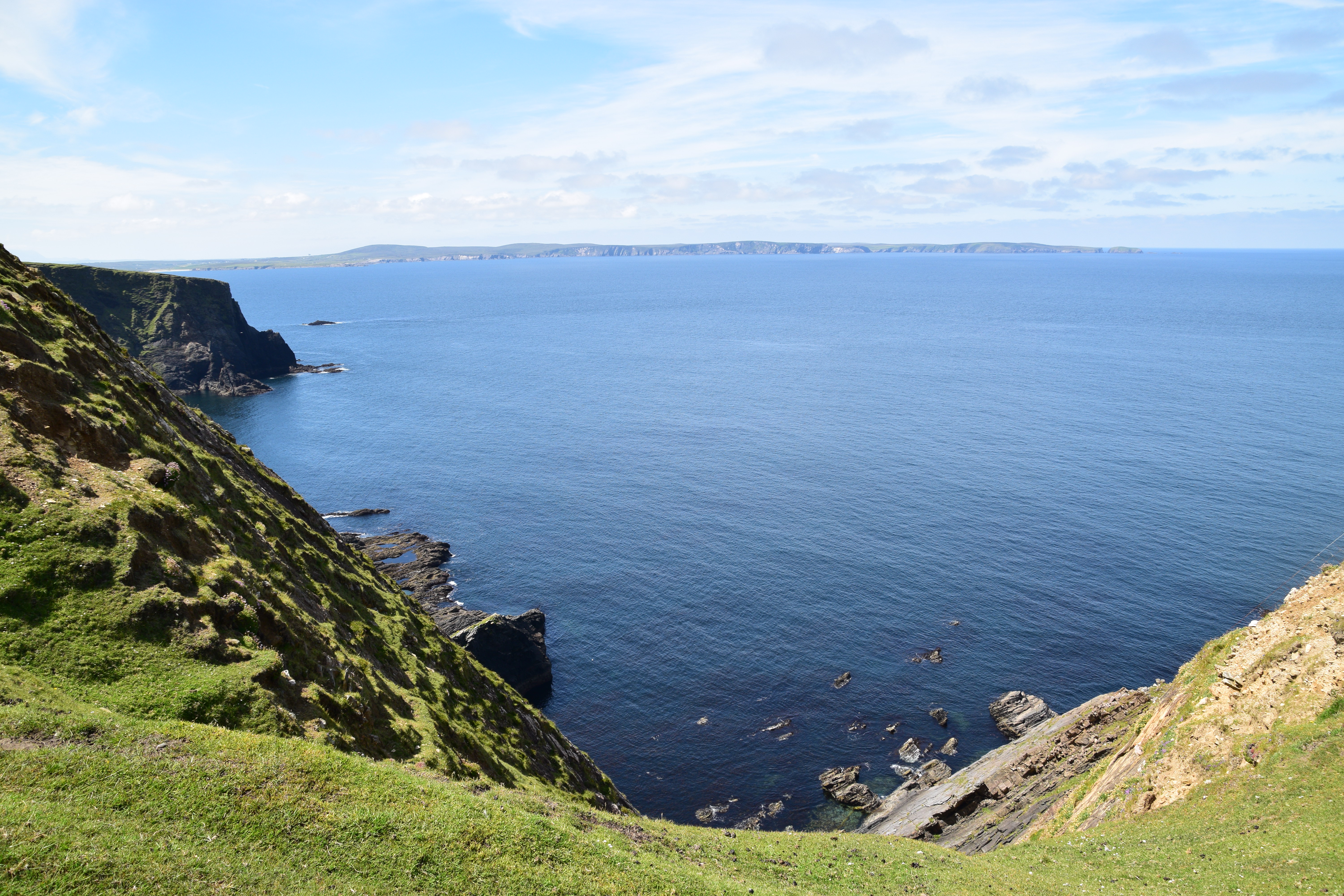
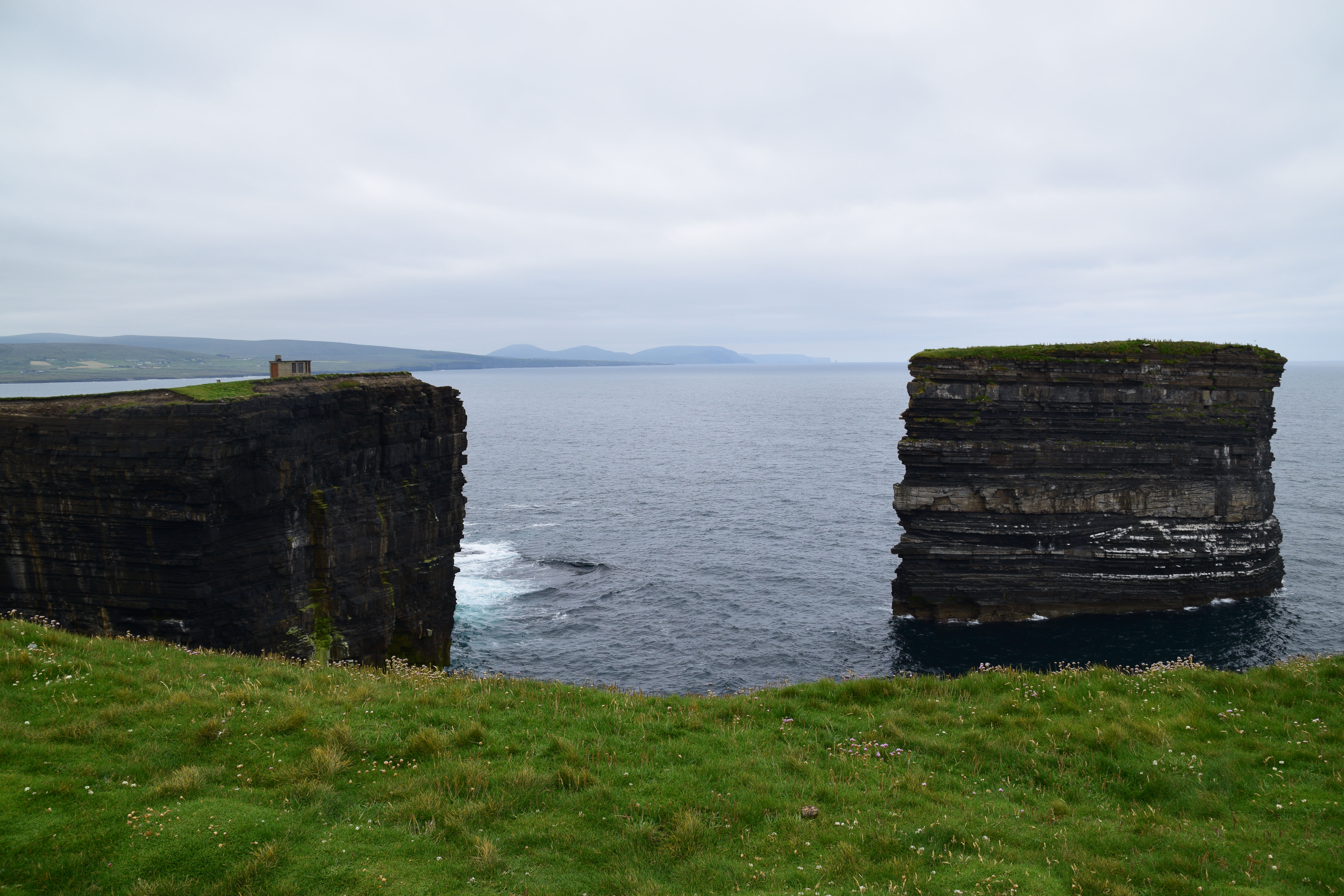
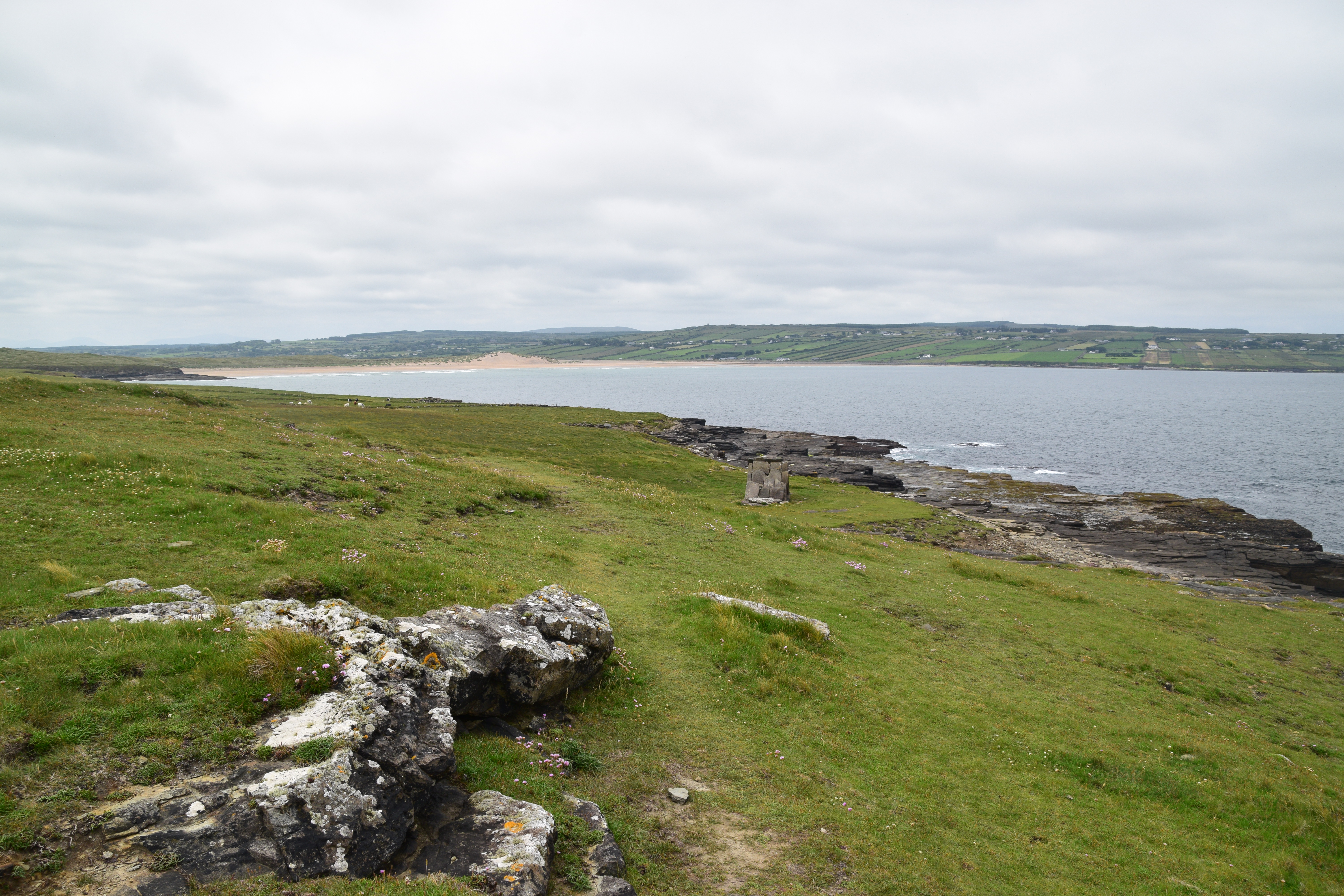
The loop follows the cliff top…..
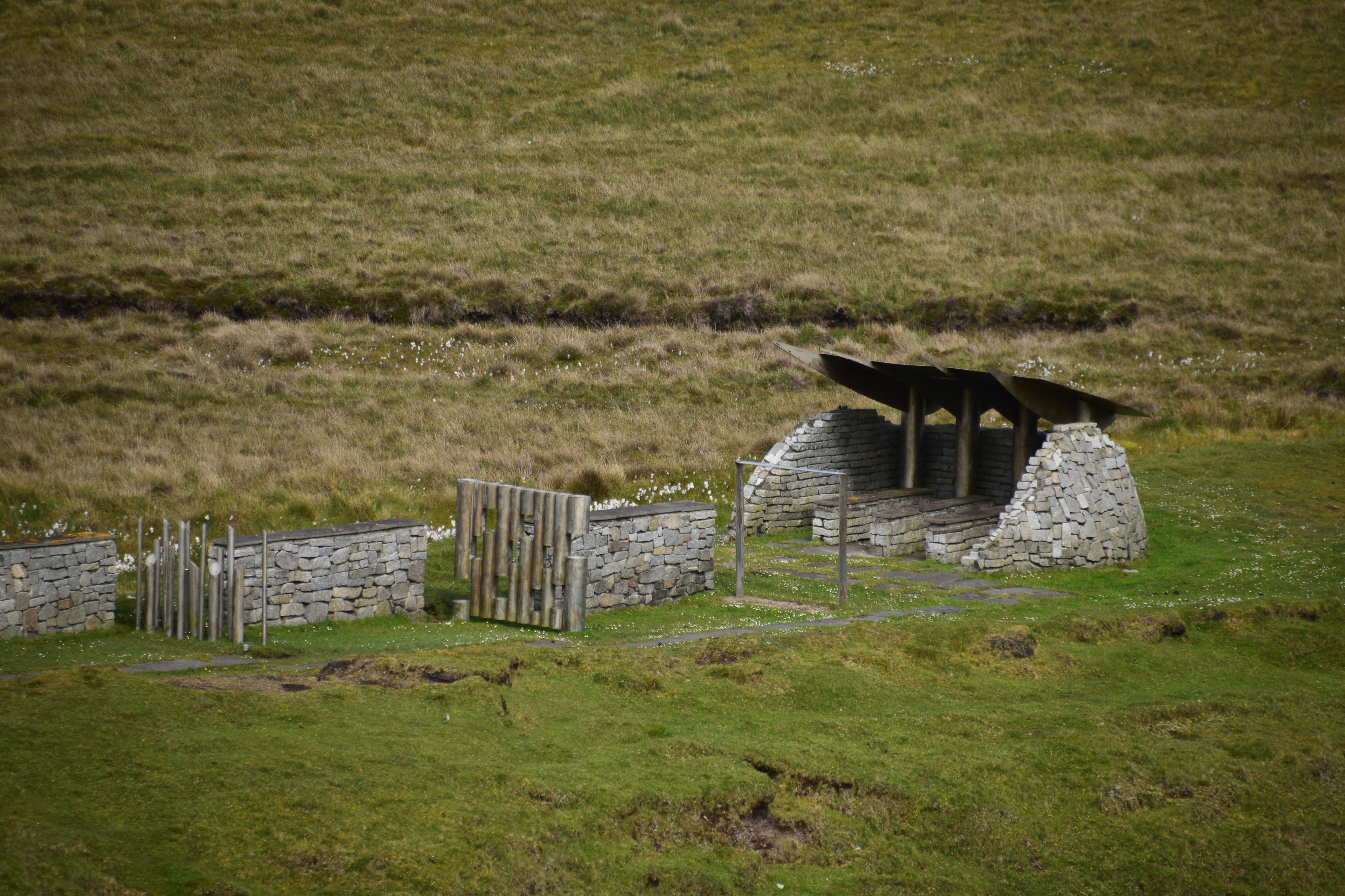
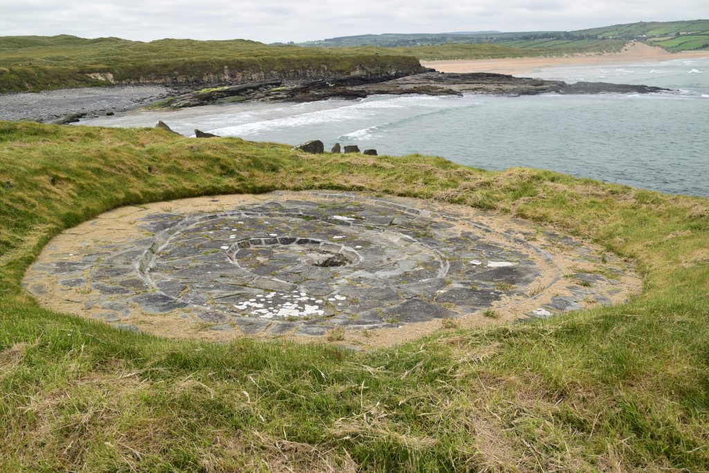
Until it reaches THE CHILDREN OF LIR monument….
I told the story in an earlier post but it’s been a while…
Lir and his wife (the king’s daughter) had 4 children – Aodh, Fionnghuala, Fiachra and Conn. When his wife died he married the king’s other daughter, Aoife, who loved the children at first but in time grew jealous of their father’s affection for them.
One day she took them on a visit to the king but when they reached Lake Derravarragh she put a spell on them and turned them into swans. Fionnghuala begged her to put some limits on the spell. Aoife allowed them to keep their human speech and gave them the gift of singing the most beautiful music ever heard. They were to remain at the lake for 300 years, then 300 years on the Straits of Moyle between Ireland and Scotland and 300 more years in Erris. The sentence would be lifted when the first bells of Christianity were heard in Ireland.
Lir went looking for his children and heard their voices at the lake. Grief stricken, he told the king what had happened. The king asked Aoife what she was most afraid of and she said ‘the howling North Wind’. Her father turned her into a ‘witch of the air’, doomed to listen to the howling north wind forever and her screams can still be heard during a storm! He decreed that no one could kill swans in all of Ireland – a law that remains in Ireland to this day!
For 300 years, men came from all over Ireland to listen to the beautiful music. Then the swans flew to the Sea of Moyle where they lived in cold and misery. They also suffered greatly in Erris.
After 900 years they returned to their old home. Of course their father was long dead and the place was desolate and empty. They flew back to Mayo to Inishglora where they first heard the Christian bells and met St. Mochaomhog.
Aoife’s spell was broken. The feathers fell away and the 4 very old withered siblings were baptised by Mochaomhog before dying peacefully. They were buried as they had lived – together always.
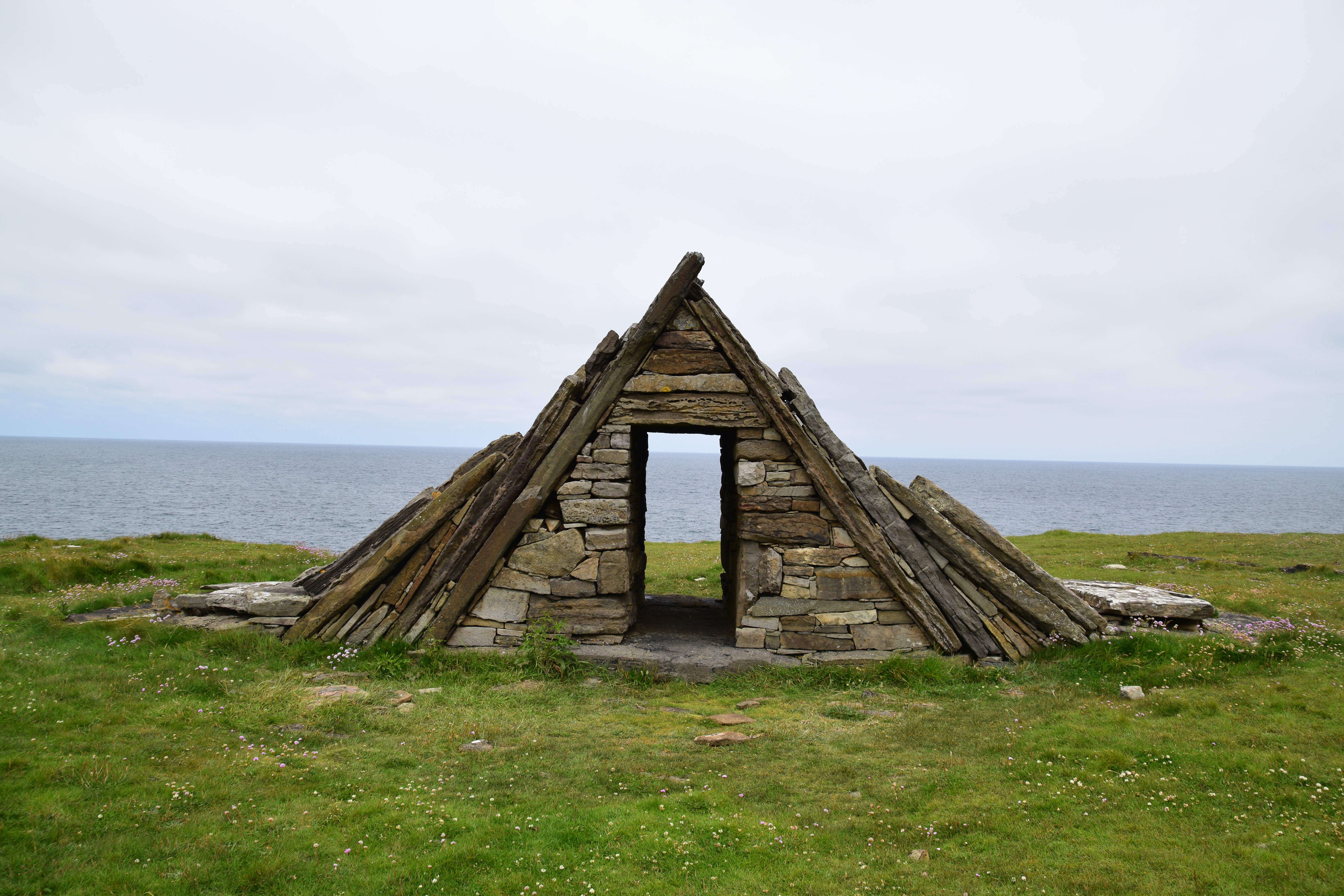
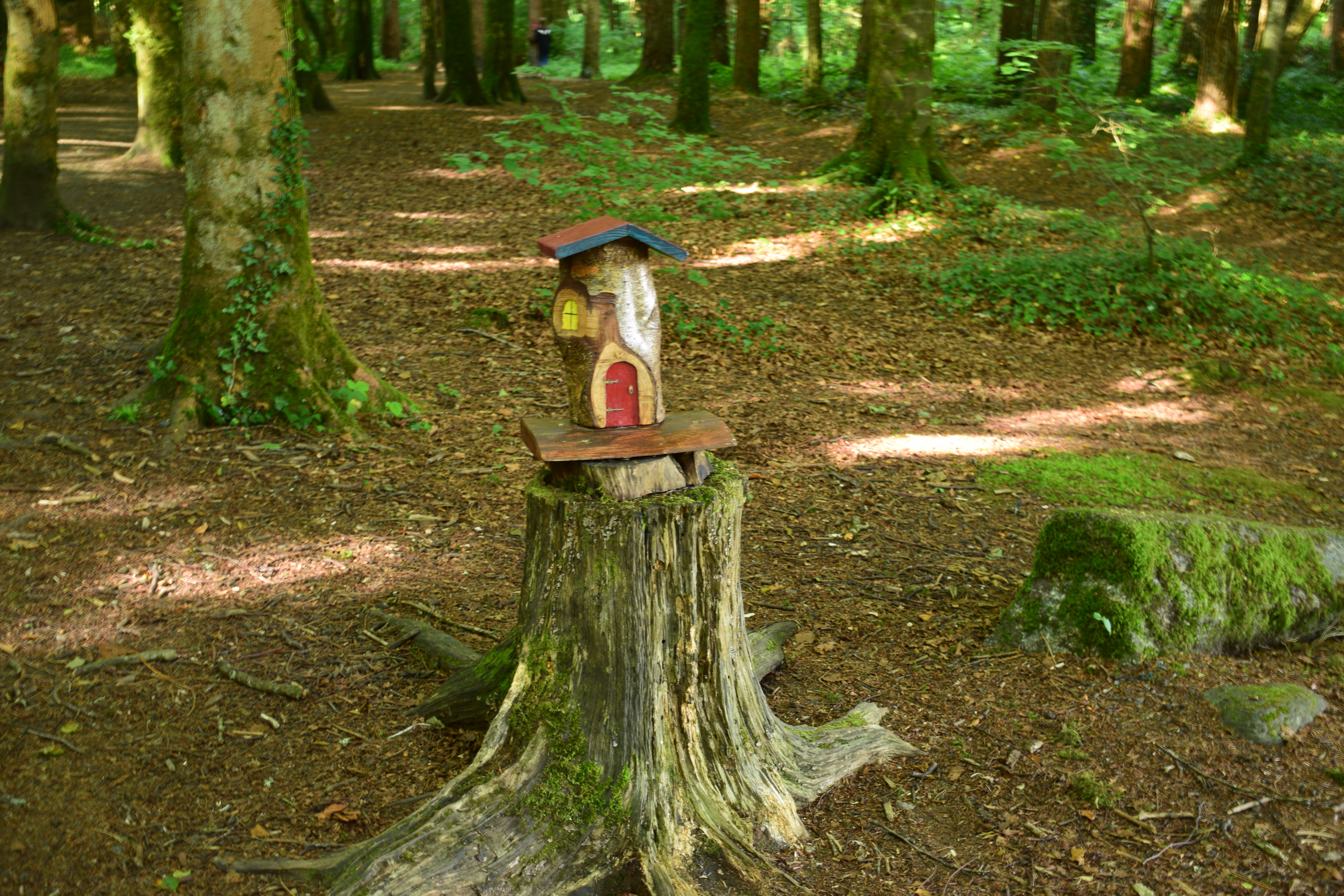
Here in Carrowteige, The story of The Children of Lír is depicted through giant wind chimes. Their beautiful song is recreated artificially through the steel chimes, in tune with the natural sounds of the wind and the sea. The shed like structure, surrounding three benches , echoes Fionnuala cradling her three brothers in her wings.

Tír Sáile – The North Mayo Sculpture Trail – originated in 1993 when 14 site specific sculptures were installed in what can only be described as spectacular locations along the coast. (Tír = land /country Sáile = saltwater / seawater)
The project embraced the spirit of Meitheal – the tradition of local people coming together to achieve a common goal. In this case, it included visiting artists, community involvement, donation of sites, etc.
The primary aim was to celebrate the past, relish the present and embrace the future. Artists were to draw their inspiration from the physical landscape and cultural heritage of the region. Locations included seashore, agricultural land and even a disused quarry. The brief required the use of natural materials by the artists who would work in harmony with the surrounding landscape – sculptures were to add to, rather than detract from, their settings.
Not all works were designed for permanency and a few have since degraded back into the environment (11 are supposedly still in existence) while others have fallen into neglect. Meanwhile, other installations have been added to the collection over the years.
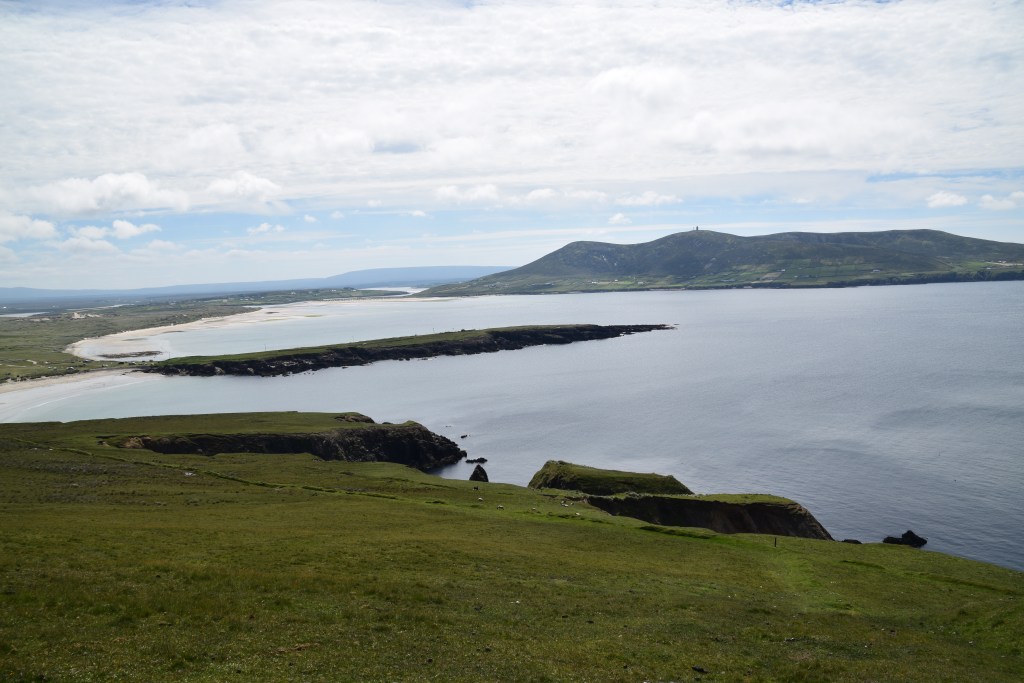
Its wild and beautiful up here… some walkers link up with another trail and head over the back of the cliffs. But if you are planning on seeing a bit more on your day out, then stick with this loop and head back to the village….

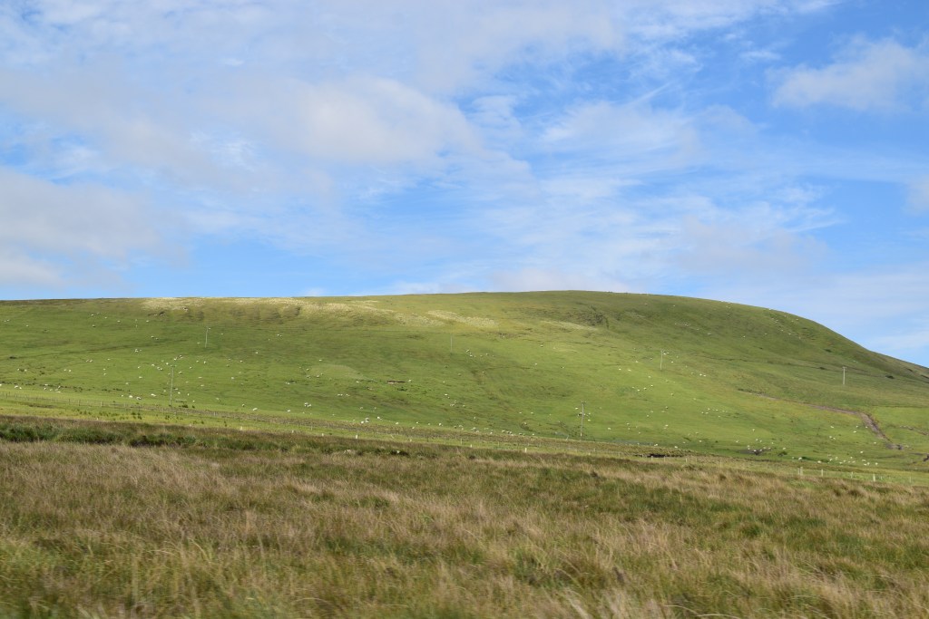
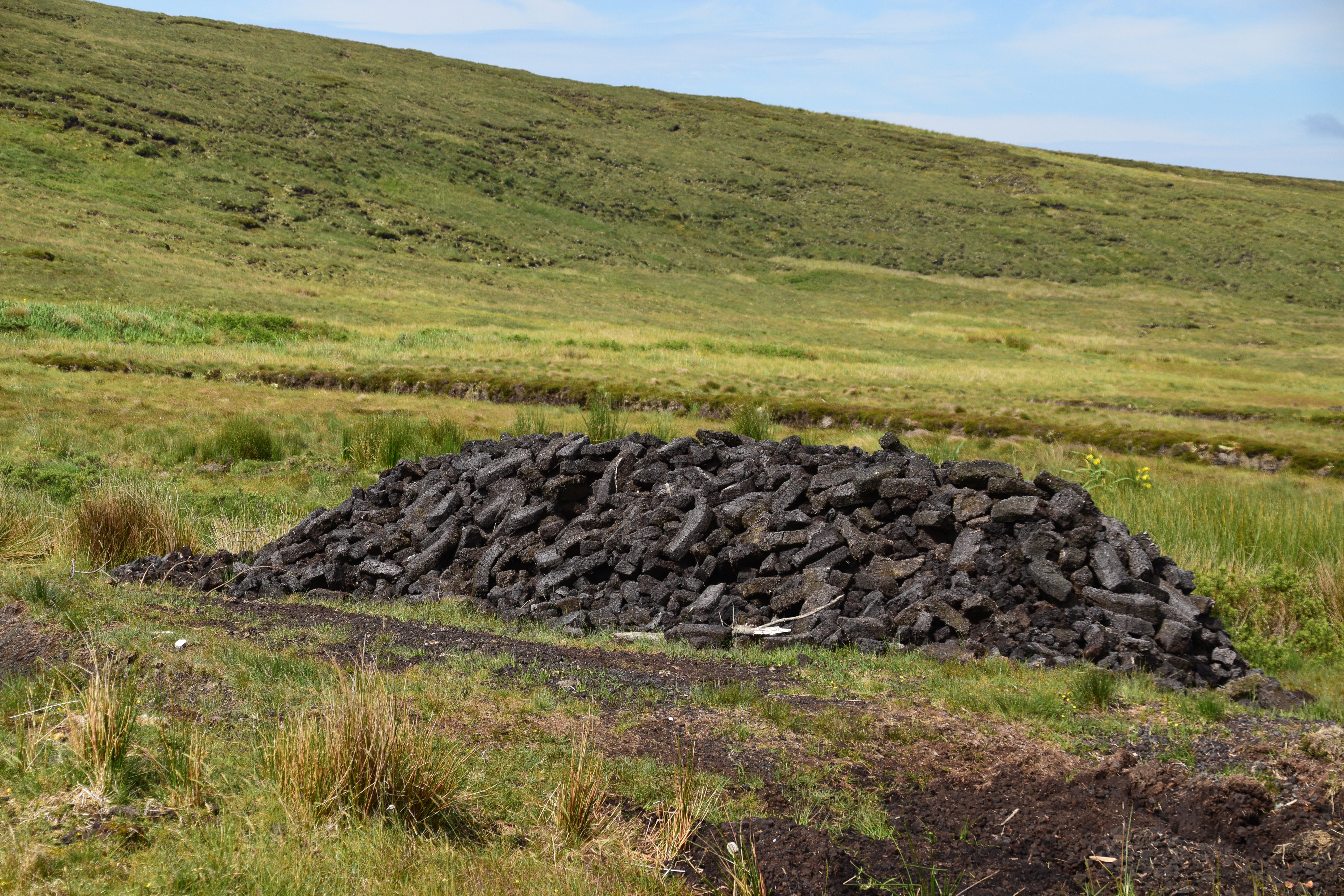
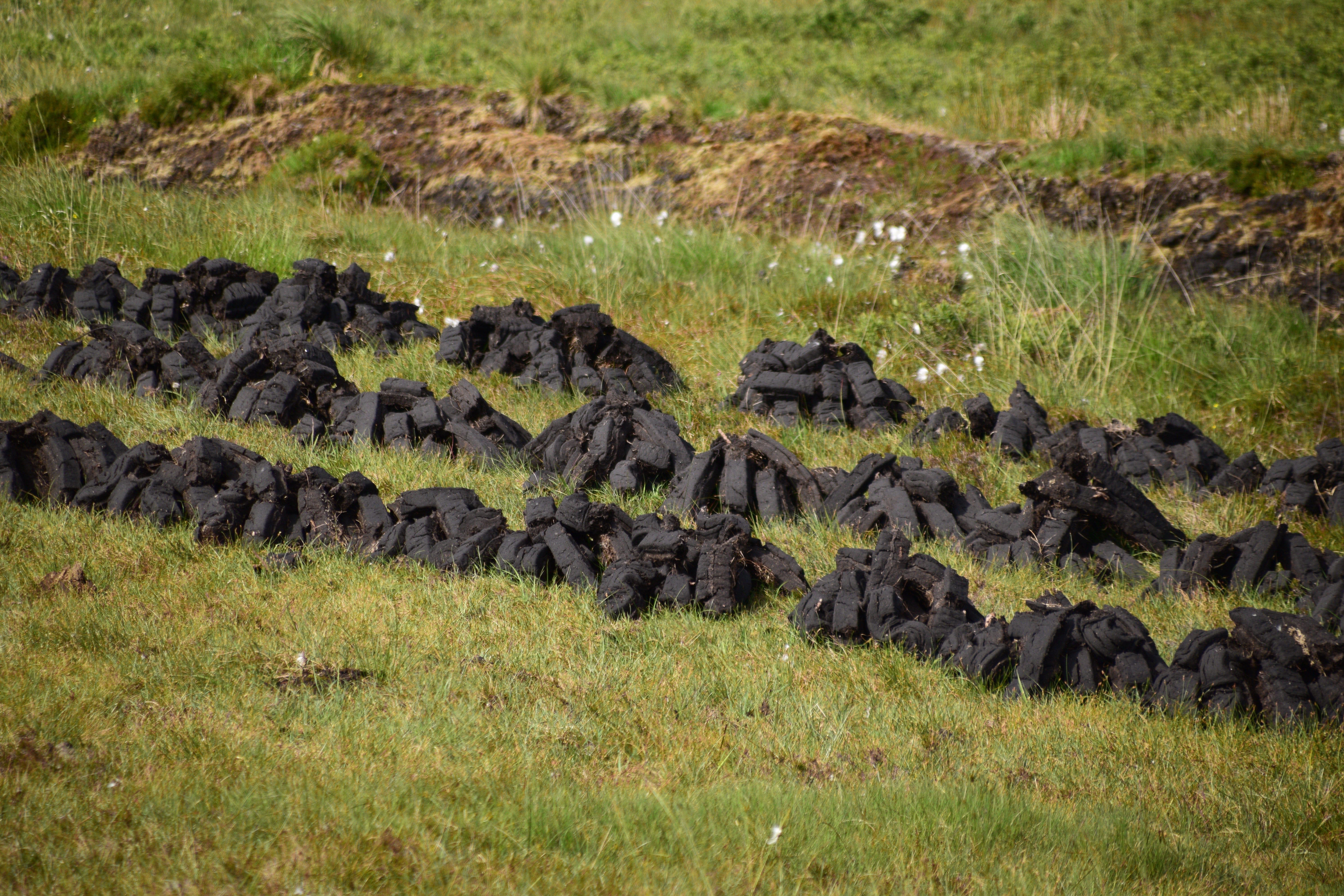
Mayo is a big county – and many areas are virtually uninhabited. Blanket bogs dominate much of the landscape. Apparently Ireland owns 8% of the world’s blanket bogs – isn’t that extraordinary, given the size of us!!!
Which brings us nicely to our next stop…..!
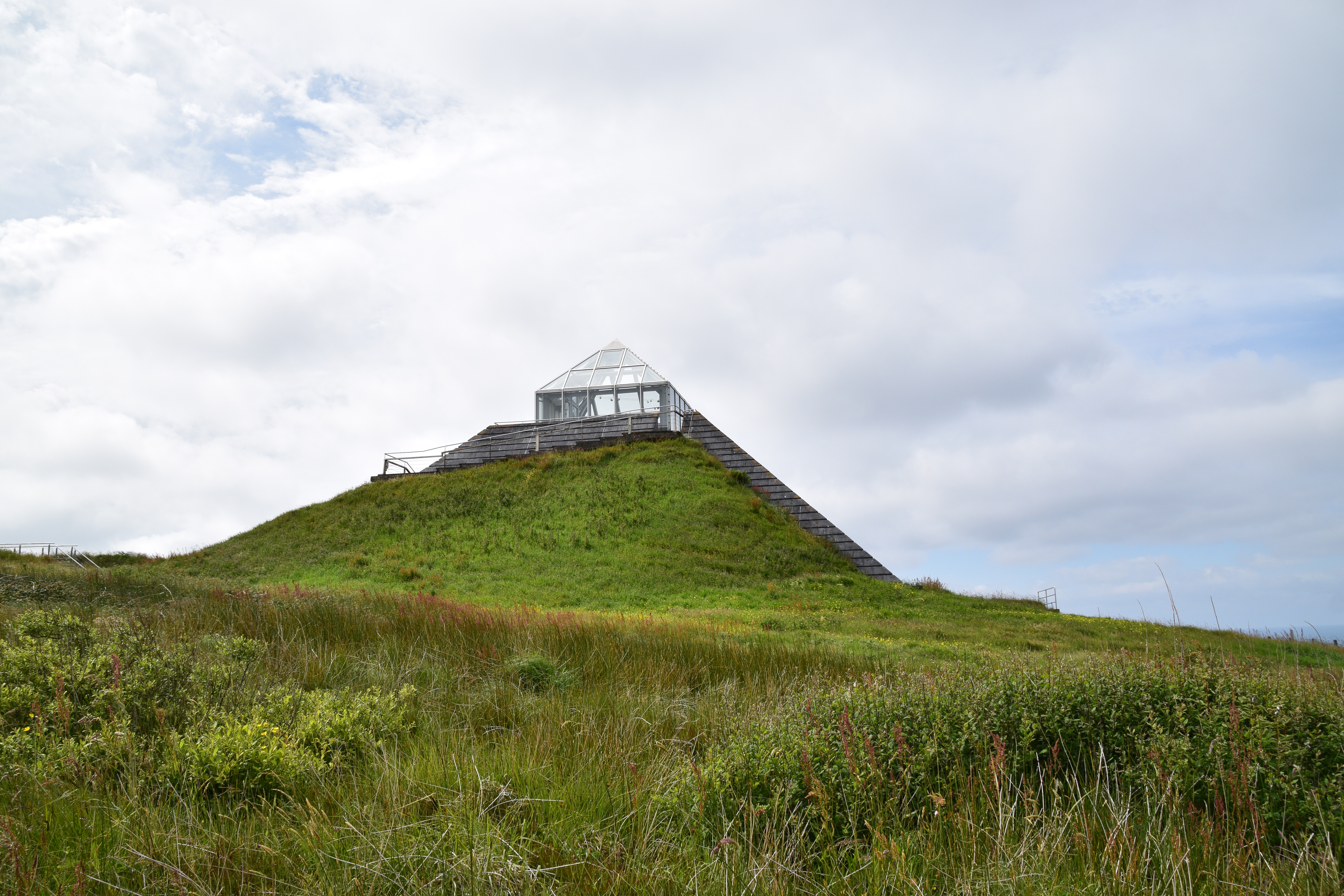
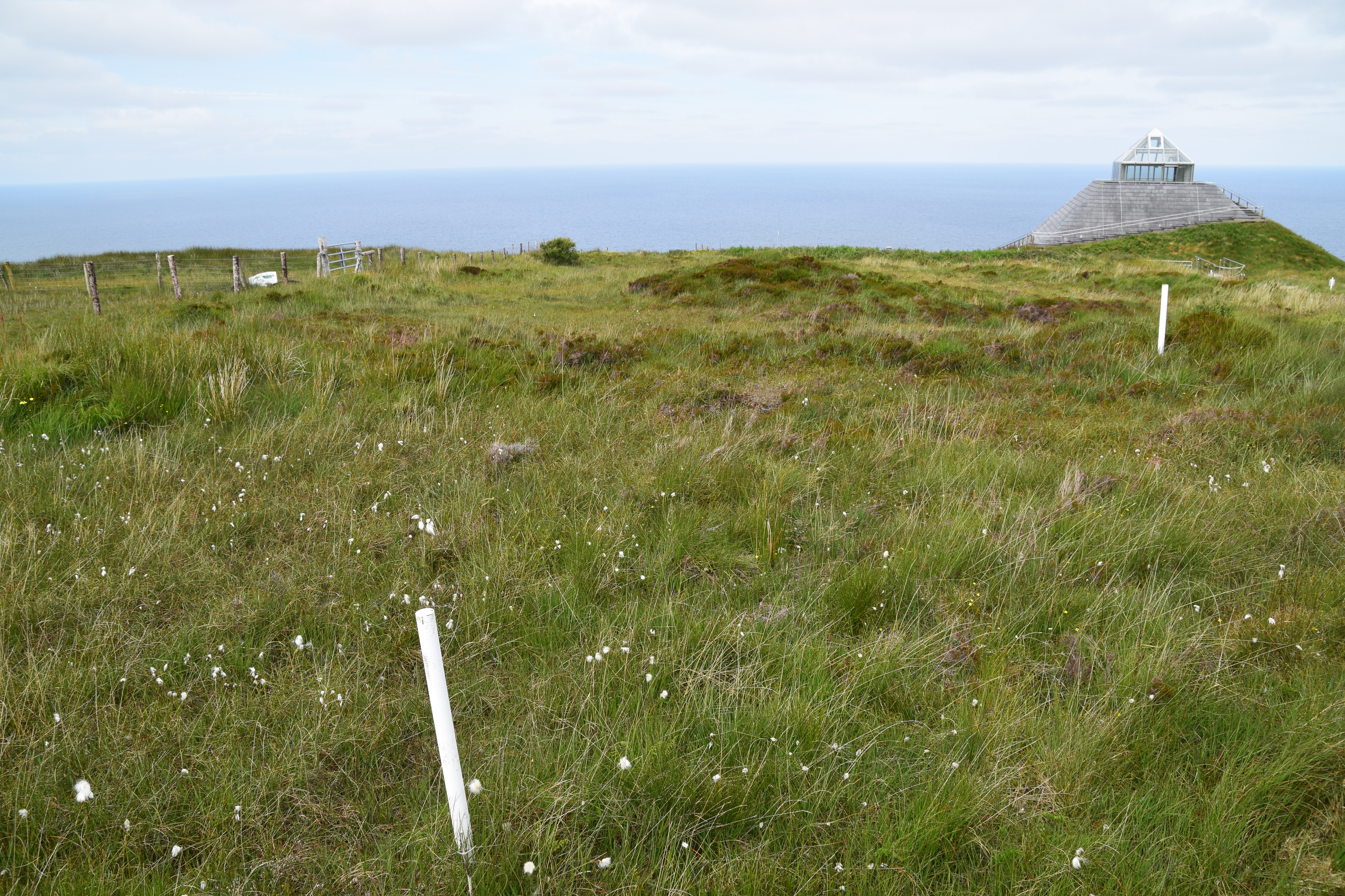
Céide Fields
This is the big one – the main attraction….
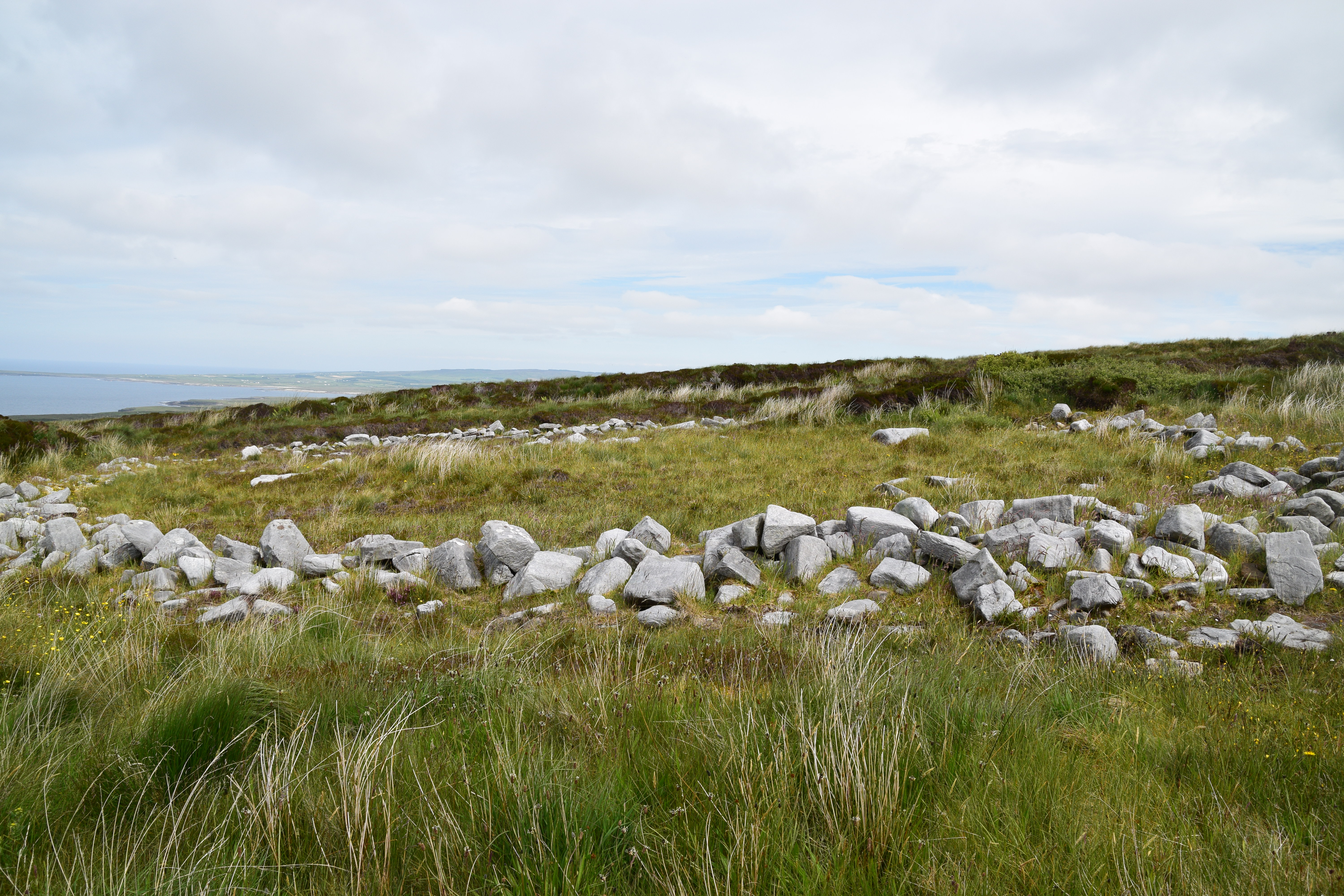
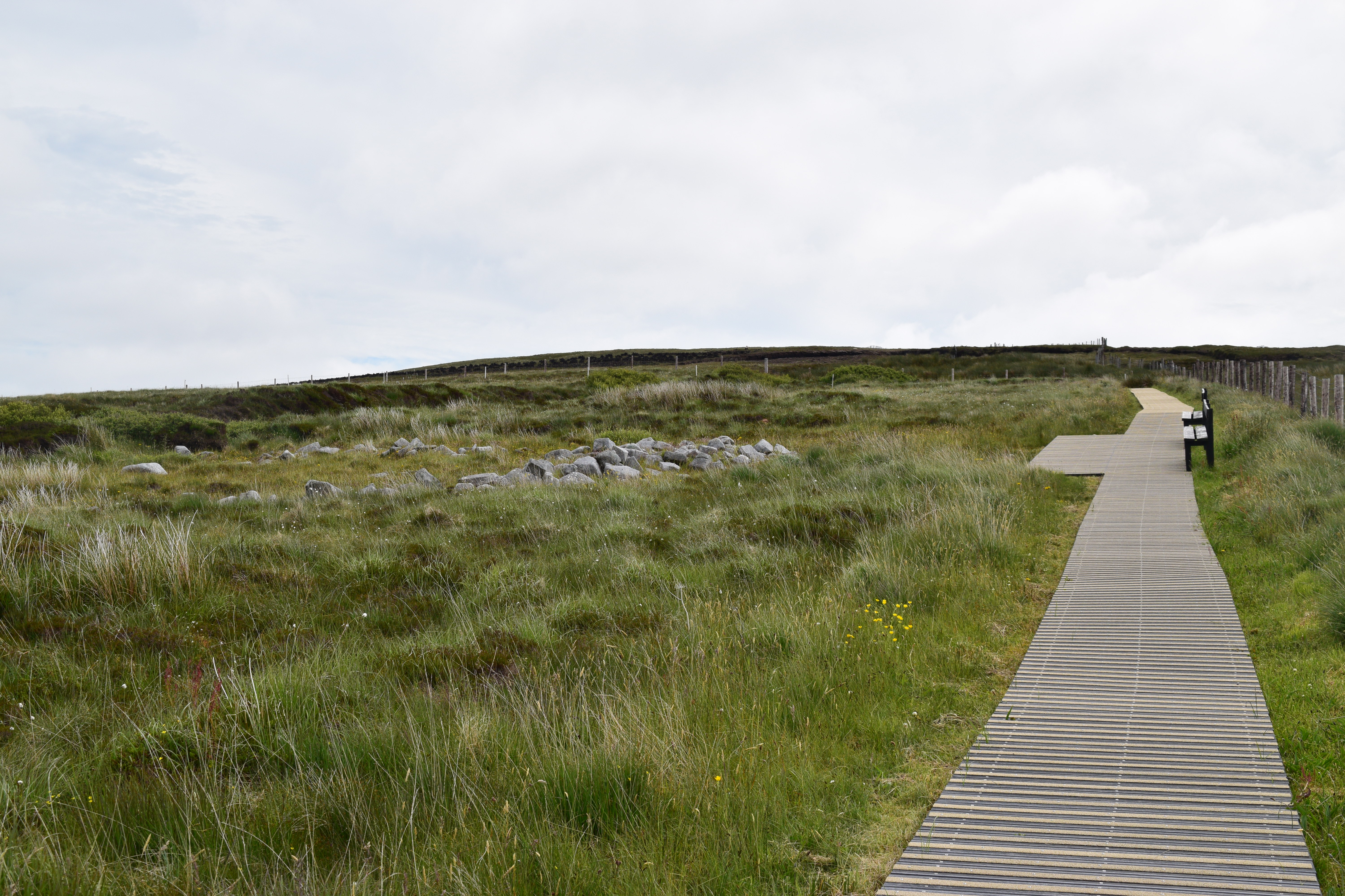
In the 1930’s, local schoolteacher Patrick Caulfield was cutting turf when he uncovered clearly defined walls of stone buried beneath the blanket bog.
Excavations revealed an extraordinary site – dating back almost 6000 years – including a system of fields extending for miles under the bog as well as dwelling areas and megalithic tombs which together make up the most extensive Stone Age monument in the world.
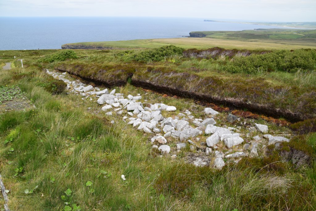
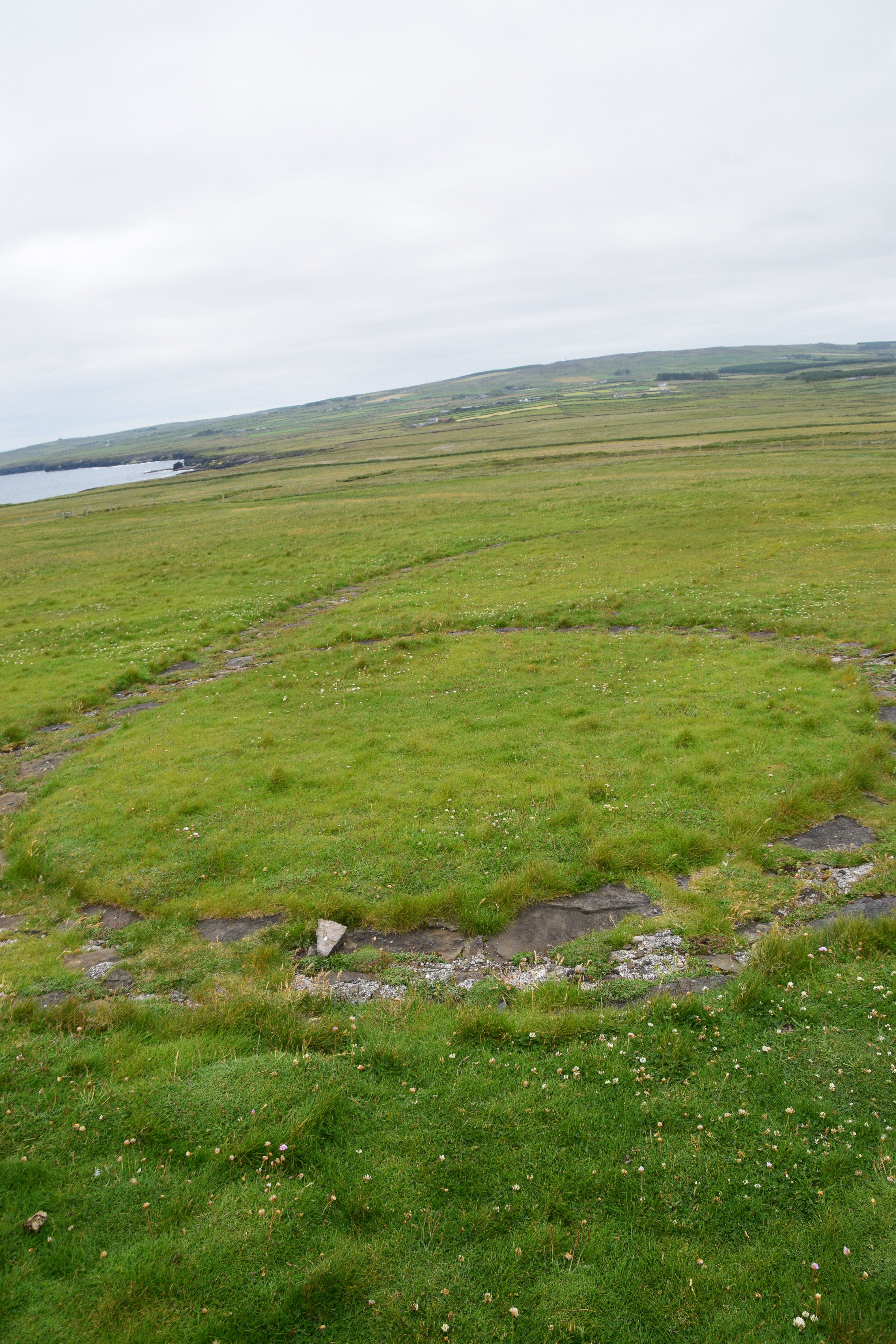
From pathways over the bog, you can see the walled fields, a domestic enclosure and a pen for animals.
Your walkabout also offers a great opportunity to get close to the unique vegetation and wildlife of the bogland. Depending on the time of year, you can enjoy mosses, lichens, heathers and flowers while keeping your eyes peeled for hares, frogs and larks.

Satellite image – the red lines are stone walls….

The award-winning Visitor Centre opened in May 1993. Rising in a pyramid shape from the peat bog, it was constructed from natural durable materials to complement the environment. Exhibitions tell the story of this ancient settlement and the everyday lives of the farming community who cleared the pine forest, reared cattle and grew crops. Hopefully you’ve allowed yourself enough time for the 20 minute audio-visual show.
The glass observation tower offers great views across the archaeological site and the Atlantic Ocean. On a good day, a viewing platform out on the edge of the 110-metre-high cliff will help you make the most of the breathtaking scenery.


Admission €3.50.
NOTE – Only exterior open at the moment – free of charge (so no guided tours, toilets or restaurants available).

Time to move on again – off towards Downpatrick Head yonder…
As we near the Head, we come across another piece from the Tír Sáile Collection….

BATTLING FORCES
This artist, inspired by the force of the sea and the wind on the headland, used two types of stone to symbolise the never ending battle. You have a structured wall of local Lacken sandstone struggling against a pile of local uncut limestone… no one knows which will win…
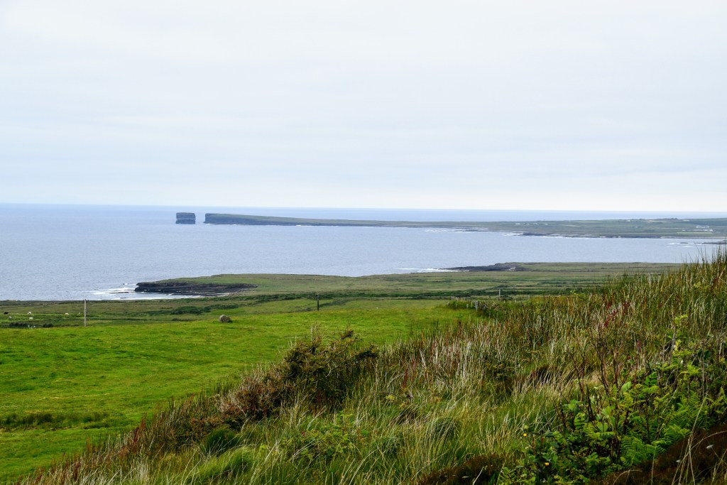
Downpatrick Head
Time for another story….
The tyrannical Celtic chieftain, Crom Dubh (Crom= bent, stooped / Dubh = black, dark > The dark, stooped one) lived on the edge of Downpatrick Head. When St. Patrick set out to convert him, Crom Dubh set a fire on the headland to hinder Patrick’s arrival. Patrick picked up a stone, scratched a cross on it and hurled it into the middle of the fire, sinking it deep into the earth.
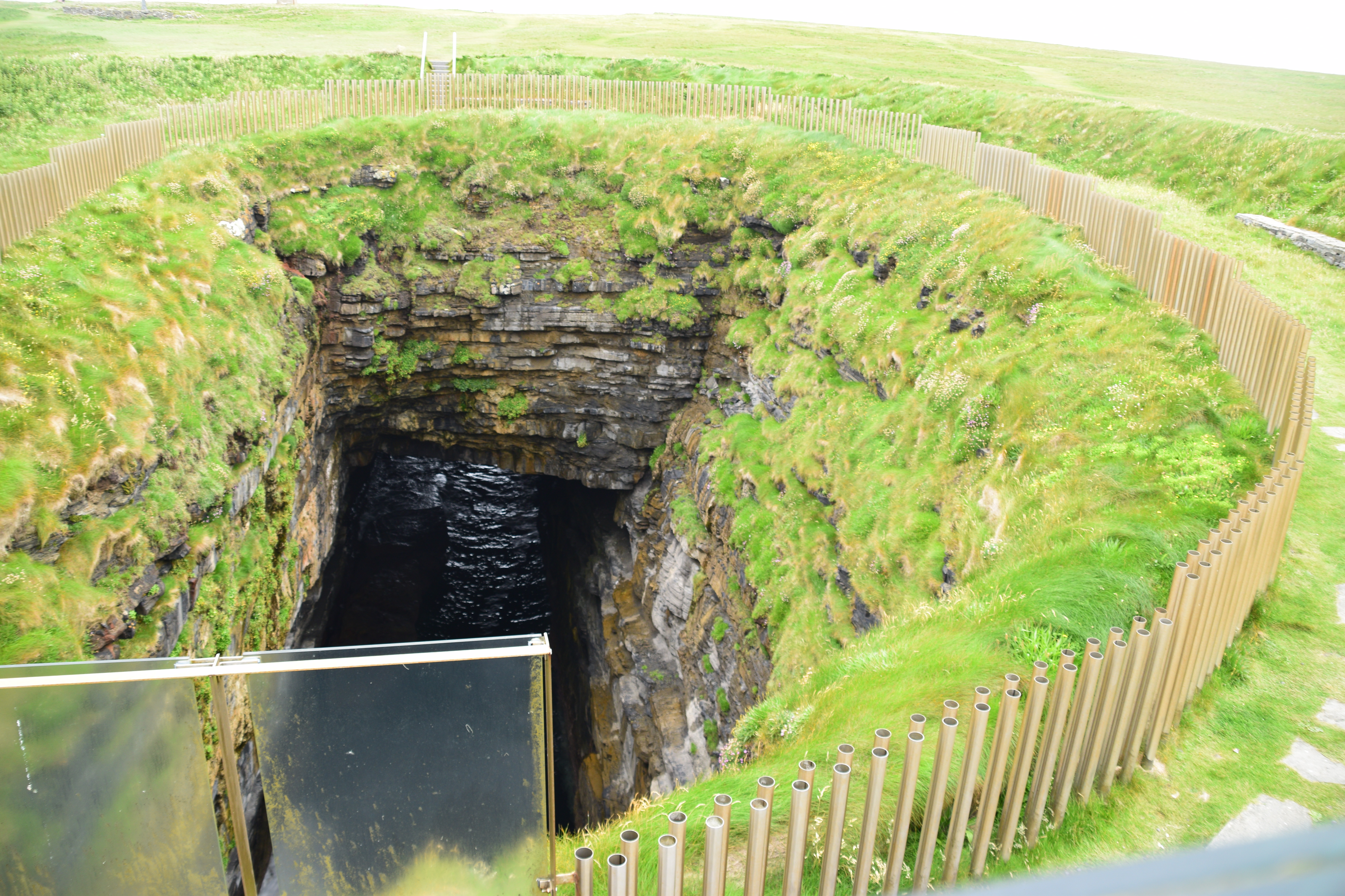
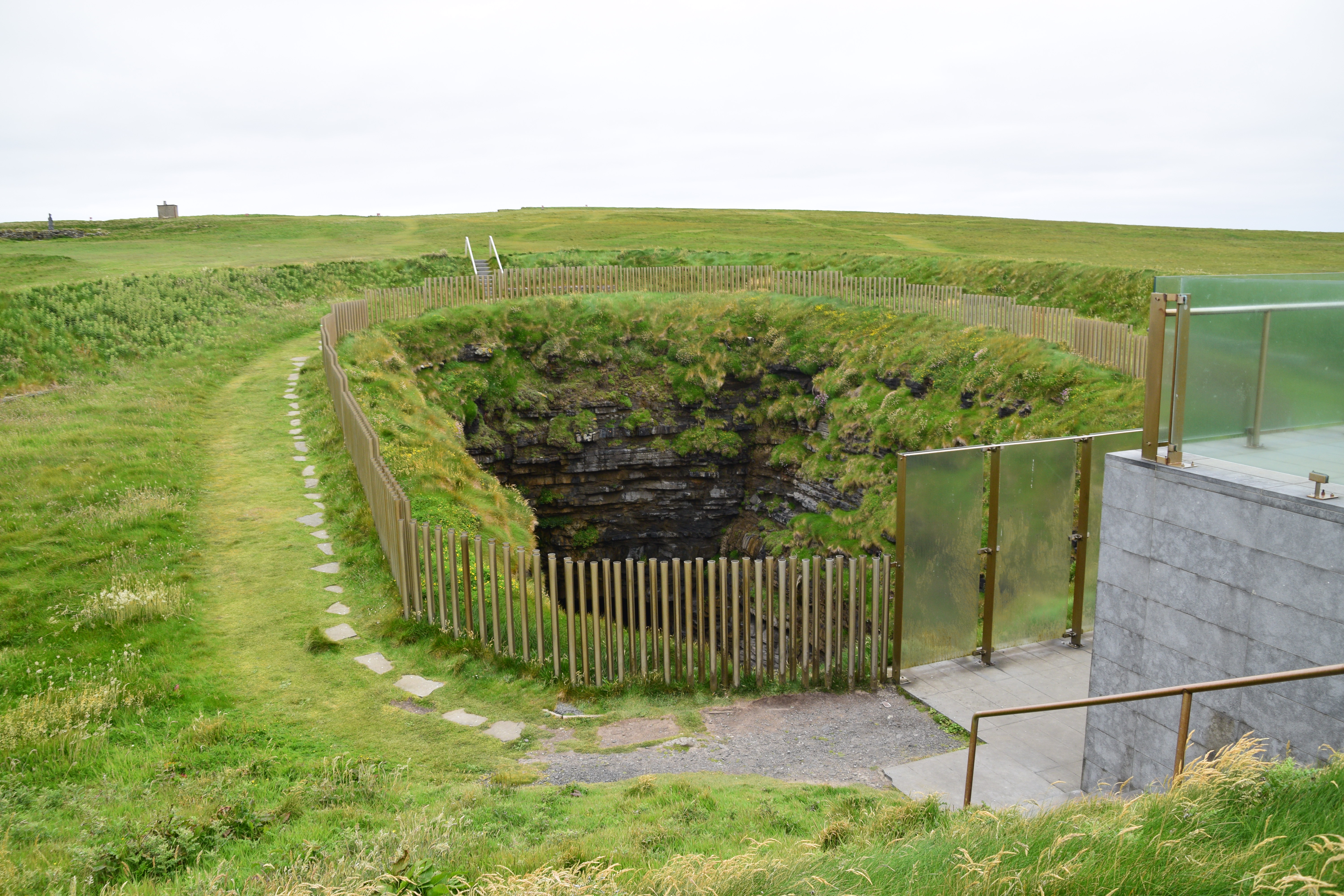
And so we have Poll na Seantainne – ( Poll = Hole / Sean = old / Tine = fire > Hole of the Old Fire) a spectacular blow-hole with subterranean channel to the sea.
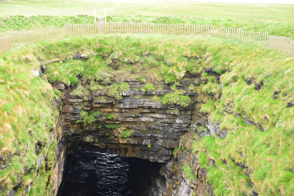
During the 1798 rebellion, 25 Irishmen and French soldiers took refuge on the ledge at the bottom, but unfortunately lost their lives when the tide came in before ladders could be replaced.
Today, Poll na Seantainne is surrounded by a Tír Sáile installation – THE CROSSING commemorates the natural power and richly-layered historical tales of the place. It consists of a mound of earth (like an ancient ring fort) with an enclosed structure and a tubular fence, all surrounding the blowhole.

Meanwhile!…
St. Patrick tried to reason with Crom Dubh and convert him to Christianity. When he refused, Patrick struck a blow to the ground with his crozier. The ground gave way, separating Crom Dubh’s home from the mainland and leaving him to die out on the rock! (How Christian is that!!!)
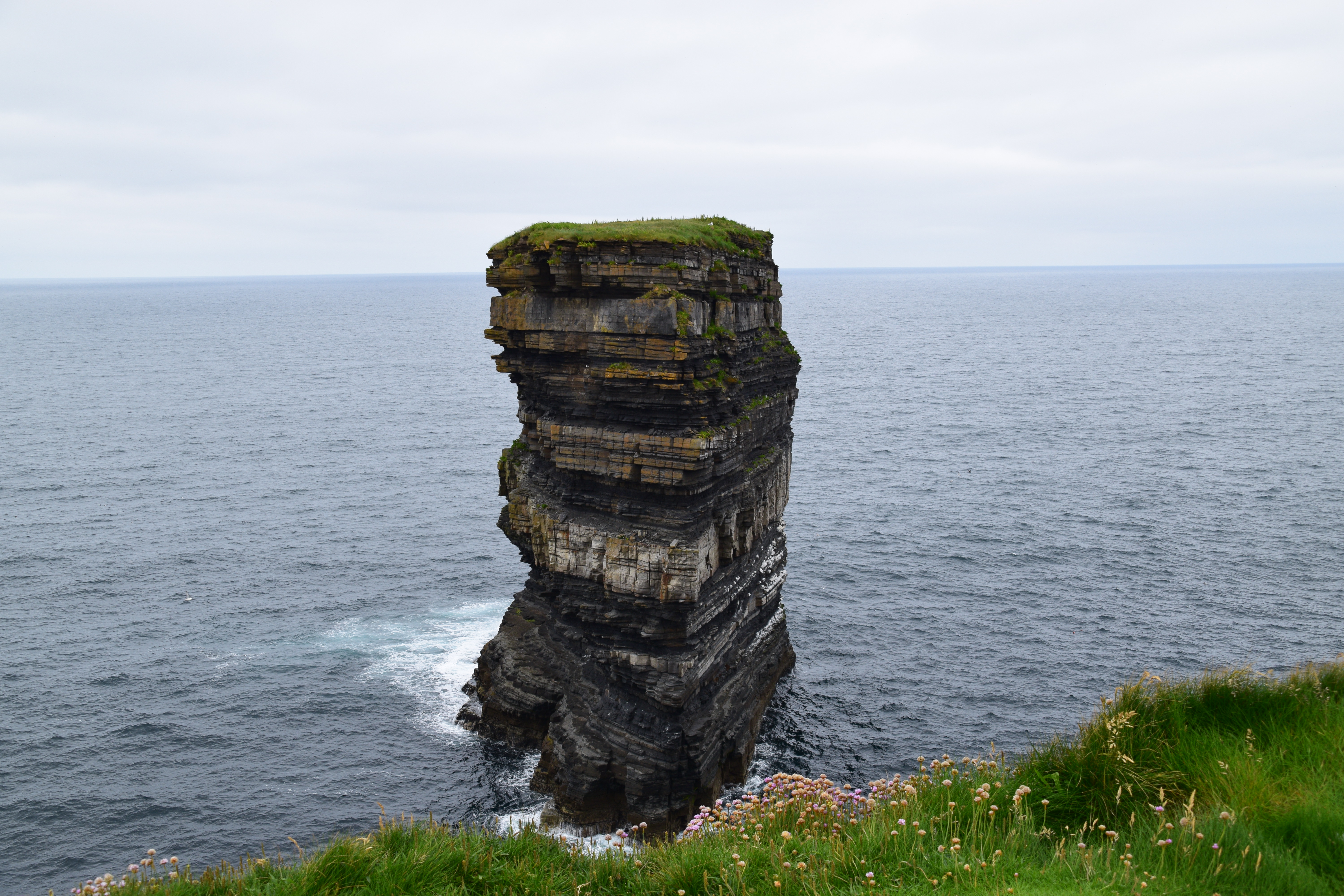
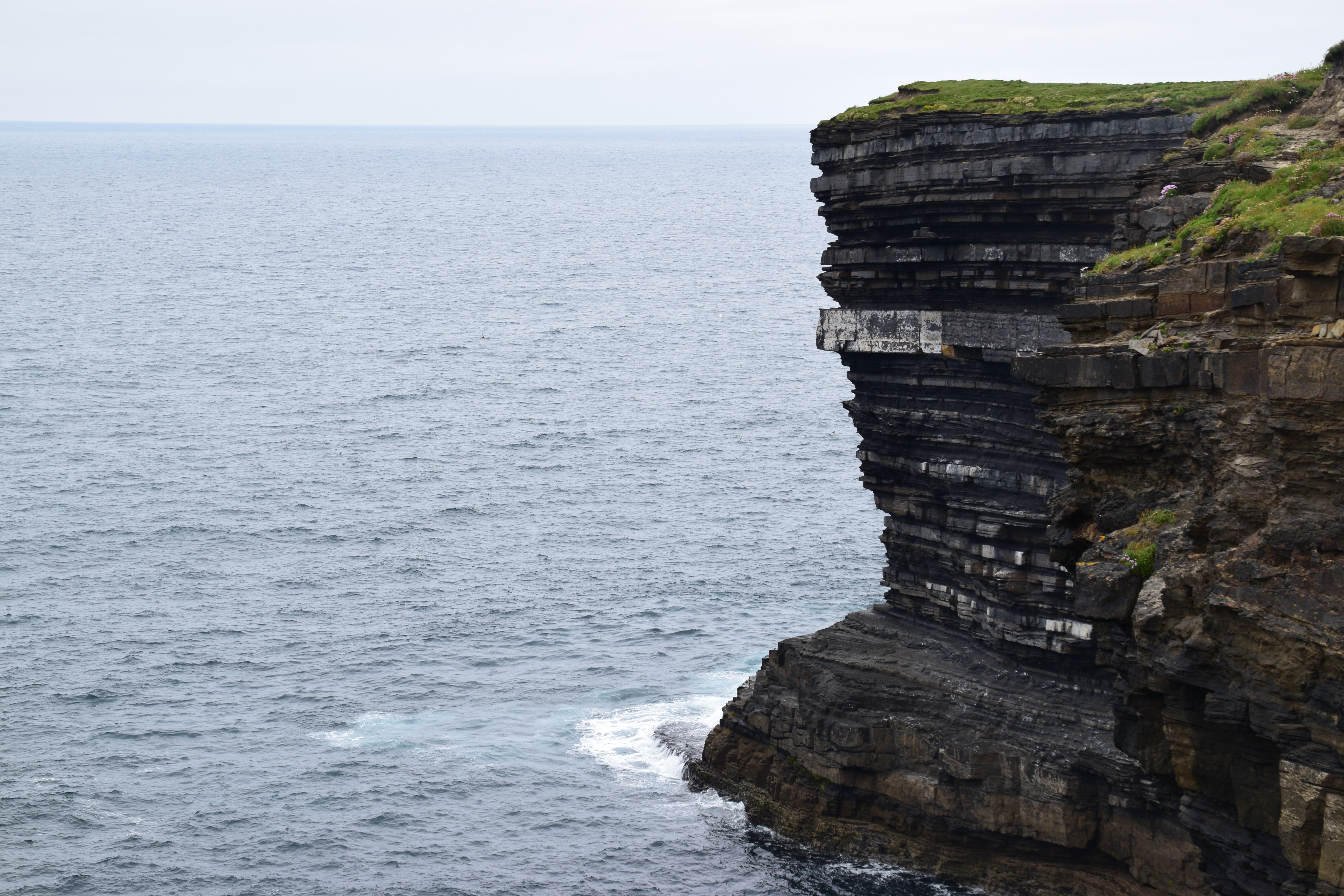
And so we have Dún Briste (Dún = fort / briste = broken).
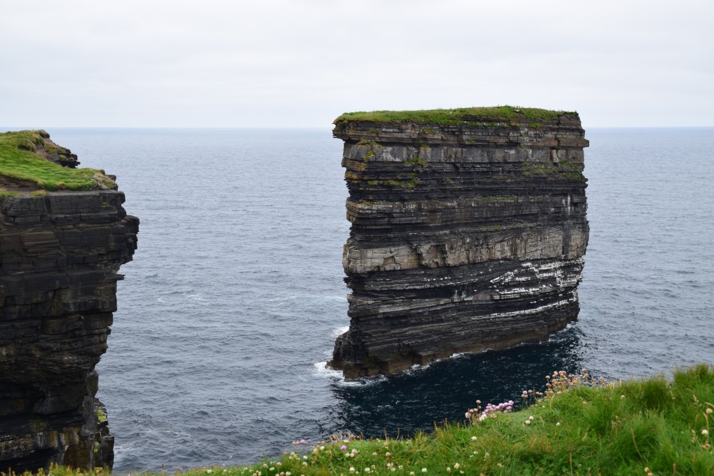
Now those old spoilsport geologists will tell you that the 45m high stack dates from 1393 when it separated from the coast during an overnight storm.
But what do they know!!!!!!
There are records of people who lived here being taken off that night, using ships ropes. In 1980, a team of scientists landed by helicopter on Dún Briste and examined its fragile plant life and the ruins of two stone buildings. They found evidence of both people and livestock inside as well as an ancient separation gate which allowed the passage of sheep from one field to another but restricted cattle. The size and shape of the buildings as well as this type of gate all suggest medieval occupation.
The surface underfoot is really weird!!!
But the views are something else……
Patrick founded a church whose ruins can be seen today. A statue of the Saint was erected in the early 1980’s.
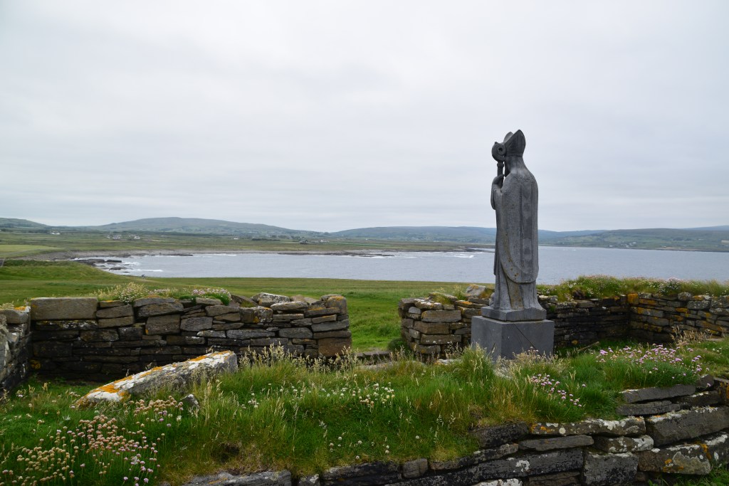


The word ÉIRE was placed all around the Irish coast during the war to allow pilots know they were flying over Ireland which was a neutral country. There were 83 such markings – usually of stone and many in very remote locations. This one at Downpatrick Head is number 64.


Moving on – roads are a TAD narrow in spots!!!

The 1798 Rebellion.
This part of the country played a role in the rebellion so here’s a bit of context….
Under the 1695 Penal Laws, those refusing to acknowledge the English King as head of their Church – i.e. Catholics and Presbyterians – were barred from parliament and all public positions. Catholics had lands confiscated for alleged political disloyalty and suffered restrictions on landholding and inheritance. Presbyterians – mostly descendants of Scottish immigrants – while not excluded from public life to the same extent as Catholics – also suffered from discrimination (e.g. marriages performed by their clergy were not legally recognised).
By the 18th century, Ireland was a Kingdom in its own right, under the Kings of England. Executive power was largely in the hands of the Lord Lieutenant and the Chief Secretary, appointed by the British prime minister.
Some Penal Laws were relaxed in 1782, allowing for the opening of Catholic churches and schools and permitting Catholics to purchase land and enter into the professions. But the majority of the Irish population was still excluded from political power.
The United Irishmen – actually founded mainly by Presbyterians in Belfast in 1791 – campaigned initially for reform, lobbying for the vote to be extended to Catholics and to non-property holders. They were greatly inspired by the events of the American and French revolutions (1776 and 1789 respectively) and hoped to eventually found a self-governing, secular Irish state.
Some of their early demands were granted by the Irish parliament – Catholics were given the right to vote in 1793, as well as the right to attend university and serve in the military and civil service.
However the reforms did not go nearly as far as the radicals wished. Catholics still could not sit in the Parliament for example, nor hold public office and the vote was granted only to holders of property worth over forty shillings a year.
Meanwhile, the United Irishmen began organising a clandestine military structure, aimed at overthrowing the Kingdom of Ireland, severing the connection with Great Britain and establishing an Irish Republic based on the principles of the French Revolution.
In 1796 revolutionary France dispatched a large invasion fleet, with nearly 14,000 troops. The fleet ran into storms and part of it was wrecked off the Irish coast. Battered by the weather and the loss of so many men, the surviving ships returned to France.
By the summer of 1798, the United Irishmen were ready for a co-ordinated nationwide uprising. However, the authorities in Dublin were aware of the plans and on the eve of the rebellion arrested most of the United Irishmen leadership. Some scattered isolated outbreaks went ahead throughout the country but within three months the uprising was over. Deaths ran into the tens of thousands. Thousands more were transported to penal colonies in Australia while others went into exile and served in the French revolutionary and Napoleonic armies.
As a result of the uprising, the Irish Parliament, which had existed since the 13th century, was abolished and under the Act of Union (1800) Ireland was to be ruled directly from London until 1922.
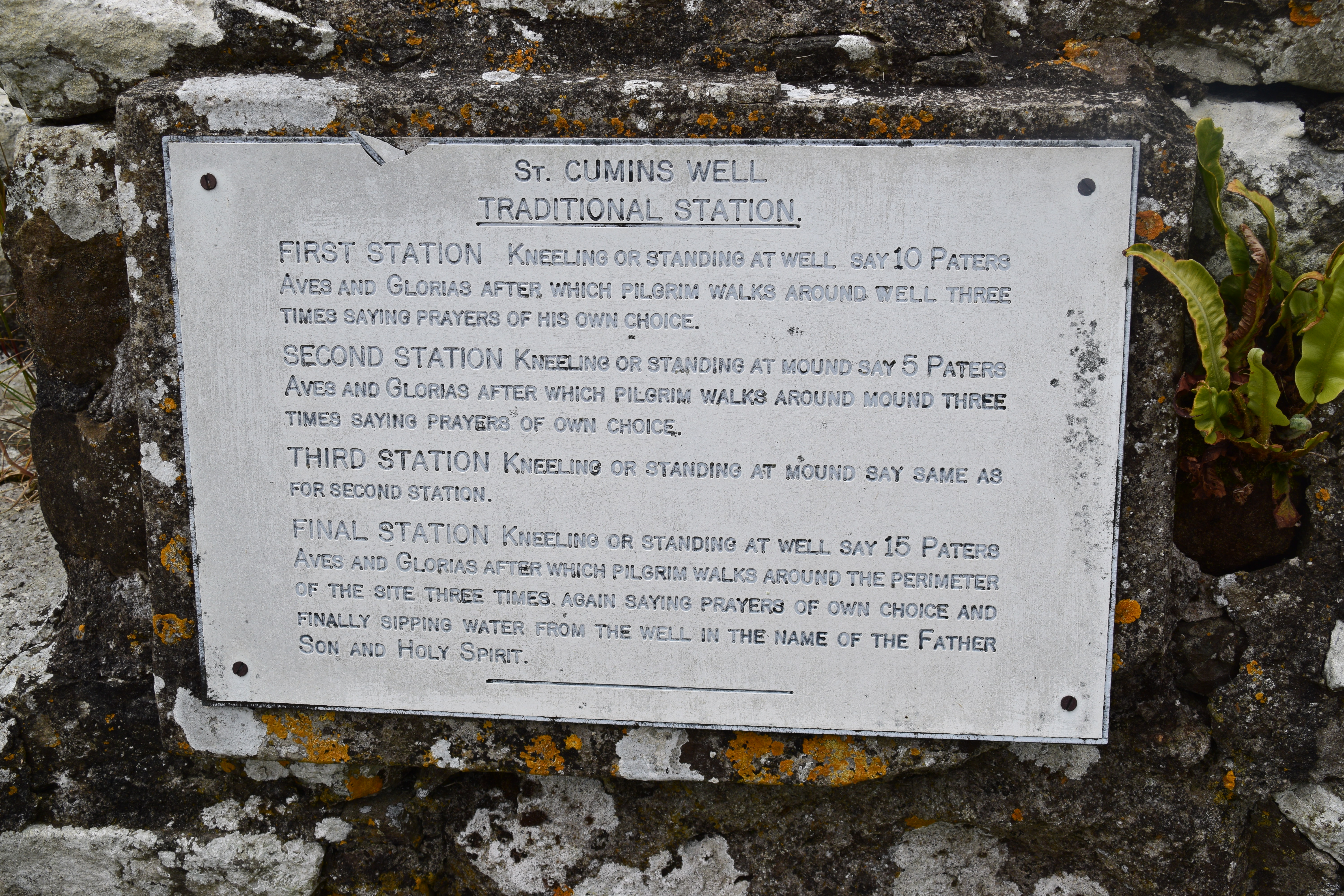
Kilcummin
The little fishing hamlet of Kilcummin is named after the early Irish saint Cuimín (Cill = Church > Church of Cuimín)
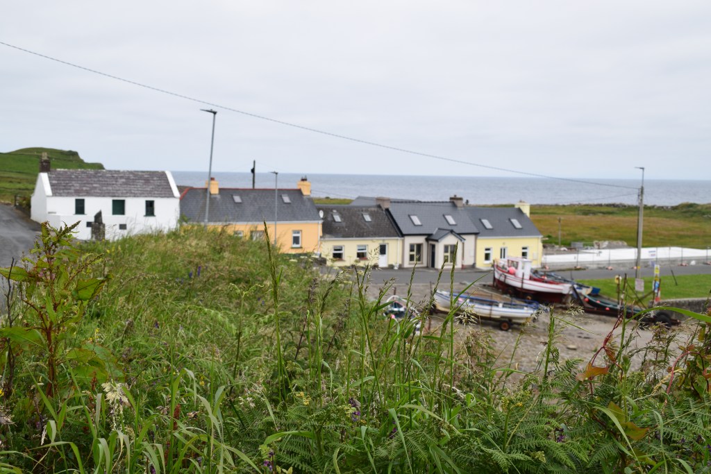


Tradition tells us that Cuimin came to Kilcummin in the 7th century, built a Church and blessed a nearby well. The Church is still standing, the water from the Holy Well is still flowing and St. Cuimin himself lies buried in sacred ground not far from his Church.
Over the centuries Kilcummin became famous as a place of prayer and pilgrimage. Many favours and cures have been granted down through the centuries and the blessed clay from St. Cuimin’s grave has been sent far and wide.

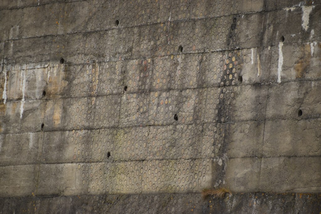
TONNTA NA MBLIANTA (Waves of the Years) is yet another piece on the Tír Sáile trail today. The piece represents time and the ages of man. It was inlaid from the centre out, with gneiss (the oldest rock), basalt, copper, iron and stainless steel. It can be found on a retaining wall at the pier but I couldn’t get close enough to work out whether it has just faded or has actually lost its stones and metal.
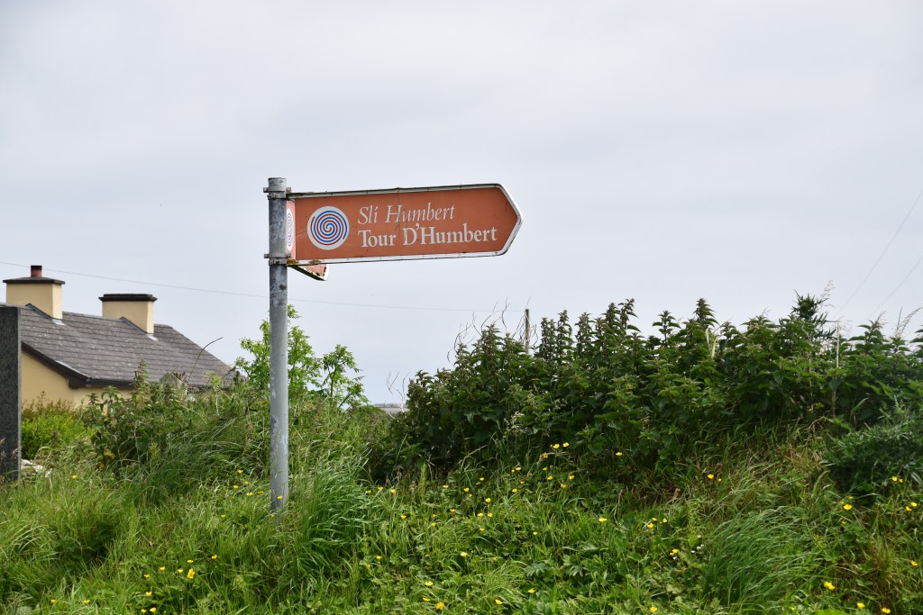
Kilcummin Pier has its own special history – On 22 August, 1798, a French expedition commanded by General Humbert arrived to play their part in the 1798 rebellion. His two frigates carried arms, uniforms and over 1000 men. He marched on nearby Killala and Ballina but success was short lived and he was defeated on September 8th. While the French soldiers were allowed to surrender, the accompanying Irish insurgents were massacred.


Tour de Humbert is a cycle trail which follows Humbert’s 225 km march. It begins at Kilcummin Pier and winds through counties Mayo, Sligo and Leitrim before finishing at Ballinamuck in Longford where the French forces were roundly defeated by the English.
Lacken Strand
You just know that this place is never going to be overcrowded! You mightn’t have time to enjoy the 10.5km loop trail from Kilcummin but make sure to at least check out the view of the vast unspoilt beach.


ECHO OF NAWASCAPE – another Tír Sáile piece – originally consisted of earthwork mounds (difficult to make out now) with a central paved space. The artist – Mariyo Yagi – frequently uses the image of rope as a symbol of continuity in her work. Here, the central theme of ‘nawa’ or DNA rope is still visible in the paving which recalls the DNA helix. The helix represents the continuity of life and the location of the work beside the ocean draws attention to water as the origin of life.
TEARMON NA GAOITHE (Sanctuary of the Winds) is a cell made up of locally sourced sandstone slabs, thrown up by the waves. The cell recalls Ireland’s monastic tradition and evokes a sense of meditation and protection.

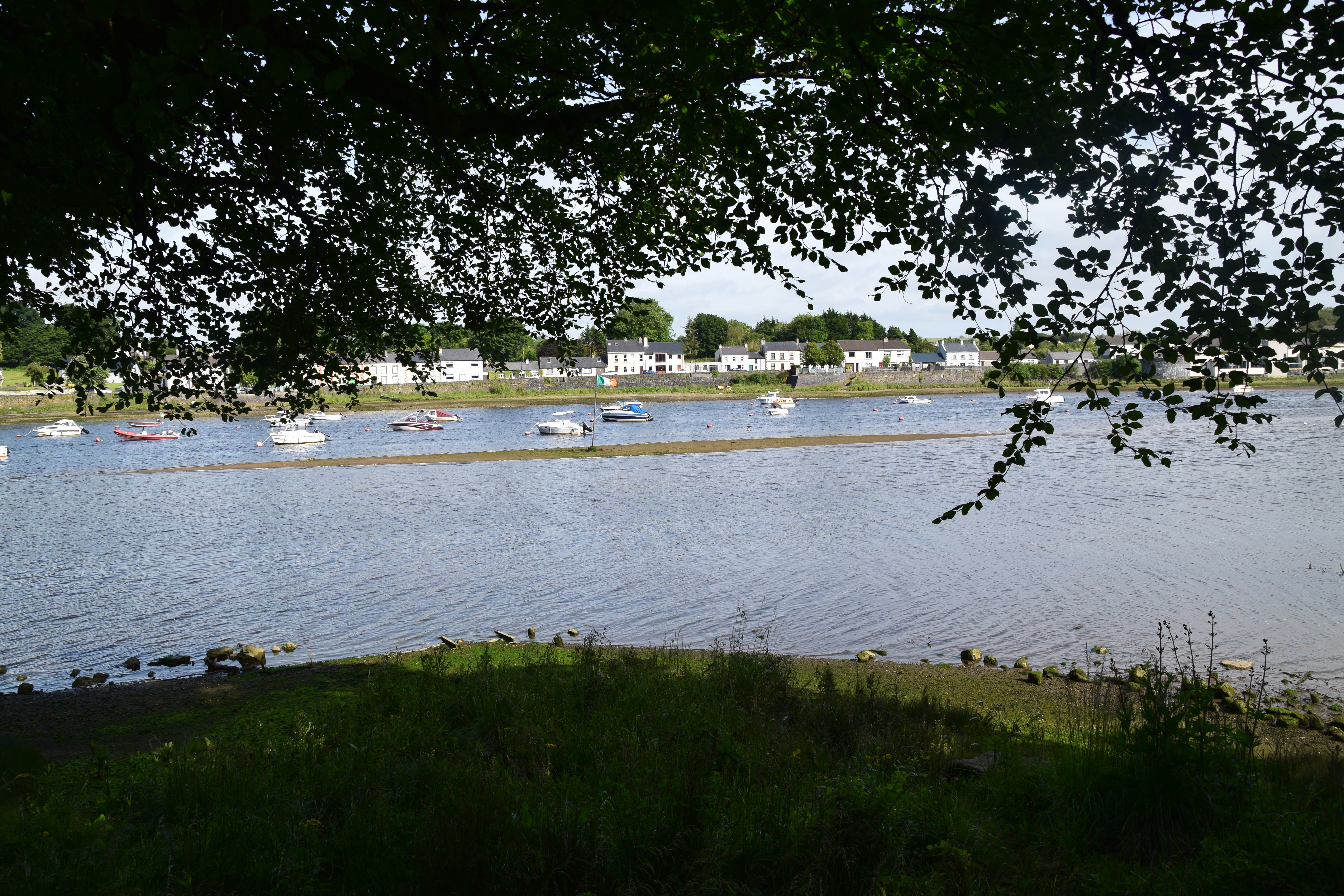
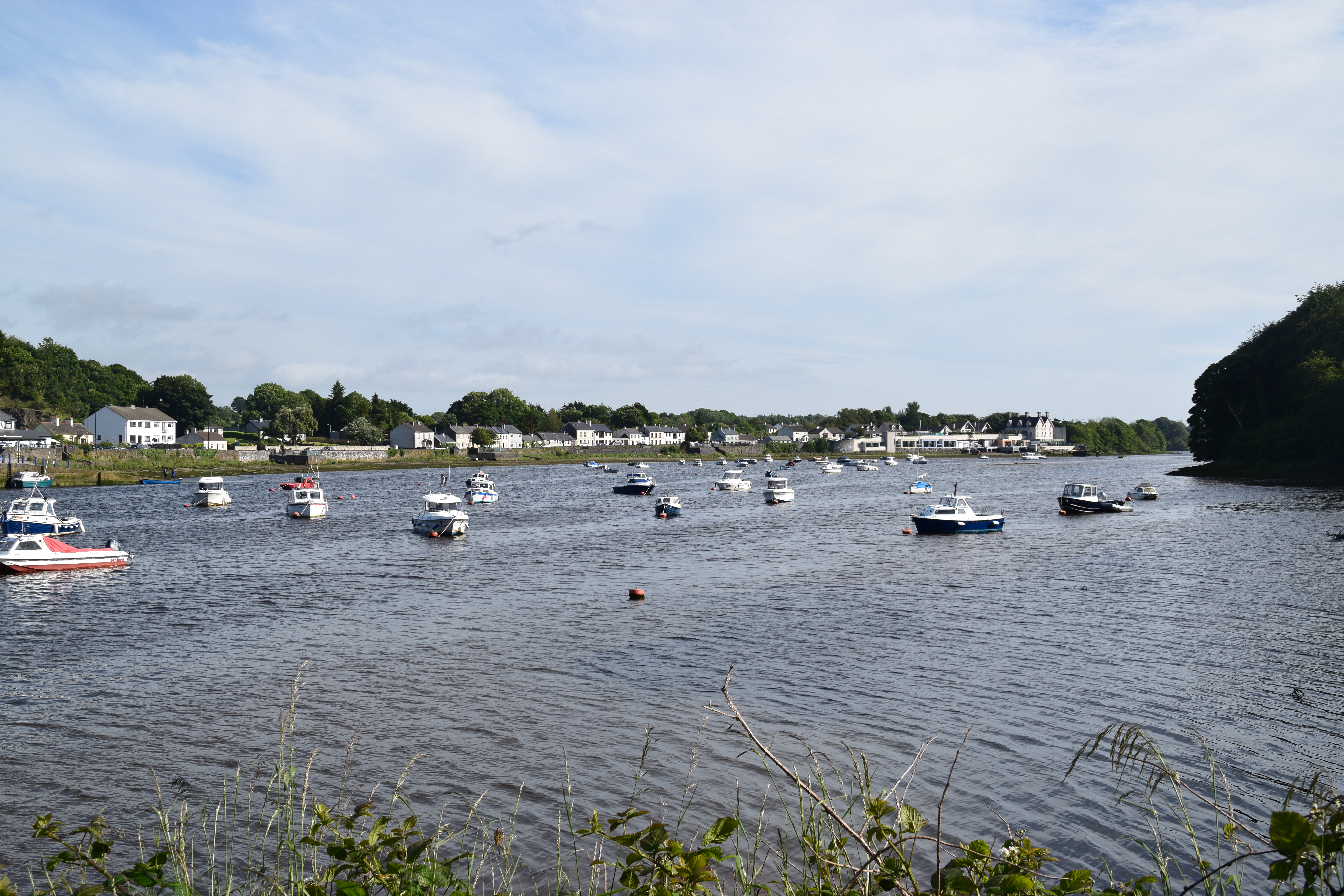
Killala
Killala dates back to the time of St Patrick (circa 386 – 461). At a well that still flows close to the town, local legend tells that Patrick baptized 12,000 converts in a single day. On the same occasion, he raised to life a dead woman whom he also baptized.
By the end of the 18th century, Killala had established itself as a small fishing port. This was the site of the first battle of the French force of General Humbert in the 1798 Rebellion.

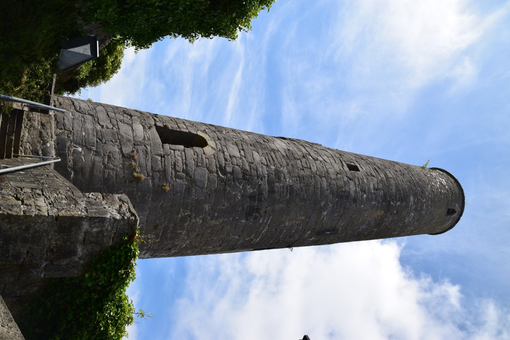
Located in the centre of the village, and well signposted (although its location is rather obvious from any direction!!!) – Killala’s skyline is dominated by a 12th century round tower.
It’s thought that the original monastic settlement here dates back to the 5th century when Patrick appointed Muiredach as first Bishop of Killala. A close inspection reveals a bulge in the stonework about half way up the 25.5 m limestone tower. Reports in 1779 mention a damaged roof and damage midway up the tower from a lightning strike.
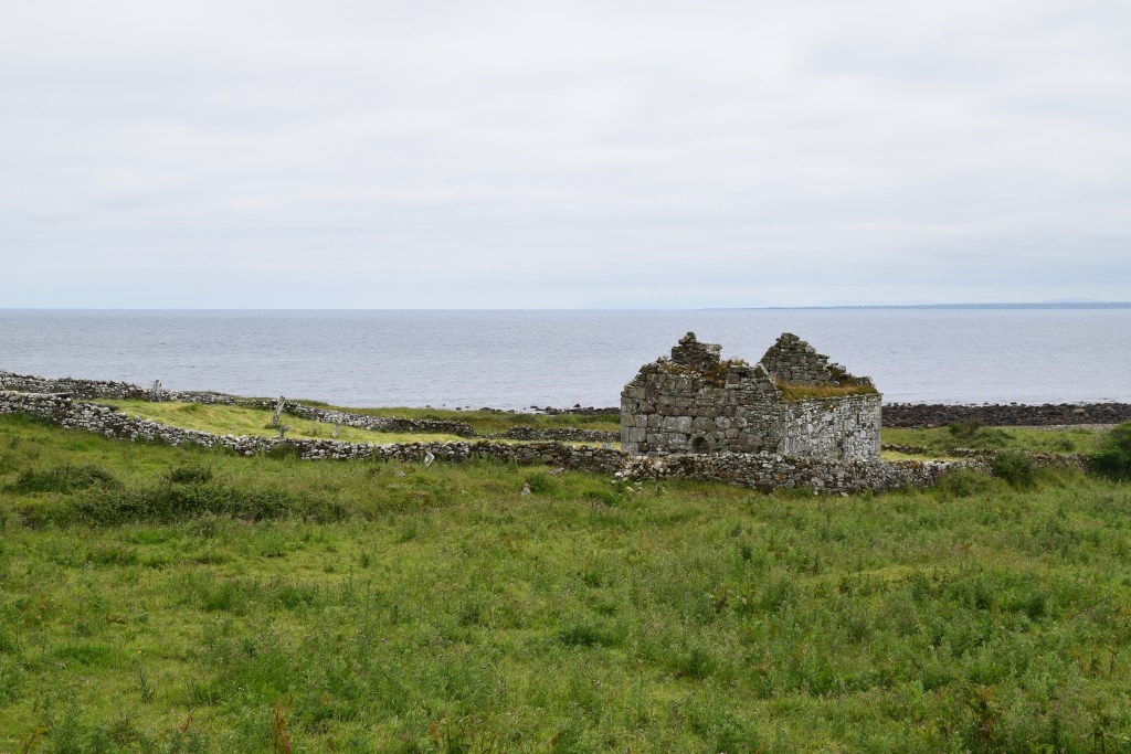
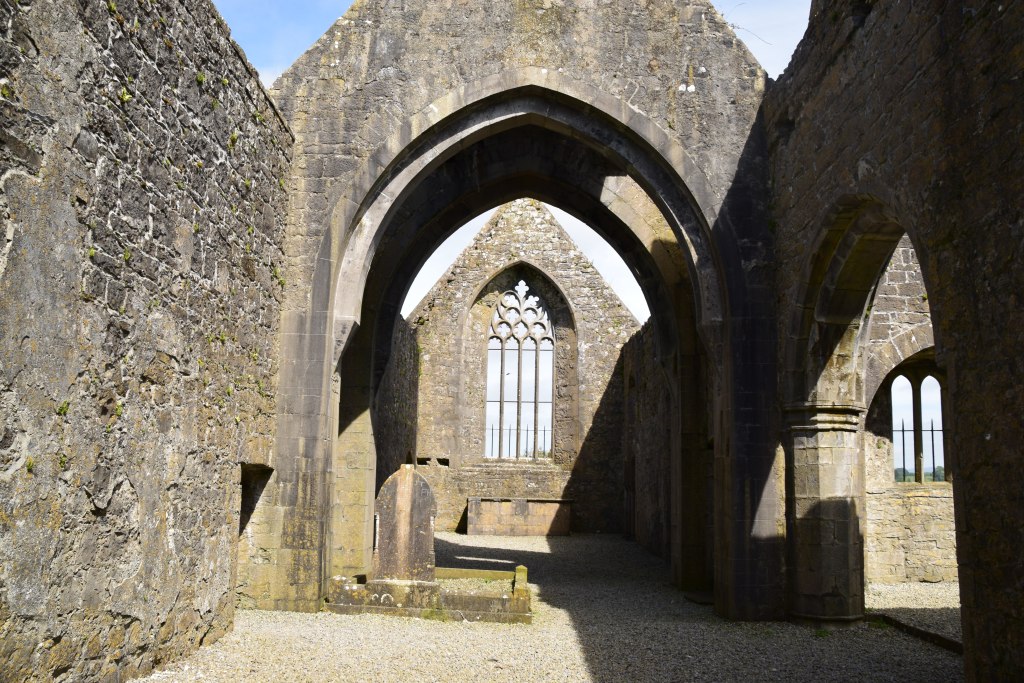
Moyne Abbey
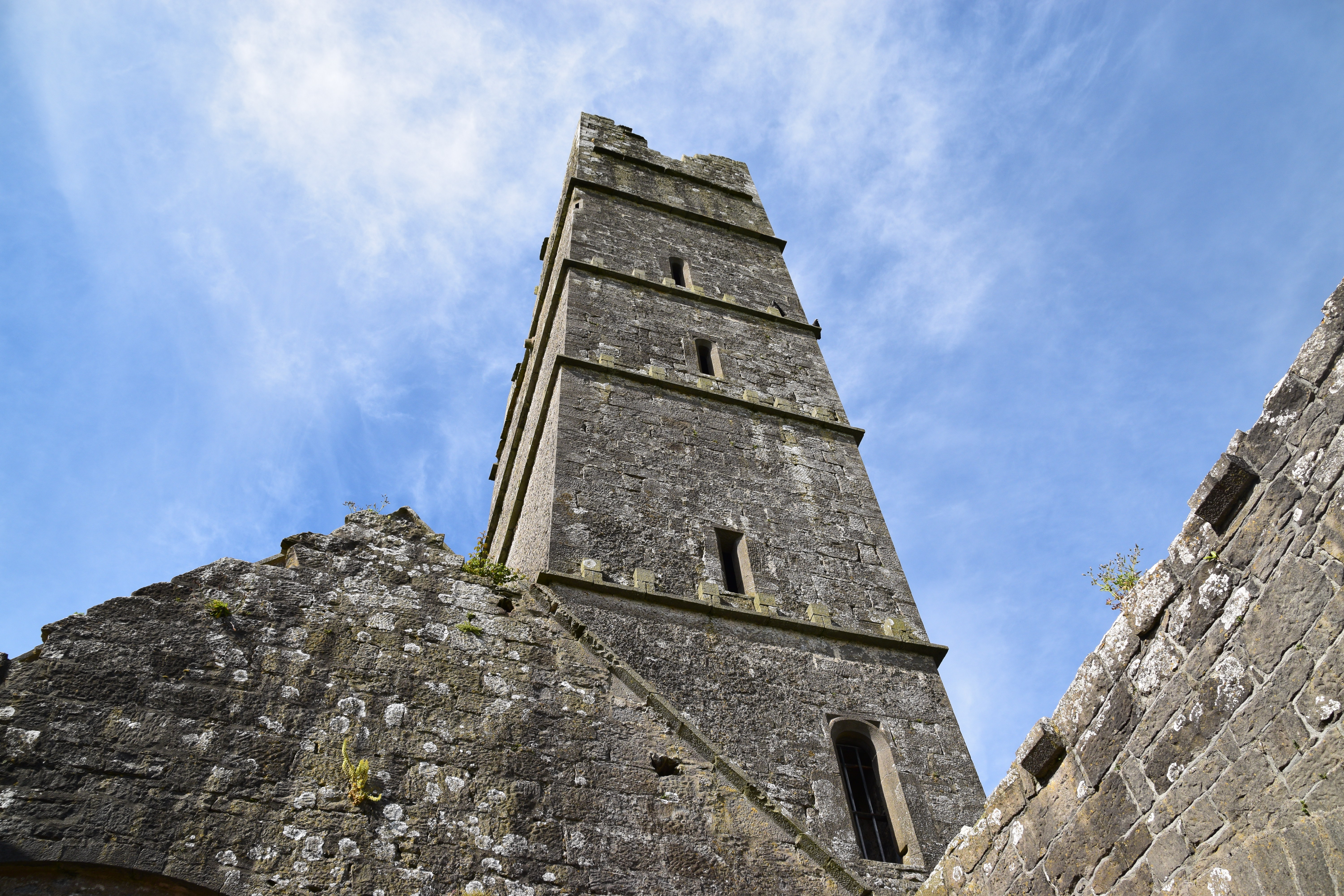
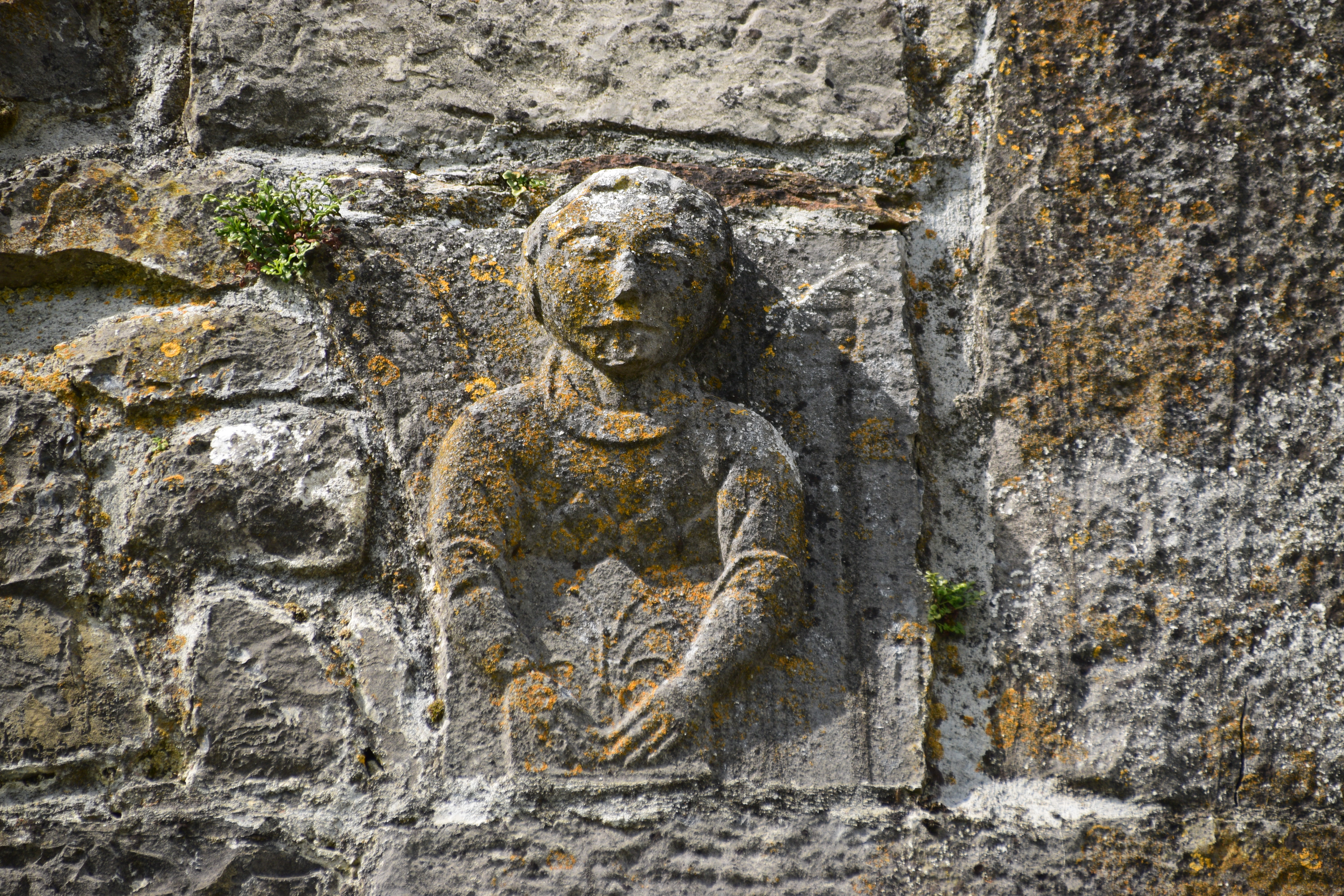
At the mouth of the River Moy, just 3.5km from Killala, lies the remains of Moyne Abbey. Founded by the Burke family as a friary for a branch of the Franciscans –Franciscans of the Strict Observance -the abbey was consecrated in 1462. According to local legend, the monks had their choice of all of the lands owned by their benefactor, and, having examined several sites, settled on Moyne – apparently with the help of a little robin or wren. It was built in the late Irish Gothic style and has extensive ruins – church, six storey bell tower and domestic buildings – all situated around a central cloister.
Moyne was to rise to prominence within Irish Franciscan circles, at its zenith boasting a library, infirmary, two corn mills, rich pasturage, and a water-mill. The community – including priests, professors, students and lay-brothers – would have numbered at least 50.
During the Tudor period, especially during the reign of Queen Elizabeth I, the community at Moyne suffered greatly at the hands of the British military. There are stories of men being hanged after accusations of plotting against the queen and of a friar being tortured to death for not revealing what he heard in the confessional.
Following years of persecution, the abbey was burned by Sir Richard Bingham, the English governor of Connacht, in 1590. Five years later, Moyne was confiscated and granted at an annual rent of 5/- (five shillings) to Edmund Barrett, a native of Cork and favourite of Queen Elizabeth who received vast tracts of confiscated church lands that year. Over the next few centuries, the lands were to be passed through several noble families until about 1948 when they were taken over by the land Commission and the buildings by the National Monuments Commission.


Note: Moyne Abbey has yet to be developed as a tourist site. Access is via a right-of-way across private property and presents difficulties for anyone with restricted mobility.

Rosserk Friary
A mere 5km further along the river lies Rosserk Friary. It was founded in the 15th century by a chieftain of the Joyce’s, a powerful family of Welsh extraction (remarkable for their gigantic stature!) who settled in West Connaught in the 13th century. It was built for the Friars of the Franciscan Third Order Regular. Their speciality was teaching – each of their monasteries had its own ‘free school’ for boys and concentrated on the cultural and local interests of Gaelic Ireland.
This was a different branch of the Order to nearby Moyne and the closeness of two large religious houses may just be a result of generous patronage. Like its neighbour, it was built in the late Irish Gothic Style and alas was also burned by Bingham in 1590.
Rosserk is accessible to the public, with parking facilities.


The Abbeys rivalled for the lucrative salmon rights of the river Moy. Apparently, the monks of Rosserk were greatly aggrieved that Moyne was built two miles nearer the mouth of the river. To gain an advantage, they cut an inlet which redirected the salmon towards the Rosserk nets! So much for brotherly love!


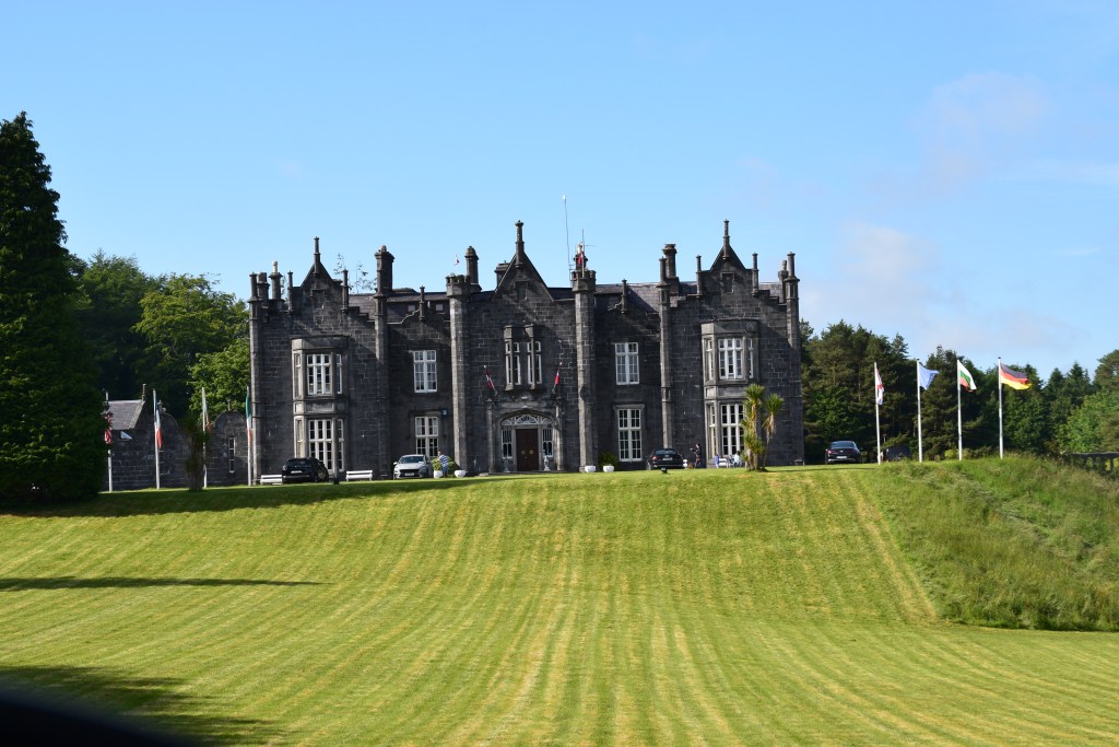
Belleek Castle and Woods
Belleek has a 4 km loop trail but there are lots of pathways if you just feel like a bit of a wander through the woods. In the mixed woodland you’ll come across Norway spruce, Scots pine and silver fir together with beech, oak and ash. You might be lucky enough to spot a fox, rabbit, hare or red squirrel amidst the trees while herons, ducks, kingfishers and otters may be seen along the riverbank. Historical features include a hermitage, ice house and a wall built during the famine (1845) as a relief scheme (each man received a bowl of Indian meal for his days work).

From the path, there are glimpses of the river Moy…..
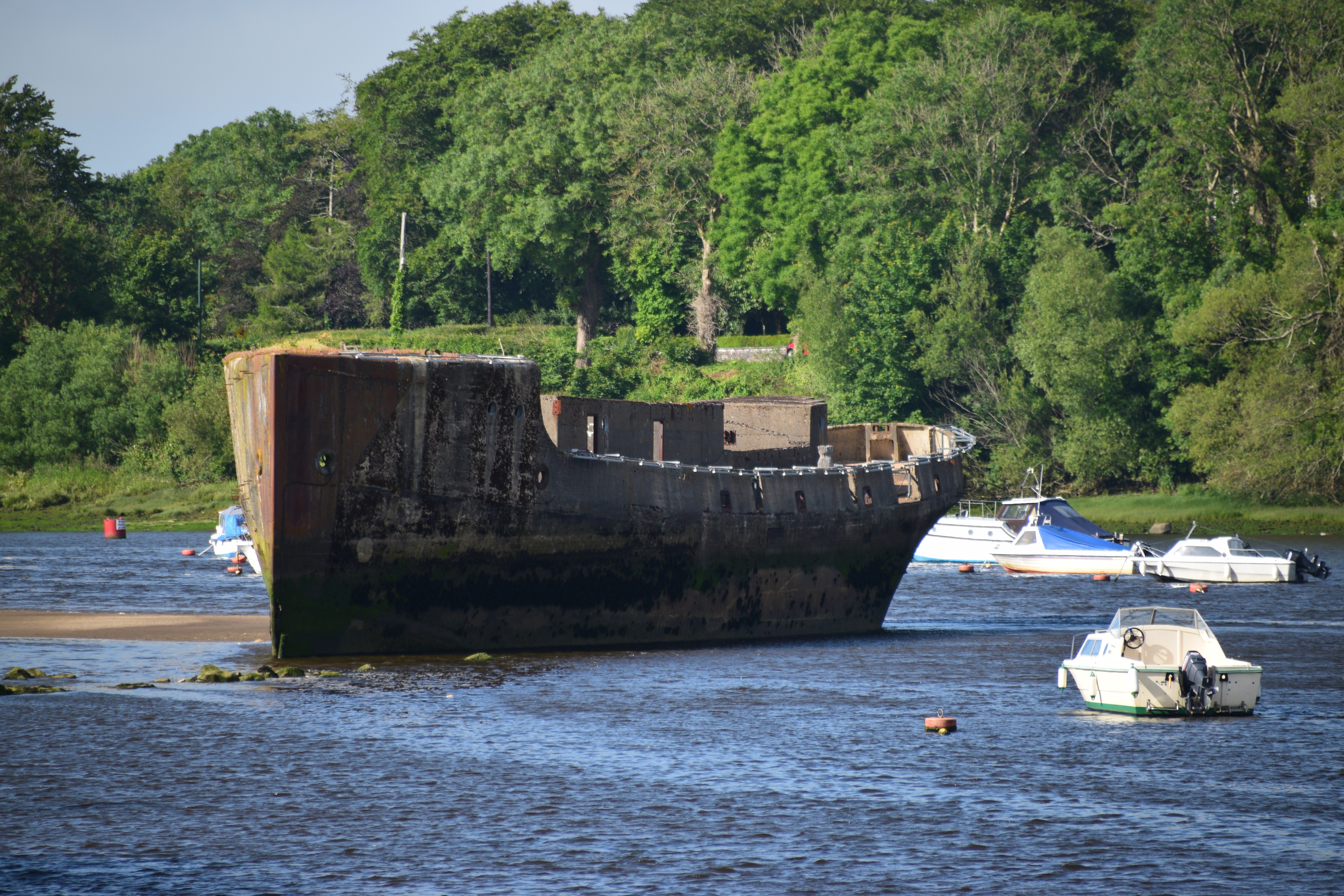
….and the oddity that is SS Crete Boom!
In 1917, three years into WWI, Britain was experiencing a severe steel shortage. Ships were needed to transport iron-ore from Spain but building a fleet would further deplete steel supplies. An alternative was needed and someone decided that a concrete fleet would be viable!
Such a fleet would make significant cost and time savings. Orders were placed for 154 units, 24 of them tugboats, at an estimated cost of £4 million.
Almost straight away, unforeseen snags began to emerge at the nineteen specially constructed sites in Britain and Northern Ireland! There weren’t enough skilled craftsmen for such a project. Costs were far exceeding the estimates – a barge costing £17,000 when built of steel was costing £27,000 when built of concrete. When the war ended in 1918, the order was cancelled and only those vessels near completion – 52 barges and 12 tugboats – were finished.
Of course, the fleet never saw ‘active service’. Most vessels spent a few years towing coal to the Continent. When that enterprise failed, the fleet was laid up until sold on again – some of the boats, like Crete Boom, being stripped of metal with just the concrete hulk remaining.
In 1937, Ballina Harbour Commissioners wanted to form a sand barrier at the entrance to the river. Crete Boom and other wrecks were bought with the intention of sinking them at the proposed barrier site. En route from England, the boat sustained damage and, when berthed at the quay, it was discovered to be taking on water. Fearing it would sink and block the quay, the Harbourmaster had it towed to mid-stream where it settled on the bottom.
Meanwhile, the sand barrier idea was running into its own snags – the Moy Fishery Company threatened legal action, fearing interference with the run of salmon in the river. With the outbreak of World War II in 1939, the project was abandoned altogether.
By the mid 1970’s the River Moy was silting badly. It was decided to finally move the Crete Boom from the centre of the river where it was impeding the flow of water and adding to the build-up of sand. The hulk was cleaned out – evicting hundreds of eels that had made their homes there! The vessel was lifted from the mud and towed a short distance to where it remains to this day,

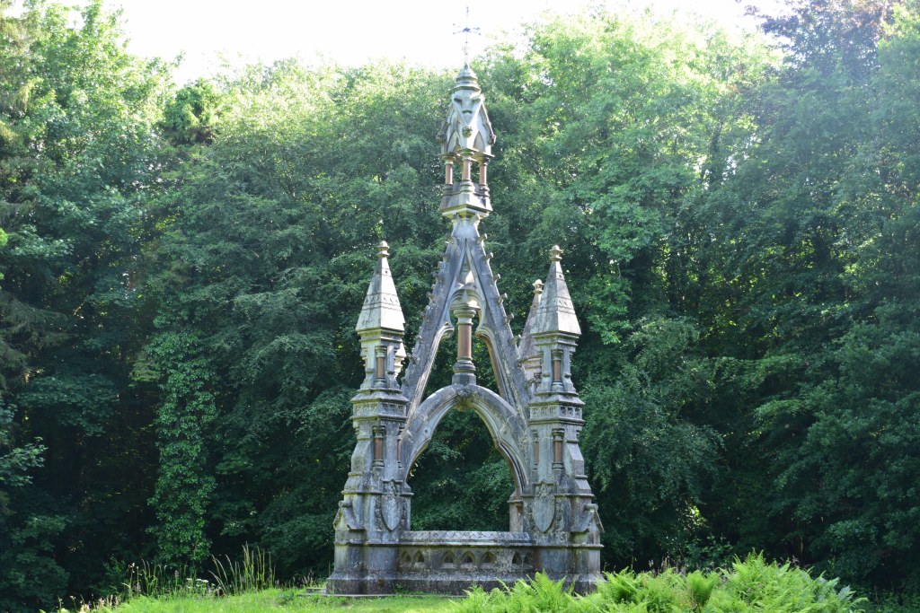
Belleek Castle was commissioned by Sir Arthur Francis Knox-Gore in 1825 at a cost of £10,000. Francis lived here with his wife and nine children until his death in 1873. He was buried in Belleek Woods where a striking Neo-Gothic Monument now marks his grave . It is said that his wife and favourite horse are both buried beside him! The ownership left the family and was eventually purchased by Mayo County Council in the 1950’s The house served as a hospital and a military barracks before being abandoned. The County Council was actually considering removing the roof of the building to avoid paying rates when Marshall Doran, a merchant navy officer and an avid collector of fossils and medieval armour, acquired the property in 1961, restored it and opened it as a hotel in 1970.
The Castle Tour includes the history of its former owners and a look at the banqueting hall and dining rooms, etc. . The Marshall Doran Collection is one of the finest collections of Jurassic fossils, Medieval weapons and Medieval armour in Ireland.
So that’s it – a North Mayo day out. And what great value!!! Lots of fresh air and no strain on the pocket! At most, you have the entrance fee for Ceide Fields (€3.50) and maybe the Belleek Castle Tour(€10)!
Before you go…..
Have a look at the rest in this Mayo series…
#3 TÍR SÁILE
A well-researched and lovely tour. I enjoyed it – thanks!
Ah thank you Carol – glad you enjoyed…..
When I need some alone time when I’m old and grey (like yesterday) I shall head for Mayo to live with the sheep and gaze on the Atlantic. Mind you, on second thoughts that might not be a good idea as who’d deliver my morning paper and where would I find a doctor if needed? Nevertheless, this is a fabulous place, and your gorgeous photographs do justice to it. I shall have to go back and look at them again a) because they are great and b) because they are appearing on my screen so enlarged that i have to scroll across to see each one fully. I don’t know how that’s happened but it’s only with your Post. Maybe I can open in another tab, I don’t know yet. Congratulations on another fine piece of work.
Lovely to visit – but – as a city girl I’m not sure I could live there – too used to having everything to hand…
Don’t know what’s going on with my photos – you’ve had such a time with your computer this year that you’re either a techno genius by now or have pulled every shred of hair from your head in frustration!!!!
Wow, this post is a real tour de force! Some fascinating stuff here. Thank you for sharing.
Glad you enjoyed ,,,,, XXXMarie
Looks like you had an amazing time visiting and exploring some of Mayo’s most beautiful sights, Marie. Given the breathtaking clifftop views over the stunning Broadhaven Bay and the birds-eye view of the Stags of Broadhaven, the Carrowteige Loop Walks is one of my favourite places to go for a walk. We haven’t been to the beautiful Moyne Abbey – have to put that on my Irish travel wish list. Thanks for sharing and stay safe, storm Barra is set to bring very strong winds and heavy rain! Aiva xx
A part of the world you must know very well Aiva – You’re lucky to have so much beauty on your doorstep!!
Every time I think Barra has moved on the wind starts up again – but hopefully we’re over the worst of it in Dublin – I hope you have a safe night. XXXX
Thank you, Marie. Schools are closed today due to Barra, so we get to sleep in 🥰
A bonus at least – like a ‘snow’ day!! Enjoy
Wow, what an excellent day out! I’m especially fascinated by the Ceide Fields (both the Stone Age remains and the bogland) and Downpatrick Head looks spectacular! I also love all the sculptures which work so well with this landscape. Thank you so much for the tour 🙂
We visited the Ceide Fields some years ago but I was so looking forward to another tour. It was disappointing to find the visitor centre closed – not due to Covid but renovations… We could still walk around but its not quite the same thing. Incredible to think there was so much lying underneath the bog and discovered in such an accidental manner…
Lots of lovely information and pictures.
One negative is that it takes ages to load this post online and it also hangs my email. I split my posts up over several days when they are large.
Ah thanks for the info Sherry – sorry about that. Glad you could still get the gist of it…..XXXMarie
I got it all. Took some time. I have super high speed internet. Hope others get faster downloads of your posts. Watch file size of images. 1000 px at 72 dpi is good.
👍👍👍
What an incredible area. It has gorgeous coastal views with wild folklore to go along. I’d love to visit one day. Maggie
I can’t believe how much I’ve managed to write about it – and I’m not finished yet! It’s a fabulous corner of the country – hope you make it there some time… XXXMarie
I love the quote about the ocean kissing the shore. Your wonderful images (and words) make me feel like I’m right there with you. Thank you!
And thank you Sandra for your lovely supportive words…. Glad you enjoyed….
You did all this in one day? Loved the story of the swan sisters, so sad. The monastery and friary ruins are beautiful, as are the green hills and rugged shoreline.
It wouldn’t really be feasible if the Visitor Centre at Ceide Fields were open. That – rightly so – would take a bit of time to assimilate and enjoy. There’s a lot in it but but everything is relatively close together – there isn’t a huge amount of driving in between. We didn’t spend long at the Round Tower – but a first time visitor to Ireland would find it interesting. We were actually ‘finished’ and heading back to our hotel when we came across the two abbeys and then Belleek Woods – which were nice bonuses. If you are in the area to enjoy walks etc, there’s easily enough in this for two days.
It reminds me of so many weekends spent in Co. Mayo, hoping for a little sunshine sometimes.
Ha – the next bit I’m writing about was the most miserable of days!! You’ll appreciate it!!
Wow – it’s just beautiful Marie. I absolutely love all the legends and stories of the area. That ground underfoot at Dún Briste almost looks like sponges, it must have been so weird to walk on!
Some sort of mossy sponge – it was the colour that fascinated me – so vibrant ….
Epic post Marie, worthy of such an epic part of Ireland. So many gems amongst the brooding bleakness. The Ceide Fields rise out of nowhere and are amazing. Did you read Flanagan’s ‘The Year of the French’? Great book. I had a nice run through Belleek Woods when staying in Ballina once. Marshall Doran is well remembered in Jersey and his son Paul and grandson own a hotel and restaurant here. I must try and visit Mayo again before too long.
Wow, with those stunning views of the rugged coastline of Ireland, you can make anyone fall in love for sure🙂 What an incredible area! Ireland is on my husband bucket list, hopefully we can visit one day! But then it’s going to be so hard to pick a route with so many beauties around🙂
Christie
Well if you’ve never been, it’s going to be tough – as is any place on a first visit… so hard to narrow down a list. Hope ye get here some day!
Hopefully we can get our lives back to normal, and we shall see🙂
Have a nice weekend!!
It’s tragic to me that those living in such a naturally beautiful area fought back against enemy land invasion. No such phenomenon it seems comparatively took place along the U.S. coastal environs. .
There must have been such inspirational leaders then to ignite rebellion. Alas, the odds were against them – in 1798 and again in 1803. There was nothing then until the 1916 rising.
Change tragic to enlightening
What a fantastic post! Amazing places and history! Cheers!
Glad you enjoyed – and hopefully you learned lots!!!!